Estimated Value: $944,000 - $1,163,145
6
Beds
5
Baths
5,297
Sq Ft
$199/Sq Ft
Est. Value
About This Home
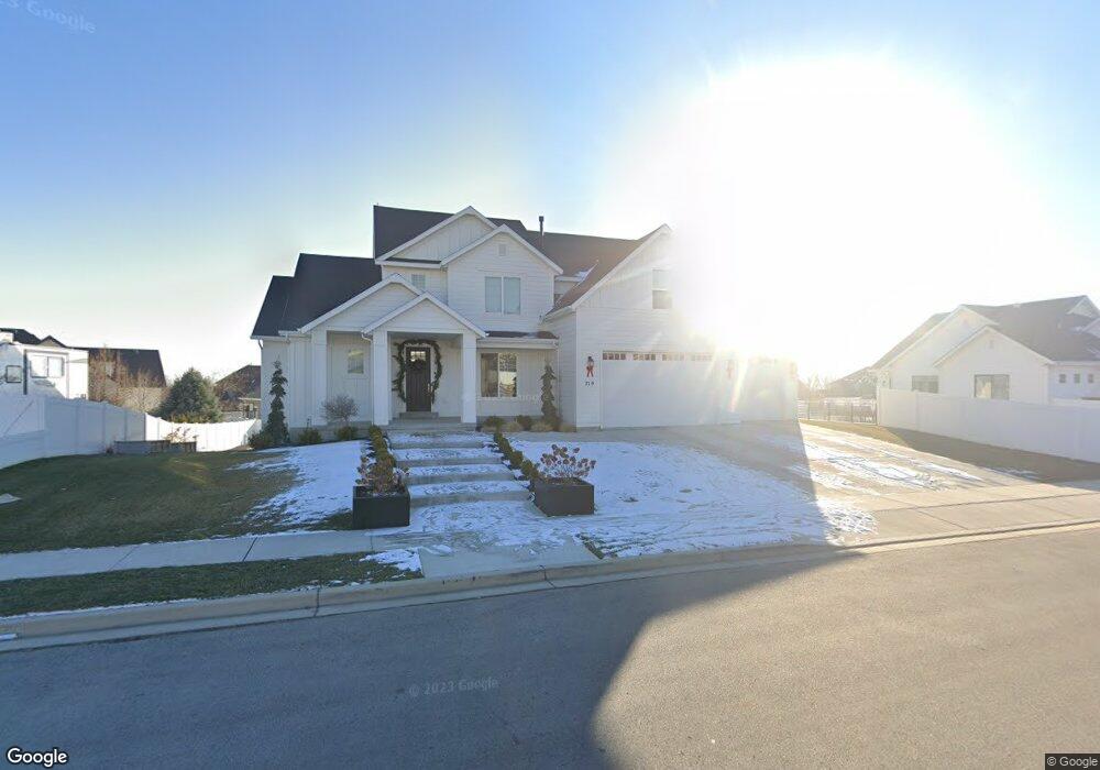
This home is located at 719 W 3430 N Unit 17, Lehi, UT 84043 and is currently estimated at $1,052,036, approximately $198 per square foot. 719 W 3430 N Unit 17 is a home located in Utah County with nearby schools including Fox Hollow Elementary School, Skyridge High School, and Ignite Entrepreneurship Academy.
Ownership History
Date
Name
Owned For
Owner Type
Purchase Details
Closed on
Nov 21, 2017
Sold by
Arive Homes Llc
Bought by
Sperry Michael G and Sperry Kelly
Current Estimated Value
Home Financials for this Owner
Home Financials are based on the most recent Mortgage that was taken out on this home.
Original Mortgage
$424,100
Outstanding Balance
$355,376
Interest Rate
3.85%
Mortgage Type
New Conventional
Estimated Equity
$696,660
Purchase Details
Closed on
Mar 29, 2017
Sold by
Jenex Development Llc
Bought by
Ariv E Homes Llc
Home Financials for this Owner
Home Financials are based on the most recent Mortgage that was taken out on this home.
Original Mortgage
$10,000
Interest Rate
4.1%
Mortgage Type
Purchase Money Mortgage
Create a Home Valuation Report for This Property
The Home Valuation Report is an in-depth analysis detailing your home's value as well as a comparison with similar homes in the area
Home Values in the Area
Average Home Value in this Area
Purchase History
| Date | Buyer | Sale Price | Title Company |
|---|---|---|---|
| Sperry Michael G | -- | Provo Land Title Co | |
| Ariv E Homes Llc | -- | Select Title Ins Agency |
Source: Public Records
Mortgage History
| Date | Status | Borrower | Loan Amount |
|---|---|---|---|
| Open | Sperry Michael G | $424,100 | |
| Previous Owner | Ariv E Homes Llc | $10,000 |
Source: Public Records
Tax History Compared to Growth
Tax History
| Year | Tax Paid | Tax Assessment Tax Assessment Total Assessment is a certain percentage of the fair market value that is determined by local assessors to be the total taxable value of land and additions on the property. | Land | Improvement |
|---|---|---|---|---|
| 2025 | $4,399 | $592,680 | $348,300 | $729,300 |
| 2024 | $4,399 | $514,745 | $0 | $0 |
| 2023 | $4,001 | $508,420 | $0 | $0 |
| 2022 | $3,819 | $470,470 | $0 | $0 |
| 2021 | $3,415 | $635,900 | $201,500 | $434,400 |
| 2020 | $3,219 | $592,600 | $186,600 | $406,000 |
| 2019 | $3,097 | $592,600 | $186,600 | $406,000 |
| 2018 | $3,143 | $568,700 | $182,400 | $386,300 |
| 2017 | $1,343 | $129,200 | $0 | $0 |
| 2016 | $1,363 | $121,600 | $0 | $0 |
| 2015 | $1,373 | $116,300 | $0 | $0 |
| 2014 | $1,249 | $105,200 | $0 | $0 |
Source: Public Records
Map
Nearby Homes
- 389 W 3200 N
- 337 W 3200 N
- 3117 N 325 W
- 3773 N 750 W
- 2946 N 1080 W
- 828 W Valley View Way
- 3080 N 1200 W
- Cleveland Plan at Fox Canyon
- Balsam Plan at Fox Canyon
- Basswood Plan at Fox Canyon
- Harrison Plan at Fox Canyon
- Sycamore Plan at Fox Canyon
- Monroe Plan at Fox Canyon
- Yukon Plan at Fox Canyon
- Ash Plan at Fox Canyon
- Charles Plan at Fox Canyon
- Spruce Pantry Plan at Fox Canyon
- Madison Plan at Fox Canyon
- Chapman Plan at Fox Canyon
- Hancock Plan at Fox Canyon
- 3424 N 775 W Unit 28
- 685 W 3430 N
- 685 W 3430 N Unit 16
- 716 W Hillside Dr
- 3388 N 775 W
- 678 W Hillside Dr
- 678 Hillside Dr
- 3453 N 700 W Unit 18
- 3378 N 775 W
- 45 Hillside Dr Unit 45
- 12 Hillside Dr Unit 12
- 3452 N 775 W
- 3454 N 700 W
- 658 W Hillside Dr
- 3475 N 700 W
- 3475 N 700 W Unit 21
- 665 W Hillside Dr
- 362 W Hillside Dr
- 3393 N 775 W
- 3427 N 775 W Unit 27