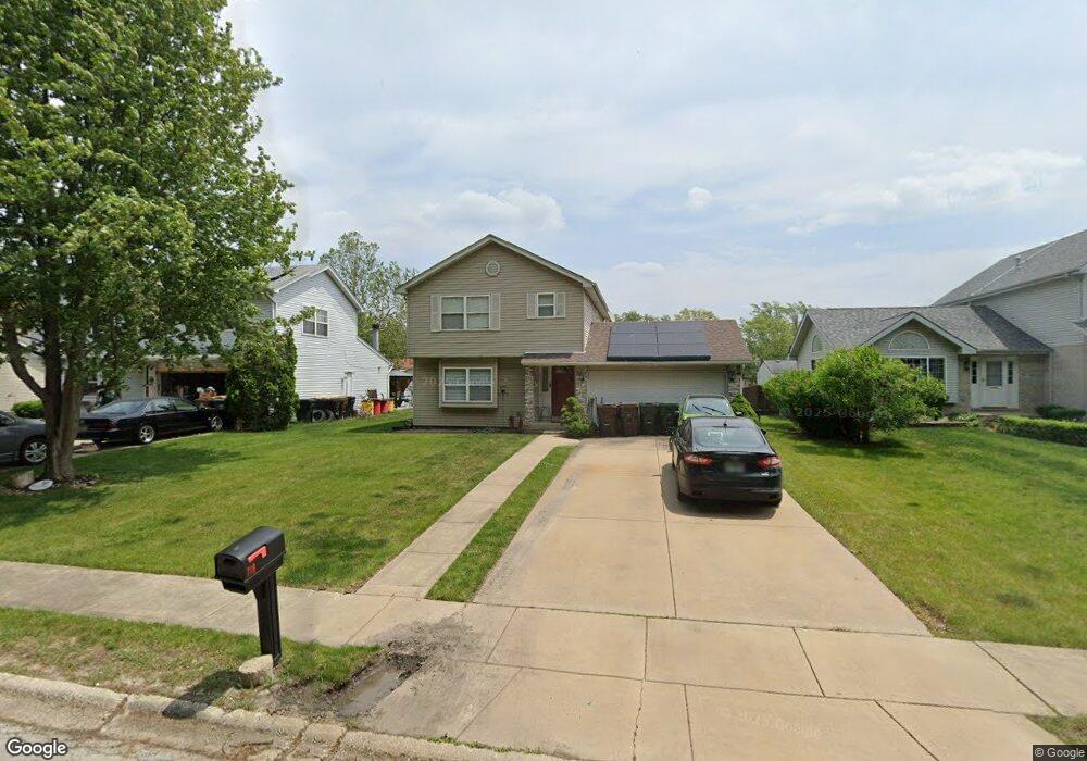
719 Wright Rd University Park, IL 60484
Estimated Value: $188,797 - $276,000
Studio
1
Bath
1,472
Sq Ft
$163/Sq Ft
Est. Value
About This Home
This home is located at 719 Wright Rd, University Park, IL 60484 and is currently estimated at $240,449, approximately $163 per square foot. 719 Wright Rd is a home located in Will County with nearby schools including Crete Elementary School, Crete-Monee Middle School, and Crete-Monee High School.
Ownership History
Date
Name
Owned For
Owner Type
Purchase Details
Closed on
Nov 3, 1997
Sold by
Federal Home Loan Mortgage Corporation
Bought by
Thomas Reginald A
Current Estimated Value
Home Financials for this Owner
Home Financials are based on the most recent Mortgage that was taken out on this home.
Original Mortgage
$98,466
Outstanding Balance
$16,360
Interest Rate
7.42%
Mortgage Type
FHA
Estimated Equity
$224,089
Purchase Details
Closed on
Sep 2, 1997
Sold by
Ward Brendan D
Bought by
Federal Home Loan Mortgage Corporation
Purchase Details
Closed on
Jul 21, 1995
Sold by
Standard Bank & Trust Company
Bought by
Mcdonald Columbus and Mcdonald Debra D
Home Financials for this Owner
Home Financials are based on the most recent Mortgage that was taken out on this home.
Original Mortgage
$95,650
Interest Rate
7.51%
Create a Home Valuation Report for This Property
The Home Valuation Report is an in-depth analysis detailing your home's value as well as a comparison with similar homes in the area
Home Values in the Area
Average Home Value in this Area
Purchase History
| Date | Buyer | Sale Price | Title Company |
|---|---|---|---|
| Thomas Reginald A | -- | Chicago Title Insurance Co | |
| Federal Home Loan Mortgage Corporation | -- | -- | |
| Mcdonald Columbus | $101,000 | -- |
Source: Public Records
Mortgage History
| Date | Status | Borrower | Loan Amount |
|---|---|---|---|
| Open | Thomas Reginald A | $98,466 | |
| Previous Owner | Mcdonald Columbus | $95,650 |
Source: Public Records
Tax History
| Year | Tax Paid | Tax Assessment Tax Assessment Total Assessment is a certain percentage of the fair market value that is determined by local assessors to be the total taxable value of land and additions on the property. | Land | Improvement |
|---|---|---|---|---|
| 2024 | $7,442 | $67,295 | $10,910 | $56,385 |
| 2023 | $7,442 | $58,013 | $9,405 | $48,608 |
| 2022 | $6,347 | $51,032 | $8,273 | $42,759 |
| 2021 | $6,076 | $47,198 | $7,523 | $39,675 |
| 2020 | $5,995 | $45,668 | $7,279 | $38,389 |
| 2019 | $6,050 | $43,308 | $6,903 | $36,405 |
| 2018 | $5,958 | $42,005 | $6,750 | $35,255 |
| 2017 | $5,877 | $40,741 | $6,539 | $34,202 |
| 2016 | $5,583 | $38,946 | $6,302 | $32,644 |
| 2015 | $5,065 | $36,555 | $5,831 | $30,724 |
| 2014 | $5,065 | $37,055 | $5,826 | $31,229 |
| 2013 | $5,065 | $38,800 | $6,100 | $32,700 |
Source: Public Records
Map
Nearby Homes
- 703 Circle Dr
- 735 Union Dr
- 807 Blackhawk Dr
- 807 Union Dr
- 820 Sandra Dr Unit 2C
- 655 Sullivan Ln
- 505 Barbara Ct
- 903 Blackhawk Dr
- 24625 S Western Ave
- 882 White Oak Ln Unit 3
- 608 Sullivan Ln
- 607 Sullivan Ln
- 918 Cordoba Ct
- 401 Pebble Beach Grove Cir
- 2337 Valley View Ln
- 1015 Sierra Ct
- 754 Mission Dr
- 740 Mission St
- 523 Nathan Rd
- 2131 W Exchange St
- 721 Wright Rd
- 717 Wright Rd
- 723 Wright Rd
- 715 Wright Rd
- 718 Blackhawk Dr
- 716 Blackhawk Dr
- 714 Blackhawk Dr
- 725 Wright Rd
- 713 Wright Rd
- 722 Blackhawk Dr
- 712 Blackhawk Dr
- 727 Wright Rd
- 724 Blackhawk Dr
- 711 Wright Rd
- 710 Blackhawk Dr
- 726 Blackhawk Dr
- 709 Wright Rd
- 719 Blackhawk Dr
- 721 Blackhawk Dr
- 728 Blackhawk Dr
Your Personal Tour Guide
Ask me questions while you tour the home.