Estimated Value: $231,000 - $279,000
--
Bed
2
Baths
1,524
Sq Ft
$172/Sq Ft
Est. Value
About This Home
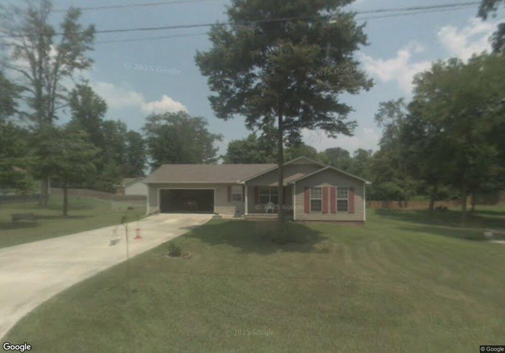
This home is located at 72 10th St W, Grant, AL 35747 and is currently estimated at $261,988, approximately $171 per square foot. 72 10th St W is a home located in Marshall County with nearby schools including Kate Duncan Smith DAR Elementary School, Claysville Jr High School, and Kate Duncan Smith DAR Middle School.
Ownership History
Date
Name
Owned For
Owner Type
Purchase Details
Closed on
Jun 14, 2024
Sold by
Ernst Michael
Bought by
Baker Charles Dustin and Baker Julianna Laszlo
Current Estimated Value
Home Financials for this Owner
Home Financials are based on the most recent Mortgage that was taken out on this home.
Original Mortgage
$279,900
Outstanding Balance
$276,463
Interest Rate
7.22%
Mortgage Type
VA
Estimated Equity
-$14,475
Purchase Details
Closed on
Sep 10, 2020
Sold by
Fletcher Russell and Giles Dori
Bought by
Ernst Michael David
Home Financials for this Owner
Home Financials are based on the most recent Mortgage that was taken out on this home.
Original Mortgage
$155,000
Interest Rate
2.8%
Mortgage Type
VA
Purchase Details
Closed on
Mar 19, 2009
Sold by
Ledbetter Rachel G
Bought by
Fletcher Russell and Giles Dori
Home Financials for this Owner
Home Financials are based on the most recent Mortgage that was taken out on this home.
Original Mortgage
$88,061
Interest Rate
5.1%
Mortgage Type
New Conventional
Create a Home Valuation Report for This Property
The Home Valuation Report is an in-depth analysis detailing your home's value as well as a comparison with similar homes in the area
Home Values in the Area
Average Home Value in this Area
Purchase History
| Date | Buyer | Sale Price | Title Company |
|---|---|---|---|
| Baker Charles Dustin | $279,900 | None Listed On Document | |
| Ernst Michael David | $155,000 | None Available | |
| Fletcher Russell | -- | None Available |
Source: Public Records
Mortgage History
| Date | Status | Borrower | Loan Amount |
|---|---|---|---|
| Open | Baker Charles Dustin | $279,900 | |
| Previous Owner | Ernst Michael David | $155,000 | |
| Previous Owner | Fletcher Russell | $88,061 |
Source: Public Records
Tax History Compared to Growth
Tax History
| Year | Tax Paid | Tax Assessment Tax Assessment Total Assessment is a certain percentage of the fair market value that is determined by local assessors to be the total taxable value of land and additions on the property. | Land | Improvement |
|---|---|---|---|---|
| 2024 | $823 | $16,800 | $0 | $0 |
| 2023 | $721 | $16,540 | $1,420 | $15,120 |
| 2022 | $699 | $16,280 | $0 | $0 |
| 2021 | $665 | $15,480 | $0 | $0 |
| 2020 | $519 | $12,040 | $0 | $0 |
| 2017 | $448 | $11,780 | $0 | $0 |
| 2015 | -- | $12,940 | $0 | $0 |
| 2014 | -- | $12,940 | $0 | $0 |
Source: Public Records
Map
Nearby Homes
- 74 3rd Ave W
- 152 6th St W
- 166 3rd Ave W
- 157 Olympia Ln
- 6 Keystone Trail
- 145 Vail Dr
- 347 Rustic Trace
- 103 Steamboat Trace
- 98 Rustic Trace
- 274 Ayers Cir
- 760 Welcome Home Rd
- 6.7+/- Acres Simpson Point Rd
- 172 Epic Way
- 8500 Simpson Point Rd
- 218 Tin Top Rd
- 10 Chera Trail
- 230 McPeters Rd
- 210 McPeters Rd
- 518 Old Union Rd
- 89 Bearden Dr