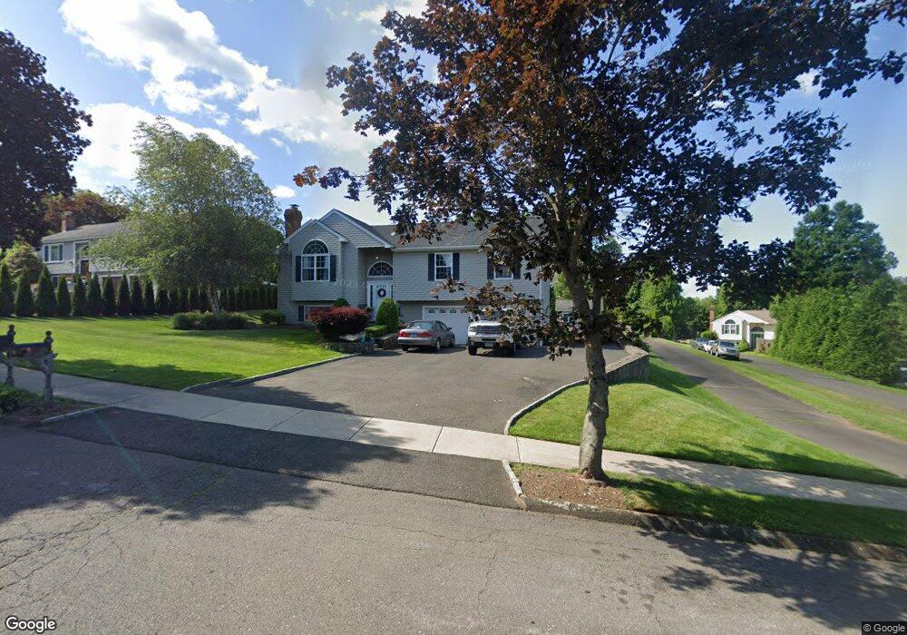
72 Briarwood Dr Seymour, CT 06483
Estimated Value: $526,000 - $581,000
3
Beds
3
Baths
1,736
Sq Ft
$317/Sq Ft
Est. Value
About This Home
This home is located at 72 Briarwood Dr, Seymour, CT 06483 and is currently estimated at $550,459, approximately $317 per square foot. 72 Briarwood Dr is a home located in New Haven County with nearby schools including Seymour Middle School and Seymour High School.
Ownership History
Date
Name
Owned For
Owner Type
Purchase Details
Closed on
Jan 2, 1997
Sold by
Pettinelli Michael
Bought by
Cirella Brian M and Lord Kristen E
Current Estimated Value
Home Financials for this Owner
Home Financials are based on the most recent Mortgage that was taken out on this home.
Original Mortgage
$86,300
Outstanding Balance
$8,953
Interest Rate
7.25%
Mortgage Type
Purchase Money Mortgage
Estimated Equity
$541,506
Create a Home Valuation Report for This Property
The Home Valuation Report is an in-depth analysis detailing your home's value as well as a comparison with similar homes in the area
Home Values in the Area
Average Home Value in this Area
Purchase History
| Date | Buyer | Sale Price | Title Company |
|---|---|---|---|
| Cirella Brian M | $172,600 | -- | |
| Cirella Brian M | $172,600 | -- |
Source: Public Records
Mortgage History
| Date | Status | Borrower | Loan Amount |
|---|---|---|---|
| Open | Cirella Brian M | $86,300 | |
| Closed | Cirella Brian M | $86,300 |
Source: Public Records
Tax History Compared to Growth
Tax History
| Year | Tax Paid | Tax Assessment Tax Assessment Total Assessment is a certain percentage of the fair market value that is determined by local assessors to be the total taxable value of land and additions on the property. | Land | Improvement |
|---|---|---|---|---|
| 2025 | $9,384 | $338,520 | $52,290 | $286,230 |
| 2024 | $9,413 | $255,500 | $43,750 | $211,750 |
| 2023 | $9,193 | $255,500 | $43,750 | $211,750 |
| 2022 | $9,093 | $255,500 | $43,750 | $211,750 |
| 2021 | $8,868 | $255,500 | $43,750 | $211,750 |
| 2020 | $7,043 | $195,650 | $51,450 | $144,200 |
| 2019 | $7,043 | $195,650 | $51,450 | $144,200 |
| 2018 | $7,043 | $195,650 | $51,450 | $144,200 |
| 2017 | $7,008 | $194,670 | $51,450 | $143,220 |
| 2016 | $7,008 | $194,670 | $51,450 | $143,220 |
| 2015 | $7,019 | $202,930 | $56,490 | $146,440 |
| 2014 | $6,908 | $202,930 | $56,490 | $146,440 |
Source: Public Records
Map
Nearby Homes
- 5 Forest Hollow Rd
- 28 Charles Rd
- 20 Falcon Ln
- 18 Fieldstone Ln
- 31 Skokorat St
- 6/6A Chatfield St
- 10 Lantern Ridge Rd
- 17 Meadow St Unit 23
- 81 Fieldstone Ln Unit 81
- 3 Timberland Way Unit 3
- 212 Bear Hill Rd
- 32 Roberts St
- 37 Quarry Rd
- 35 Cogwheel Ln
- 25 Noe Place
- 38 Sanford St
- 58 Anthony Ct
- 226 Walnut St
- 159 Bethany Rd
- 167 Bethmour Rd
- 74 Briarwood Dr
- 70 Briarwood Dr
- 66 Briarwood Dr
- 145 Skokorat St
- 68 Briarwood Dr
- 69 Briarwood Dr
- 73 Briarwood Dr
- 67 Briarwood Dr
- 75 Briarwood Dr
- 65 Briarwood Dr
- 64 Briarwood Dr
- 158 Skokorat St
- 160 Skokorat St
- 141 Skokorat St
- 142 Skokorat St
- 2 Evergreen Terrace
- 60 Briarwood Dr
- 139 Skokorat St
- 140 Skokorat St
- 62 Briarwood Dr