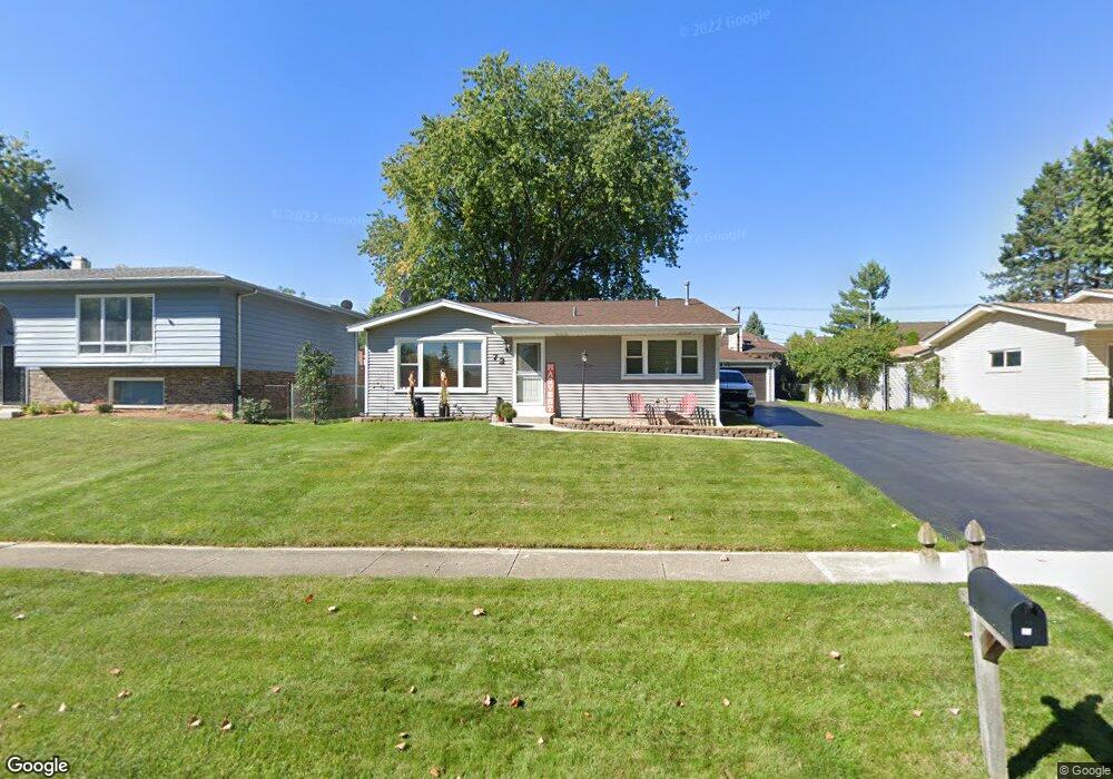
72 Bunkerhill Ave South Elgin, IL 60177
Estimated Value: $334,910 - $349,000
3
Beds
2
Baths
1,800
Sq Ft
$191/Sq Ft
Est. Value
About This Home
This home is located at 72 Bunkerhill Ave, South Elgin, IL 60177 and is currently estimated at $343,228, approximately $190 per square foot. 72 Bunkerhill Ave is a home located in Kane County with nearby schools including Willard Elementary School, Kenyon Woods Middle School, and South Elgin High School.
Ownership History
Date
Name
Owned For
Owner Type
Purchase Details
Closed on
Jun 12, 2009
Sold by
Schubbe Diane
Bought by
Irwin Jeffrey J and Irwin Kimberly D
Current Estimated Value
Home Financials for this Owner
Home Financials are based on the most recent Mortgage that was taken out on this home.
Original Mortgage
$129,000
Outstanding Balance
$82,161
Interest Rate
4.92%
Mortgage Type
Purchase Money Mortgage
Estimated Equity
$261,067
Create a Home Valuation Report for This Property
The Home Valuation Report is an in-depth analysis detailing your home's value as well as a comparison with similar homes in the area
Home Values in the Area
Average Home Value in this Area
Purchase History
| Date | Buyer | Sale Price | Title Company |
|---|---|---|---|
| Irwin Jeffrey J | $165,000 | Attorneys Title Guaranty Fun |
Source: Public Records
Mortgage History
| Date | Status | Borrower | Loan Amount |
|---|---|---|---|
| Open | Irwin Jeffrey J | $129,000 |
Source: Public Records
Tax History Compared to Growth
Tax History
| Year | Tax Paid | Tax Assessment Tax Assessment Total Assessment is a certain percentage of the fair market value that is determined by local assessors to be the total taxable value of land and additions on the property. | Land | Improvement |
|---|---|---|---|---|
| 2024 | $6,460 | $89,858 | $19,391 | $70,467 |
| 2023 | $6,140 | $81,180 | $17,518 | $63,662 |
| 2022 | $5,854 | $74,022 | $15,973 | $58,049 |
| 2021 | $5,505 | $69,206 | $14,934 | $54,272 |
| 2020 | $5,114 | $63,601 | $14,257 | $49,344 |
| 2019 | $4,919 | $60,584 | $13,581 | $47,003 |
| 2018 | $5,347 | $62,733 | $12,794 | $49,939 |
| 2017 | $5,076 | $59,305 | $12,095 | $47,210 |
| 2016 | $4,825 | $55,019 | $11,221 | $43,798 |
| 2015 | -- | $50,430 | $10,285 | $40,145 |
| 2014 | -- | $44,160 | $10,158 | $34,002 |
| 2013 | -- | $45,325 | $10,426 | $34,899 |
Source: Public Records
Map
Nearby Homes
- 308 Cornwall Ave
- 194 S Collins St
- 8N594 S Mclean Blvd
- 387 S Pointe Ave
- 295 S Walnut St
- 590 Fenwick Ln
- 897 N Camden Ln
- 336 Windsor Ct Unit D
- 126 Kingsport Dr
- 291 Kingsport Dr
- 289 Kingsport Dr
- 287 Kingsport Dr
- 285 Kingsport Dr
- 447 Hancock Ave
- 283 Kingsport Dr
- 307 Kingsport Dr
- 281 Kingsport Dr
- 303 Kingsport Dr
- 435 Sandhurst Ln Unit 3
- 301 Kingsport Dr
- 64 Bunkerhill Ave
- 86 Bunkerhill Ave
- 75 E Lynn St
- 54 Bunkerhill Ave
- 95 E Lynn St
- 65 E Lynn St
- 71 Bunkerhill Ave
- 63 Bunkerhill Ave
- 858 Sunbury Rd
- 875 Sunbury Rd
- 53 Bunkerhill Ave
- 135 E Lynn St
- 114 Bunkerhill Ave
- 857 Sunbury Rd
- 35 E Lynn St
- 80 E Lynn St
- 54 E Lynn St
- 72 Concord Ave
- 86 Concord Ave
- 100 E Lynn St