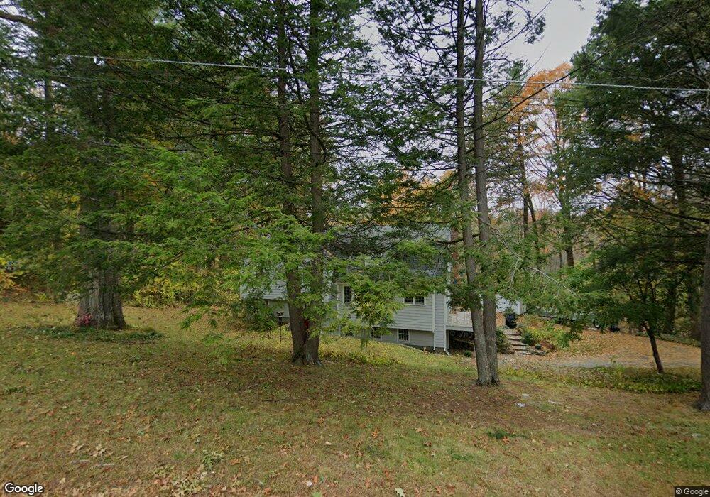
72 Colonial Rd Sudbury, MA 01776
Estimated Value: $991,000 - $1,310,000
4
Beds
3
Baths
1,704
Sq Ft
$645/Sq Ft
Est. Value
About This Home
This home is located at 72 Colonial Rd, Sudbury, MA 01776 and is currently estimated at $1,098,336, approximately $644 per square foot. 72 Colonial Rd is a home located in Middlesex County with nearby schools including Peter Noyes Elementary School, Ephraim Curtis Middle School, and Lincoln-Sudbury Regional High School.
Ownership History
Date
Name
Owned For
Owner Type
Purchase Details
Closed on
Jun 25, 2024
Sold by
Halporn John D and Davis Sarah B
Bought by
Davis Sarah B
Current Estimated Value
Purchase Details
Closed on
Jun 28, 2001
Sold by
Hunt Anthony and Mahone-Hunt Clare
Bought by
Davis Sarah B and Halporn John D
Home Financials for this Owner
Home Financials are based on the most recent Mortgage that was taken out on this home.
Original Mortgage
$413,000
Interest Rate
7.14%
Mortgage Type
Purchase Money Mortgage
Purchase Details
Closed on
Aug 17, 2000
Sold by
Odonnell Michael and Ocdonnell Judith
Bought by
Hunt Anthony and Mahon-Hunt Clare
Home Financials for this Owner
Home Financials are based on the most recent Mortgage that was taken out on this home.
Original Mortgage
$252,700
Interest Rate
8.13%
Mortgage Type
Purchase Money Mortgage
Purchase Details
Closed on
Apr 6, 1992
Sold by
Cornell Ronald S and Gevirtzman Joyce
Bought by
Odonnell Michael A and Odonnell Judith B
Home Financials for this Owner
Home Financials are based on the most recent Mortgage that was taken out on this home.
Original Mortgage
$243,000
Interest Rate
8.73%
Mortgage Type
Purchase Money Mortgage
Purchase Details
Closed on
Feb 14, 1989
Sold by
Hall Nancy J
Bought by
Cornell Ronald S
Home Financials for this Owner
Home Financials are based on the most recent Mortgage that was taken out on this home.
Original Mortgage
$150,000
Interest Rate
10.73%
Mortgage Type
Purchase Money Mortgage
Create a Home Valuation Report for This Property
The Home Valuation Report is an in-depth analysis detailing your home's value as well as a comparison with similar homes in the area
Home Values in the Area
Average Home Value in this Area
Purchase History
| Date | Buyer | Sale Price | Title Company |
|---|---|---|---|
| Davis Sarah B | -- | None Available | |
| Davis Sarah B | -- | None Available | |
| Cornell Ronald S | $275,000 | -- | |
| Davis Sarah B | $538,000 | -- | |
| Hunt Anthony | $467,000 | -- | |
| Odonnell Michael A | $270,000 | -- | |
| Cornell Ronald S | $275,000 | -- |
Source: Public Records
Mortgage History
| Date | Status | Borrower | Loan Amount |
|---|---|---|---|
| Previous Owner | Cornell Ronald S | $413,000 | |
| Previous Owner | Cornell Ronald S | $252,700 | |
| Previous Owner | Cornell Ronald S | $243,000 | |
| Previous Owner | Cornell Ronald S | $150,000 |
Source: Public Records
Tax History Compared to Growth
Tax History
| Year | Tax Paid | Tax Assessment Tax Assessment Total Assessment is a certain percentage of the fair market value that is determined by local assessors to be the total taxable value of land and additions on the property. | Land | Improvement |
|---|---|---|---|---|
| 2025 | $13,765 | $940,200 | $461,500 | $478,700 |
| 2024 | $13,302 | $910,500 | $447,900 | $462,600 |
| 2023 | $13,225 | $838,600 | $414,700 | $423,900 |
| 2022 | $12,103 | $670,500 | $380,300 | $290,200 |
| 2021 | $11,516 | $611,600 | $380,300 | $231,300 |
| 2020 | $11,284 | $611,600 | $380,300 | $231,300 |
| 2019 | $10,954 | $611,600 | $380,300 | $231,300 |
| 2018 | $10,615 | $592,000 | $400,300 | $191,700 |
| 2017 | $10,177 | $573,700 | $395,500 | $178,200 |
| 2016 | $9,190 | $516,300 | $380,300 | $136,000 |
Source: Public Records
Map
Nearby Homes
- 270 Old Lancaster Rd
- 24 Goodnow Rd
- 427 Concord Rd
- 36 Old Forge Ln
- 89 Bridle Path
- 36 Concord Rd
- 25 Bridle Path
- 10 Bradley Place
- 63 Canterbury Dr
- 23 Massasoit Ave
- 7 Saddle Ridge Rd
- 14 Tanbark Rd
- 94 Goodmans Hill Rd
- 12 Camperdown Ln
- 4 Elderberry Cir
- 47 Fairbank Rd
- 1011 Boston Post Rd
- 30 Rolling Ln
- 55 Widow Rites Ln
- 45 Widow Rites Ln