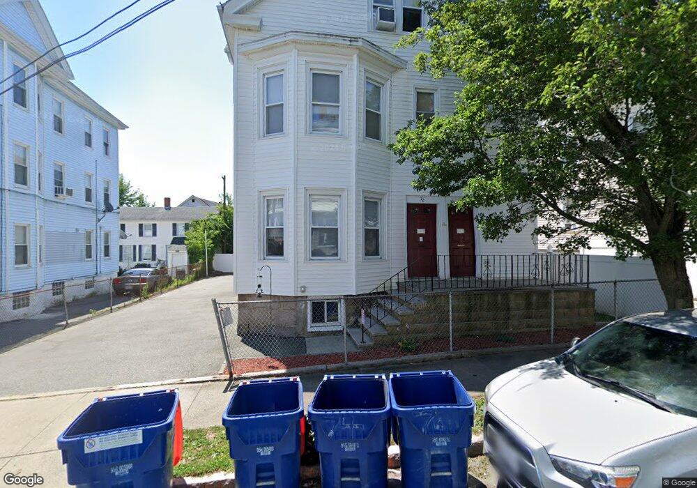
72 Deane St Unit 74 New Bedford, MA 02746
Riverside Park NeighborhoodEstimated Value: $570,000 - $619,000
9
Beds
3
Baths
3,873
Sq Ft
$153/Sq Ft
Est. Value
About This Home
This home is located at 72 Deane St Unit 74, New Bedford, MA 02746 and is currently estimated at $591,667, approximately $152 per square foot. 72 Deane St Unit 74 is a home located in Bristol County with nearby schools including Abraham Lincoln Elementary School, Normandin Middle School, and New Bedford High School.
Ownership History
Date
Name
Owned For
Owner Type
Purchase Details
Closed on
Mar 2, 2016
Sold by
Adesso Ft
Bought by
Ferreira Jennifer and Letendre Chad W
Current Estimated Value
Home Financials for this Owner
Home Financials are based on the most recent Mortgage that was taken out on this home.
Original Mortgage
$106,043
Outstanding Balance
$84,376
Interest Rate
3.81%
Mortgage Type
FHA
Estimated Equity
$507,291
Purchase Details
Closed on
Aug 21, 2013
Sold by
Adesso Frank J and Adesso Lydia
Bought by
Adesso Ft and Rich
Create a Home Valuation Report for This Property
The Home Valuation Report is an in-depth analysis detailing your home's value as well as a comparison with similar homes in the area
Home Values in the Area
Average Home Value in this Area
Purchase History
| Date | Buyer | Sale Price | Title Company |
|---|---|---|---|
| Ferreira Jennifer | $108,000 | -- | |
| Ferreira Jennifer | $108,000 | -- | |
| Adesso Ft | -- | -- | |
| Adesso Ft | -- | -- |
Source: Public Records
Mortgage History
| Date | Status | Borrower | Loan Amount |
|---|---|---|---|
| Open | Ferreira Jennifer | $106,043 | |
| Closed | Ferreira Jennifer | $106,043 | |
| Previous Owner | Adesso Ft | $20,000 | |
| Previous Owner | Adesso Ft | $48,500 | |
| Previous Owner | Adesso Ft | $2,700 |
Source: Public Records
Tax History Compared to Growth
Tax History
| Year | Tax Paid | Tax Assessment Tax Assessment Total Assessment is a certain percentage of the fair market value that is determined by local assessors to be the total taxable value of land and additions on the property. | Land | Improvement |
|---|---|---|---|---|
| 2025 | $6,242 | $551,900 | $100,200 | $451,700 |
| 2024 | $5,460 | $455,000 | $75,200 | $379,800 |
| 2023 | $4,601 | $322,000 | $64,100 | $257,900 |
| 2022 | $4,180 | $269,000 | $58,500 | $210,500 |
| 2021 | $4,078 | $261,600 | $58,500 | $203,100 |
| 2020 | $4,038 | $249,900 | $58,500 | $191,400 |
| 2019 | $3,467 | $210,500 | $58,500 | $152,000 |
| 2018 | $3,291 | $197,900 | $58,500 | $139,400 |
| 2017 | $3,036 | $181,900 | $58,500 | $123,400 |
| 2016 | $2,907 | $176,300 | $58,500 | $117,800 |
| 2015 | $2,734 | $173,800 | $60,100 | $113,700 |
| 2014 | $2,686 | $177,200 | $63,500 | $113,700 |
Source: Public Records
Map
Nearby Homes
- 330 N Front St
- 234 Phillips Ave
- 178 Ashley Blvd
- 193 Ashley Blvd
- 161 Deane St
- 239 Sawyer St
- 284 Sawyer St
- 98 Beetle St
- 153 Belleville Ave
- 125 +135 Tinkham St
- 301 Davis St
- 10 Erics Way
- 128 Nash Rd
- 0 Coggeshall St
- 24 Cotter St
- 203-205 Tinkham St
- 228 Eugenia St
- 34 Washburn St Unit 36
- 498-500 Coggeshall St
- 18 Edison St
- 68 Deane St
- 76 Deane St
- 364 N Front St
- NS Deane St
- 374 N Front St
- 62 Deane St
- 35 Bullard St
- 73 Deane St
- 69 Deane St
- 358 N Front St
- 67 Deane St
- 63 Deane St Unit 65
- 363 1/2 N Front St
- 61 Deane St
- 363 N Front St
- 382 N Front St
- 85 Deane St Unit 1S
- 85 Deane St Unit 3W
- 85 Deane St Unit 2E
- 85 Deane St Unit 3E