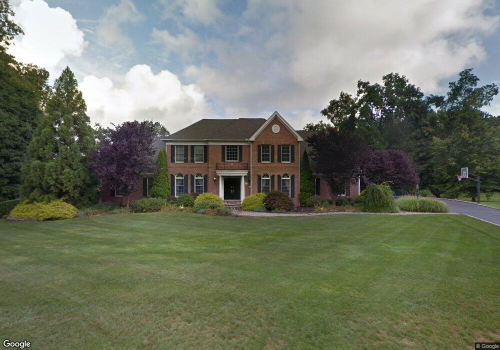
72 Farm Hill Rd Orange, CT 06477
Estimated Value: $1,380,000 - $1,403,015
4
Beds
3
Baths
3,918
Sq Ft
$355/Sq Ft
Est. Value
About This Home
This home is located at 72 Farm Hill Rd, Orange, CT 06477 and is currently estimated at $1,392,005, approximately $355 per square foot. 72 Farm Hill Rd is a home located in New Haven County with nearby schools including Mary L. Tracy School, Peck Place School, and Amity Middle School: Orange.
Ownership History
Date
Name
Owned For
Owner Type
Purchase Details
Closed on
Dec 16, 2016
Sold by
Walsh Lisa A
Bought by
Walsh Lisa A and Walsh John T
Current Estimated Value
Purchase Details
Closed on
Dec 23, 2002
Sold by
Toll Ct 2 Lp
Bought by
Walsh John T and Walsh Lisa A
Home Financials for this Owner
Home Financials are based on the most recent Mortgage that was taken out on this home.
Original Mortgage
$500,000
Interest Rate
5.25%
Create a Home Valuation Report for This Property
The Home Valuation Report is an in-depth analysis detailing your home's value as well as a comparison with similar homes in the area
Home Values in the Area
Average Home Value in this Area
Purchase History
| Date | Buyer | Sale Price | Title Company |
|---|---|---|---|
| Walsh Lisa A | -- | -- | |
| Walsh Lisa A | -- | -- | |
| Walsh John T | $739,518 | -- | |
| Walsh John T | $739,518 | -- |
Source: Public Records
Mortgage History
| Date | Status | Borrower | Loan Amount |
|---|---|---|---|
| Previous Owner | Walsh John T | $399,600 | |
| Previous Owner | Walsh John T | $500,000 |
Source: Public Records
Tax History
| Year | Tax Paid | Tax Assessment Tax Assessment Total Assessment is a certain percentage of the fair market value that is determined by local assessors to be the total taxable value of land and additions on the property. | Land | Improvement |
|---|---|---|---|---|
| 2025 | $24,531 | $843,000 | $318,400 | $524,600 |
| 2024 | $26,133 | $843,000 | $318,400 | $524,600 |
| 2023 | $20,249 | $626,700 | $232,400 | $394,300 |
| 2022 | $20,499 | $626,700 | $232,400 | $394,300 |
| 2021 | $20,838 | $626,700 | $232,400 | $394,300 |
| 2020 | $20,518 | $626,700 | $232,400 | $394,300 |
| 2019 | $20,424 | $626,700 | $232,400 | $394,300 |
| 2018 | $20,054 | $626,700 | $232,400 | $394,300 |
| 2017 | $20,294 | $609,800 | $216,200 | $393,600 |
| 2016 | $19,636 | $609,800 | $216,200 | $393,600 |
| 2015 | $19,148 | $609,800 | $216,200 | $393,600 |
| 2014 | $18,599 | $609,800 | $216,200 | $393,600 |
Source: Public Records
Map
Nearby Homes
- 24 Brierwood Dr
- 489 Derby Milford Rd
- 830 Bayberry Ln
- 11A Derby-Milford Rd
- 847 Glenbrook Rd
- 884 Grassy Hill Rd
- 920 Green Cir
- 424 Racebrook Rd
- 941 Garden Rd
- 84 Chelsea Ct
- 463 Herbert St
- 420 Narrow Ln
- 74 Victory St
- 317 Narrow Ln
- 323 Goose Ln Unit 323
- 109 Green Meadow Rd
- 500 River Rd Unit 3
- 148 Kennedy Dr
- 11 Williamsburg Dr
- 1025 Willard Rd
Your Personal Tour Guide
Ask me questions while you tour the home.