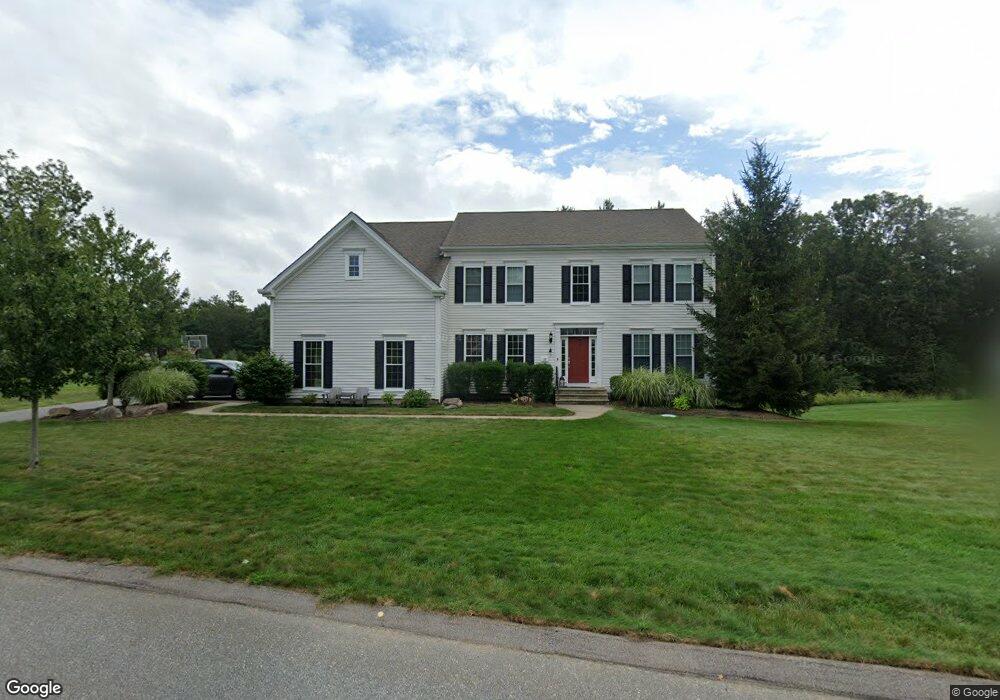
72 Farrington Ave Wrentham, MA 02093
Estimated Value: $1,165,580 - $1,324,000
4
Beds
4
Baths
3,627
Sq Ft
$350/Sq Ft
Est. Value
About This Home
This home is located at 72 Farrington Ave, Wrentham, MA 02093 and is currently estimated at $1,270,145, approximately $350 per square foot. 72 Farrington Ave is a home with nearby schools including Delaney Elementary School and Charles E Roderick.
Ownership History
Date
Name
Owned For
Owner Type
Purchase Details
Closed on
Oct 23, 2012
Sold by
Pulte Homes New Eng Ll
Bought by
Tezber John D and Tezber Beth S
Current Estimated Value
Home Financials for this Owner
Home Financials are based on the most recent Mortgage that was taken out on this home.
Original Mortgage
$500,000
Outstanding Balance
$397,572
Interest Rate
3%
Mortgage Type
New Conventional
Estimated Equity
$872,573
Create a Home Valuation Report for This Property
The Home Valuation Report is an in-depth analysis detailing your home's value as well as a comparison with similar homes in the area
Purchase History
| Date | Buyer | Sale Price | Title Company |
|---|---|---|---|
| Tezber John D | $631,002 | -- |
Source: Public Records
Mortgage History
| Date | Status | Borrower | Loan Amount |
|---|---|---|---|
| Open | Tezber John D | $500,000 |
Source: Public Records
Tax History
| Year | Tax Paid | Tax Assessment Tax Assessment Total Assessment is a certain percentage of the fair market value that is determined by local assessors to be the total taxable value of land and additions on the property. | Land | Improvement |
|---|---|---|---|---|
| 2025 | $11,566 | $997,900 | $281,300 | $716,600 |
| 2024 | $11,036 | $919,700 | $281,300 | $638,400 |
| 2023 | $11,016 | $872,900 | $255,700 | $617,200 |
| 2022 | $10,523 | $769,800 | $238,500 | $531,300 |
| 2021 | $9,805 | $696,900 | $208,200 | $488,700 |
| 2020 | $10,090 | $708,100 | $185,200 | $522,900 |
| 2019 | $9,877 | $699,500 | $200,600 | $498,900 |
| 2018 | $9,404 | $660,400 | $200,900 | $459,500 |
| 2017 | $9,099 | $638,500 | $197,000 | $441,500 |
| 2016 | $8,981 | $628,900 | $191,300 | $437,600 |
| 2015 | $9,595 | $640,500 | $212,200 | $428,300 |
| 2014 | $9,503 | $620,700 | $204,100 | $416,600 |
Source: Public Records
Map
Nearby Homes
- 45 Joshua Rd
- 287 Park St
- 50 Reed Fulton Ave Unit Lot 61
- 246 Forest Grove Ave
- 500 Franklin St
- 0 W Birch Rd
- 9 Elliot Mills Unit 5
- 8 Elliot Mills Unit 30
- 5 Elliot Mills Unit 3
- 7 Elliot Mills Unit 4
- 10 Elliot Mills Unit 29
- 23 Fredrickson Rd
- 20 Waites Crossing
- 19 Waites Crossing
- 13 Waites Crossing
- 14 Waites Crossing
- 11 Weber Farm Rd Unit 11
- 8 Weber Farm Rd Unit 8
- 10 Nature View Dr
- 15 Nature View Dr
- 64 Farrington Ave
- 80 Farrington Ave
- 79 Farrington Ave
- 71 Farrington Ave
- 63 Farrington Ave
- 56 Farrington Ave
- 87 Farrington Ave
- 88 Farrington Ave
- 57 Farrington Ave
- 70 Warren Dr
- 96 Farrington Ave
- 104 Hemmingway Place
- 47 Farrington Ave
- 60 Warren Dr
- 50 Warren Dr
- 106 Hemmingway Place
- 39 Farrington Ave
- 86 Hemmingway Place
- 124 Hemmingway Place
- 40 Warren Dr
Your Personal Tour Guide
Ask me questions while you tour the home.