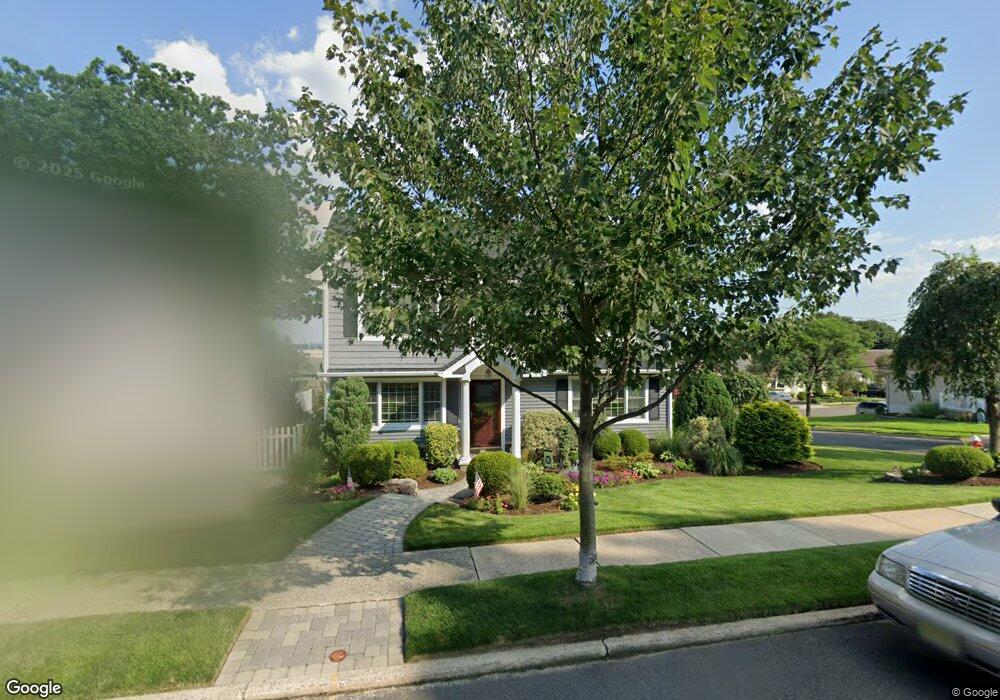
72 Hasbrouck Ave Hasbrouck Heights, NJ 07604
Estimated Value: $736,000 - $828,000
--
Bed
--
Bath
1,984
Sq Ft
$390/Sq Ft
Est. Value
About This Home
This home is located at 72 Hasbrouck Ave, Hasbrouck Heights, NJ 07604 and is currently estimated at $774,651, approximately $390 per square foot. 72 Hasbrouck Ave is a home located in Bergen County with nearby schools including Hasbrouck Heights High School and Corpus Christi School.
Ownership History
Date
Name
Owned For
Owner Type
Purchase Details
Closed on
Aug 30, 2001
Sold by
Tornatore Paul C
Bought by
Morrow Brian R and Mccallum Julie L
Current Estimated Value
Home Financials for this Owner
Home Financials are based on the most recent Mortgage that was taken out on this home.
Original Mortgage
$229,900
Outstanding Balance
$89,126
Interest Rate
6.91%
Estimated Equity
$685,525
Purchase Details
Closed on
Feb 11, 1998
Sold by
Yurgelonis Linda and Rondelli Carmela
Bought by
Tornatore Paul C and Tornatore Stacey A
Home Financials for this Owner
Home Financials are based on the most recent Mortgage that was taken out on this home.
Original Mortgage
$164,700
Interest Rate
6.93%
Create a Home Valuation Report for This Property
The Home Valuation Report is an in-depth analysis detailing your home's value as well as a comparison with similar homes in the area
Home Values in the Area
Average Home Value in this Area
Purchase History
| Date | Buyer | Sale Price | Title Company |
|---|---|---|---|
| Morrow Brian R | $249,900 | -- | |
| Tornatore Paul C | $183,000 | -- |
Source: Public Records
Mortgage History
| Date | Status | Borrower | Loan Amount |
|---|---|---|---|
| Open | Morrow Brian R | $229,900 | |
| Previous Owner | Tornatore Paul C | $164,700 |
Source: Public Records
Tax History Compared to Growth
Tax History
| Year | Tax Paid | Tax Assessment Tax Assessment Total Assessment is a certain percentage of the fair market value that is determined by local assessors to be the total taxable value of land and additions on the property. | Land | Improvement |
|---|---|---|---|---|
| 2025 | $15,432 | $604,000 | $218,000 | $386,000 |
| 2024 | $15,088 | $604,000 | $218,000 | $386,000 |
| 2023 | $14,784 | $585,500 | $213,000 | $372,500 |
| 2022 | $14,784 | $549,200 | $195,500 | $353,700 |
| 2021 | $14,318 | $507,000 | $183,000 | $324,000 |
| 2020 | $13,874 | $482,400 | $175,500 | $306,900 |
| 2019 | $13,474 | $473,600 | $173,000 | $300,600 |
| 2018 | $13,256 | $464,800 | $170,500 | $294,300 |
| 2017 | $13,109 | $459,000 | $168,000 | $291,000 |
| 2016 | $13,205 | $435,100 | $158,000 | $277,100 |
| 2015 | $12,992 | $435,100 | $158,000 | $277,100 |
| 2014 | $12,635 | $435,100 | $158,000 | $277,100 |
Source: Public Records
Map
Nearby Homes
- 48 Hasbrouck Ave
- 18 Hasbrouck Ave
- 444 Washington Place
- 140 Prospect St
- 417 Franklin Ave
- 233 Lasalle Ave
- 8800 Boulevard Unit 5F
- 8800 Boulevard Unit 7K
- 8800 Boulevard Unit 4B
- 485 Hasbrouck Ave
- 208 Jefferson Ave
- 460 Boulevard
- 74 Kipp Ave
- 252 Paterson Ave
- 513 Boulevard
- 35 Franklin Ave
- 212 Paterson Ave
- 238 Bell Ave
- 14 Jefferson Ave Unit 16
- 229 Baldwin Ave
- 74 Hasbrouck Ave
- 447 Madison Ave
- 448 Madison Ave
- 451 Madison Ave
- 71 Hasbrouck Ave
- 440 Madison Ave
- 76 Hasbrouck Ave
- 442 Lasalle Ave
- 65 Garrison Ave
- 457 Madison Ave
- 75 Hasbrouck Ave
- 446 Lasalle Ave
- 450 Lasalle Ave
- 450 Lasalle Ave Unit house
- 432 Lasalle Ave
- 456 Madison Ave
- 59 Garrison Ave
- 461 Madison Ave
- 62 Garrison Ave
- 428 Lasalle Ave