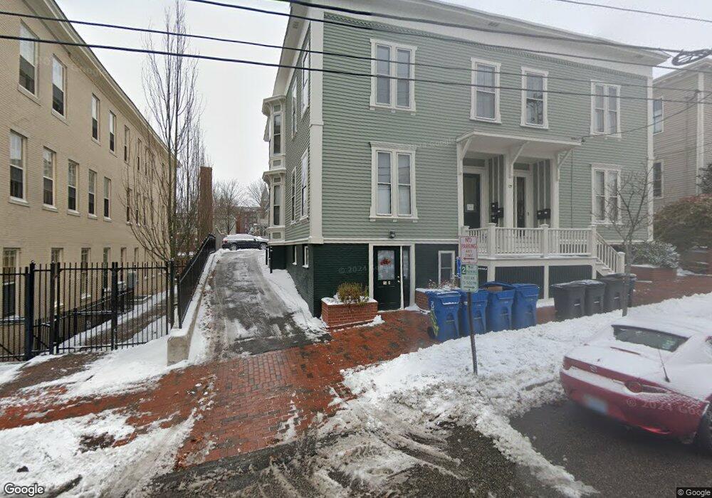
72 High St Unit B2 Portland, ME 04101
West End NeighborhoodEstimated Value: $500,000 - $627,000
2
Beds
1
Bath
965
Sq Ft
$560/Sq Ft
Est. Value
About This Home
This home is located at 72 High St Unit B2, Portland, ME 04101 and is currently estimated at $540,002, approximately $559 per square foot. 72 High St Unit B2 is a home located in Cumberland County with nearby schools including Howard C. Reiche Community School, King Middle School, and Baxter Academy for Tech & Sciences.
Ownership History
Date
Name
Owned For
Owner Type
Purchase Details
Closed on
Oct 15, 2024
Sold by
Guptill Charlotte E
Bought by
Charlotte E Guptill Lt and Guptill
Current Estimated Value
Purchase Details
Closed on
Mar 28, 2013
Sold by
Leavitt Charlotte and Guptill Charlotte E
Bought by
Guptill Charlotte E and Guptill John B
Purchase Details
Closed on
May 30, 2008
Sold by
Mortimer Harold J and Seals Mary E
Bought by
Leavitt Charlotte
Home Financials for this Owner
Home Financials are based on the most recent Mortgage that was taken out on this home.
Original Mortgage
$140,000
Interest Rate
5.91%
Mortgage Type
Unknown
Create a Home Valuation Report for This Property
The Home Valuation Report is an in-depth analysis detailing your home's value as well as a comparison with similar homes in the area
Home Values in the Area
Average Home Value in this Area
Purchase History
| Date | Buyer | Sale Price | Title Company |
|---|---|---|---|
| Charlotte E Guptill Lt | -- | None Available | |
| Charlotte E Guptill Lt | -- | None Available | |
| Guptill Charlotte E | -- | -- | |
| Guptill Charlotte E | -- | -- | |
| Leavitt Charlotte | -- | -- | |
| Leavitt Charlotte | -- | -- |
Source: Public Records
Mortgage History
| Date | Status | Borrower | Loan Amount |
|---|---|---|---|
| Previous Owner | Leavitt Charlotte | $143,000 | |
| Previous Owner | Leavitt Charlotte | $140,000 |
Source: Public Records
Tax History Compared to Growth
Tax History
| Year | Tax Paid | Tax Assessment Tax Assessment Total Assessment is a certain percentage of the fair market value that is determined by local assessors to be the total taxable value of land and additions on the property. | Land | Improvement |
|---|---|---|---|---|
| 2024 | $4,593 | $306,000 | $61,200 | $244,800 |
| 2023 | $4,409 | $306,000 | $61,200 | $244,800 |
| 2022 | $4,165 | $306,000 | $61,200 | $244,800 |
| 2021 | $3,975 | $306,000 | $61,200 | $244,800 |
| 2020 | $4,168 | $178,800 | $35,800 | $143,000 |
| 2019 | $4,168 | $178,800 | $35,800 | $143,000 |
| 2018 | $3,464 | $178,800 | $35,800 | $143,000 |
| 2017 | $3,871 | $178,800 | $35,800 | $143,000 |
| 2016 | $3,774 | $178,800 | $35,800 | $143,000 |
| 2015 | $3,689 | $178,800 | $35,800 | $143,000 |
| 2014 | $3,576 | $178,800 | $35,800 | $143,000 |
Source: Public Records
Map
Nearby Homes
- 88 Park St Unit 41
- 25 High St Unit 214
- 25 High St Unit 408
- 68 Pleasant St
- 40 Pleasant St
- 387 Commercial St Unit 710
- 387 Commercial St Unit 205
- 32 State St Unit 5
- 32 State St Unit 1
- 383 Commercial St
- 383 Commercial St Unit 405
- 383 Commercial St Unit 709
- 383 Commercial St Unit 315
- 64 Gray St
- 148 State St
- 83 Brackett St
- 547 Congress St Unit 6
- 15 Brown St Unit 405
- 15 Brown St Unit 206
- 207 State St
- 72 High St Unit G3
- 72 High St Unit F3
- 72 High St Unit E3
- 72 High St Unit E2
- 72 High St Unit E1
- 72 High St Unit D3
- 72 High St Unit D2
- 72 High St Unit D1
- 72 High St Unit C3
- 72 High St Unit C2
- 72 High St Unit C1
- 72 High St Unit B3
- 72 High St Unit B1
- 72 High St Unit A3
- 72 High St Unit A2
- 72 High St Unit A1
- 72 High St Unit 1A
- 72 High St
- 72 High St Unit 2
- 72 High St Unit B