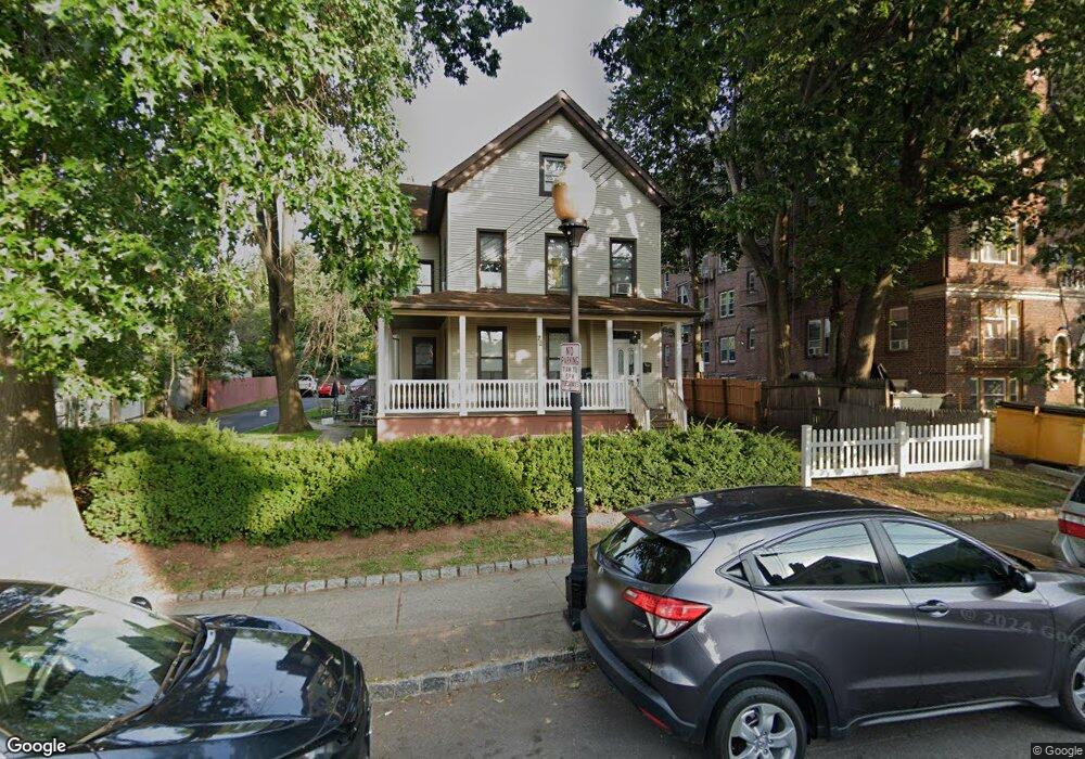
72 James St Englewood, NJ 07631
Estimated Value: $679,000 - $942,000
--
Bed
--
Bath
2,836
Sq Ft
$280/Sq Ft
Est. Value
About This Home
This home is located at 72 James St, Englewood, NJ 07631 and is currently estimated at $795,131, approximately $280 per square foot. 72 James St is a home located in Bergen County with nearby schools including Dr Mccloud Elementary School, Dr J Grieco Elementary School, and J.E. Dismus Middle School.
Ownership History
Date
Name
Owned For
Owner Type
Purchase Details
Closed on
Jan 15, 2004
Current Estimated Value
Purchase Details
Closed on
Dec 23, 1999
Sold by
Lopez Monica and Restrepo Veronica
Bought by
Lopez Monica P and Restrepo Veronica P
Home Financials for this Owner
Home Financials are based on the most recent Mortgage that was taken out on this home.
Original Mortgage
$216,667
Interest Rate
7.84%
Mortgage Type
FHA
Purchase Details
Closed on
Oct 6, 1999
Sold by
Ocampo Dario
Bought by
Lopez Monica and Restrepo Veronica
Purchase Details
Closed on
Jan 6, 1997
Sold by
Simon Betty
Bought by
Ocampo Dario
Home Financials for this Owner
Home Financials are based on the most recent Mortgage that was taken out on this home.
Original Mortgage
$203,000
Interest Rate
7.36%
Mortgage Type
FHA
Create a Home Valuation Report for This Property
The Home Valuation Report is an in-depth analysis detailing your home's value as well as a comparison with similar homes in the area
Home Values in the Area
Average Home Value in this Area
Purchase History
| Date | Buyer | Sale Price | Title Company |
|---|---|---|---|
| -- | -- | -- | |
| Lopez Monica P | -- | Commonwealth Land Title Ins | |
| Lopez Monica | -- | -- | |
| Ocampo Dario | $215,000 | -- |
Source: Public Records
Mortgage History
| Date | Status | Borrower | Loan Amount |
|---|---|---|---|
| Previous Owner | Lopez Monica P | $216,667 | |
| Previous Owner | Ocampo Dario | $203,000 |
Source: Public Records
Tax History Compared to Growth
Tax History
| Year | Tax Paid | Tax Assessment Tax Assessment Total Assessment is a certain percentage of the fair market value that is determined by local assessors to be the total taxable value of land and additions on the property. | Land | Improvement |
|---|---|---|---|---|
| 2025 | $12,375 | $402,700 | $177,000 | $225,700 |
| 2024 | $12,000 | $402,700 | $177,000 | $225,700 |
| 2023 | $11,876 | $402,700 | $177,000 | $225,700 |
| 2022 | $11,876 | $402,700 | $177,000 | $225,700 |
| 2021 | $11,638 | $402,700 | $177,000 | $225,700 |
| 2020 | $11,336 | $402,700 | $177,000 | $225,700 |
| 2019 | $11,231 | $402,700 | $177,000 | $225,700 |
| 2018 | $11,419 | $419,500 | $177,000 | $242,500 |
| 2017 | $11,079 | $419,500 | $177,000 | $242,500 |
| 2016 | $10,727 | $419,500 | $177,000 | $242,500 |
| 2015 | $10,634 | $419,500 | $177,000 | $242,500 |
| 2014 | $10,546 | $419,500 | $177,000 | $242,500 |
Source: Public Records
Map
Nearby Homes
- 79 Slocum Ave
- 142 Slocum Ave
- 109 Slocum Ave
- 15 W Hamilton Ave
- 192 W Englewood Ave
- 24 Cleveland St
- 180 Central Ave Unit A
- 180 Central Ave
- 254 Pindle Ave
- 190 Central Ave
- 201 W Englewood Ave
- 130 Hillside Ave
- 100 E Palisade Ave Unit A24
- 100 E Palisade Ave Unit B31
- 100 E Palisade Ave Unit A51
- 100 E Palisade Ave Unit D34
- 100 E Palisade Ave Unit C14
- 100 E Palisade Ave Unit B22
- 101 E Palisade Ave
- 206 Central Ave