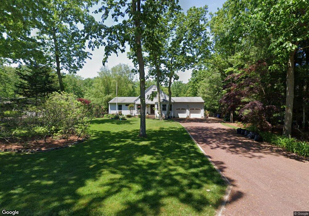
72 Johnson St Waretown, NJ 08758
Estimated Value: $544,993 - $578,000
4
Beds
3
Baths
2,629
Sq Ft
$212/Sq Ft
Est. Value
About This Home
This home is located at 72 Johnson St, Waretown, NJ 08758 and is currently estimated at $556,248, approximately $211 per square foot. 72 Johnson St is a home located in Ocean County with nearby schools including Waretown Elementary School and Frederic A. Priff Elementary School.
Ownership History
Date
Name
Owned For
Owner Type
Purchase Details
Closed on
Aug 5, 2004
Current Estimated Value
Purchase Details
Closed on
Nov 1, 1994
Sold by
Hopson Joseph
Bought by
Lonergan Brian
Home Financials for this Owner
Home Financials are based on the most recent Mortgage that was taken out on this home.
Original Mortgage
$125,000
Interest Rate
8.91%
Create a Home Valuation Report for This Property
The Home Valuation Report is an in-depth analysis detailing your home's value as well as a comparison with similar homes in the area
Home Values in the Area
Average Home Value in this Area
Purchase History
| Date | Buyer | Sale Price | Title Company |
|---|---|---|---|
| -- | $285,000 | -- | |
| Lonergan Brian | $132,000 | -- |
Source: Public Records
Mortgage History
| Date | Status | Borrower | Loan Amount |
|---|---|---|---|
| Previous Owner | Lonergan Brian | $125,000 |
Source: Public Records
Tax History
| Year | Tax Paid | Tax Assessment Tax Assessment Total Assessment is a certain percentage of the fair market value that is determined by local assessors to be the total taxable value of land and additions on the property. | Land | Improvement |
|---|---|---|---|---|
| 2025 | $8,832 | $559,700 | $133,400 | $426,300 |
| 2024 | $8,193 | $559,700 | $133,400 | $426,300 |
| 2023 | $7,664 | $352,700 | $103,400 | $249,300 |
| 2022 | $7,664 | $352,700 | $103,400 | $249,300 |
| 2021 | $7,537 | $352,700 | $103,400 | $249,300 |
| 2020 | $7,438 | $352,700 | $103,400 | $249,300 |
| 2019 | $7,294 | $352,700 | $103,400 | $249,300 |
| 2018 | $7,160 | $352,700 | $103,400 | $249,300 |
| 2017 | $6,916 | $352,700 | $103,400 | $249,300 |
| 2016 | $5,159 | $270,800 | $103,400 | $167,400 |
| 2015 | $5,023 | $270,800 | $103,400 | $167,400 |
| 2014 | $4,983 | $270,800 | $103,400 | $167,400 |
Source: Public Records
Map
Nearby Homes
- 356 Route 9
- 199 Royal Oak Dr
- 43 Baybreeze Dr
- 43 Baybreeze Dr
- 39 Baybreeze Dr
- 41 Baybreeze Dr
- 46 Baybreeze Dr
- 37 Baybreeze Dr
- 35 Baybreeze Dr
- 31 Baybreeze Dr
- 21 Baybreeze Dr
- 37 Bay Breeze Dr
- 35 Forest Park Dr
- 31 Forest Park Dr
- 34 Forest Park Dr
- 36 Forest Park Dr
- 32 Forest Park Dr
- 28 Forest Park Dr
- 30 Forest Park Dr
- 12 Forest Park Dr
Your Personal Tour Guide
Ask me questions while you tour the home.