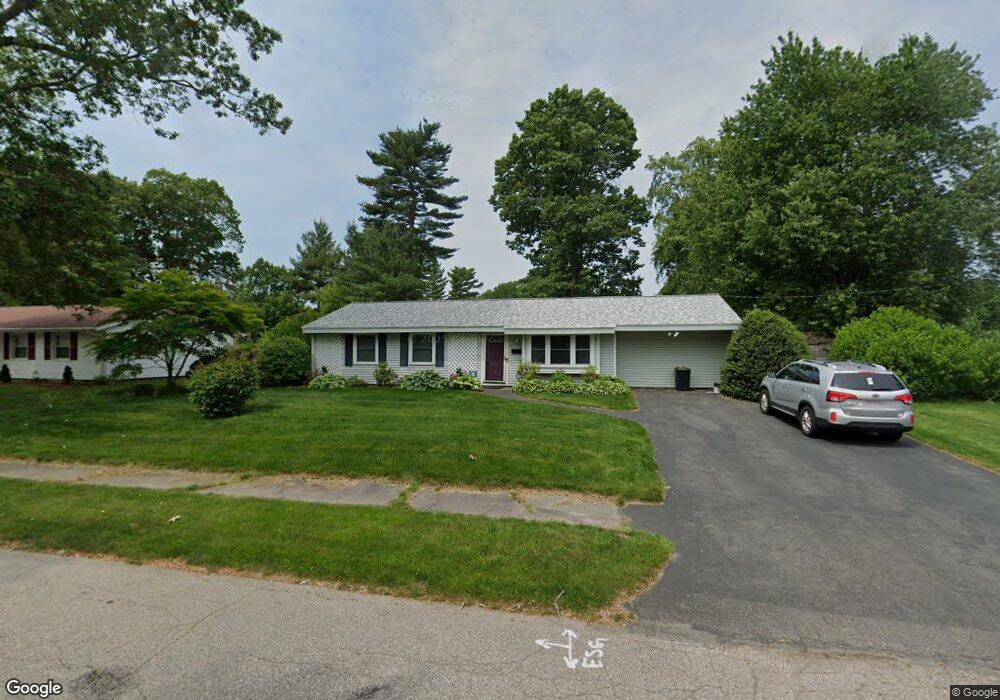
72 Maguire Rd Brockton, MA 02302
Estimated Value: $480,000 - $519,000
3
Beds
1
Bath
1,260
Sq Ft
$392/Sq Ft
Est. Value
About This Home
This home is located at 72 Maguire Rd, Brockton, MA 02302 and is currently estimated at $493,330, approximately $391 per square foot. 72 Maguire Rd is a home located in Plymouth County with nearby schools including Davis K-8 School, John F. Kennedy Elementary School, and South Middle School.
Ownership History
Date
Name
Owned For
Owner Type
Purchase Details
Closed on
Mar 1, 1999
Sold by
Loughlin William K and Loughlin Suzanne M
Bought by
Shaw Matthew L and Shaw Cheri E
Current Estimated Value
Create a Home Valuation Report for This Property
The Home Valuation Report is an in-depth analysis detailing your home's value as well as a comparison with similar homes in the area
Home Values in the Area
Average Home Value in this Area
Purchase History
| Date | Buyer | Sale Price | Title Company |
|---|---|---|---|
| Shaw Matthew L | $107,000 | -- |
Source: Public Records
Mortgage History
| Date | Status | Borrower | Loan Amount |
|---|---|---|---|
| Open | Shaw Matthew L | $128,335 | |
| Closed | Shaw Matthew L | $50,000 |
Source: Public Records
Tax History Compared to Growth
Tax History
| Year | Tax Paid | Tax Assessment Tax Assessment Total Assessment is a certain percentage of the fair market value that is determined by local assessors to be the total taxable value of land and additions on the property. | Land | Improvement |
|---|---|---|---|---|
| 2025 | $4,745 | $391,800 | $162,000 | $229,800 |
| 2024 | $4,572 | $380,400 | $162,000 | $218,400 |
| 2023 | $4,498 | $346,500 | $112,300 | $234,200 |
| 2022 | $4,026 | $288,200 | $102,100 | $186,100 |
| 2021 | $4,066 | $280,400 | $95,400 | $185,000 |
| 2020 | $3,984 | $263,000 | $83,500 | $179,500 |
| 2019 | $3,680 | $236,800 | $79,900 | $156,900 |
| 2018 | $3,459 | $215,400 | $79,900 | $135,500 |
| 2017 | $2,943 | $182,800 | $79,900 | $102,900 |
| 2016 | $3,139 | $180,800 | $76,200 | $104,600 |
| 2015 | $2,815 | $155,100 | $76,200 | $78,900 |
| 2014 | $2,928 | $161,500 | $76,200 | $85,300 |
Source: Public Records
Map
Nearby Homes
- 63 Southfield Dr
- 64 Maguire Rd
- 245 Sinclair Rd
- 237 Sinclair Rd
- 73 Maguire Rd
- 65 Maguire Rd
- 77 Southfield Dr
- 229 Sinclair Rd
- 57 Maguire Rd
- 7 Burdett Rd
- 56 Southfield Dr
- 64 Dondi Rd
- 242 Sinclair Rd
- 85 Southfield Dr
- 74 Southfield Dr
- 48 Maguire Rd
- 234 Sinclair Rd
- 48 Southfield Dr
- 56 Dondi Rd
- 49 Maguire Rd