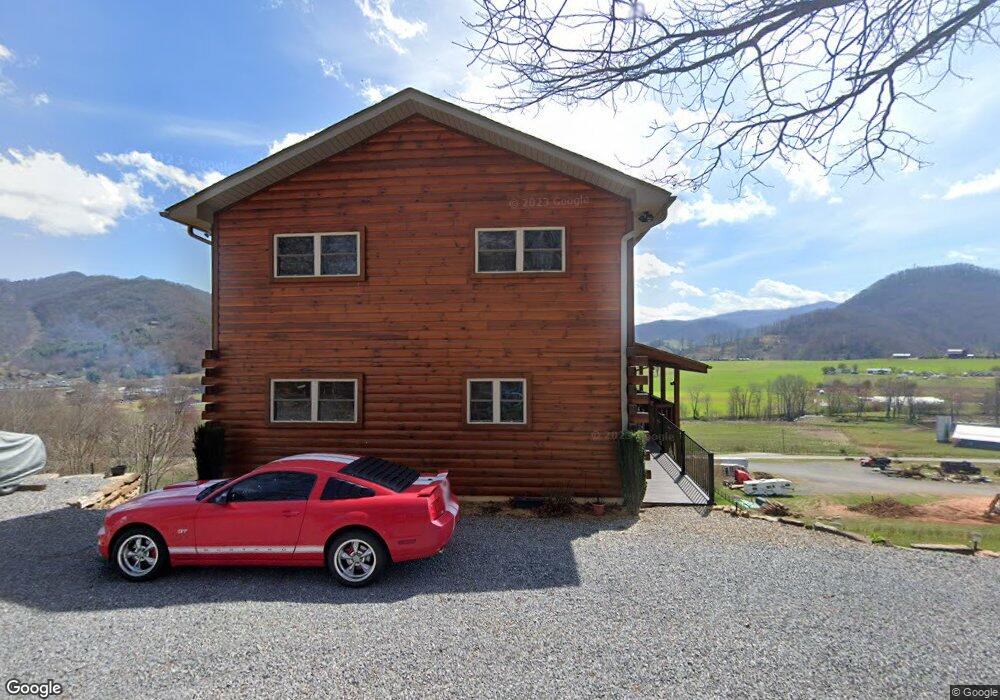
72 Midland Dr Waynesville, NC 28785
Estimated Value: $420,000 - $502,000
3
Beds
3
Baths
1,008
Sq Ft
$448/Sq Ft
Est. Value
About This Home
This home is located at 72 Midland Dr, Waynesville, NC 28785 and is currently estimated at $451,170, approximately $447 per square foot. 72 Midland Dr is a home located in Haywood County with nearby schools including Jonathan Valley Elementary School, Waynesville Middle, and Tuscola High.
Ownership History
Date
Name
Owned For
Owner Type
Purchase Details
Closed on
Nov 14, 2007
Sold by
Jhh Property Investments Llc
Bought by
Diez George E and Diez Carol B
Current Estimated Value
Home Financials for this Owner
Home Financials are based on the most recent Mortgage that was taken out on this home.
Original Mortgage
$195,000
Outstanding Balance
$123,251
Interest Rate
6.36%
Mortgage Type
New Conventional
Estimated Equity
$327,919
Create a Home Valuation Report for This Property
The Home Valuation Report is an in-depth analysis detailing your home's value as well as a comparison with similar homes in the area
Home Values in the Area
Average Home Value in this Area
Purchase History
| Date | Buyer | Sale Price | Title Company |
|---|---|---|---|
| Diez George E | $295,000 | None Available |
Source: Public Records
Mortgage History
| Date | Status | Borrower | Loan Amount |
|---|---|---|---|
| Open | Diez George E | $195,000 |
Source: Public Records
Tax History Compared to Growth
Tax History
| Year | Tax Paid | Tax Assessment Tax Assessment Total Assessment is a certain percentage of the fair market value that is determined by local assessors to be the total taxable value of land and additions on the property. | Land | Improvement |
|---|---|---|---|---|
| 2025 | -- | $288,200 | $48,200 | $240,000 |
| 2024 | $1,902 | $281,200 | $41,200 | $240,000 |
| 2023 | $1,902 | $281,200 | $41,200 | $240,000 |
| 2022 | $1,860 | $281,200 | $41,200 | $240,000 |
| 2021 | $1,860 | $281,200 | $41,200 | $240,000 |
| 2020 | $1,493 | $203,600 | $27,500 | $176,100 |
| 2019 | $1,498 | $203,600 | $27,500 | $176,100 |
| 2018 | $1,498 | $203,600 | $27,500 | $176,100 |
| 2017 | $1,498 | $203,600 | $0 | $0 |
| 2016 | $1,631 | $230,600 | $0 | $0 |
| 2015 | $1,631 | $230,600 | $0 | $0 |
| 2014 | $1,502 | $230,600 | $0 | $0 |
Source: Public Records
Map
Nearby Homes
- 443 Cedarwood Dr
- 0 Asa Trail
- Lot 23 Asa Trail
- 64 Cradling Cove
- 0 Cradling Cove Unit 3
- 284 Aqua Vista Loop
- 25 Summer Place Dr
- 71 Flat Creek Dr
- 52 Strollers Ln
- Lot 17 Covered Bridge Trail Unit 17
- Lot 24 Covered Bridge Trail Unit 24
- 297 Mallard Loop
- 00 Buckeye Dr Unit 35
- 158 Summer Place Dr
- 222 Pike Point
- 158 & 161 Summer Place Dr
- 161 Summer Place Dr
- 85 Garnet Spring Ln
- 164 Carsen Loop
- 217 Mallard Loop
- LOT A Midland Dr Unit LOT A
- 94 Midland Dr
- 111 Midland Dr
- 42 Midland Dr
- 31 Midland Dr
- 119 Midland Dr
- 00 Cedarwood Dr
- LOT B Midland Dr
- 128 Cedarwood Dr
- 128 Cedarwood Dr Unit 9
- 123 Midland Dr
- 28 Viewpoint Dr
- 154 Cedarwood Dr
- 0 Martins Creek
- 56 Cedarwood Dr Unit Lot 7
- 56 Cedarwood Dr
- 770 Grindstone Rd
- 766 Grindstone Rd Unit 1
- LOT B Midland Dr Unit B
- 36 Cedarwood Dr