72 Patterson Rd Unit 74 Shirley, MA 01464
About This Home
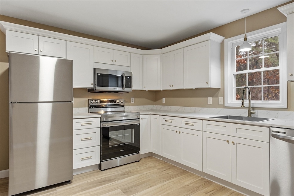
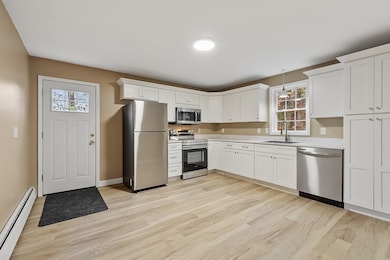
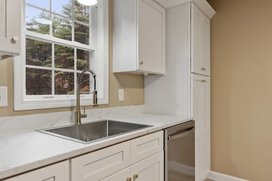
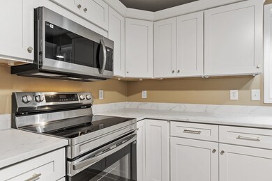
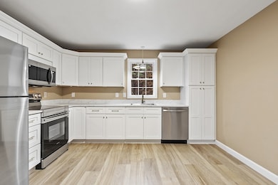
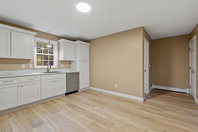
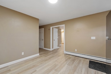
Welcome home to this beautifully renovated 2-bedroom, 1.5-bath Shirley rental. Completely renovated from top to bottom, this home offers modern style, comfort, and convenience. The spacious eat-in kitchen features brand-new cabinetry, countertops, and appliances. The first floor also includes a bright and open living room and a convenient half bath. Upstairs, you’ll find two generous-sized bedrooms and a brand-new full bathroom with stylish finishes. The basement provides washer/dryer hookups and plenty of storage space. The backyard is large and private. Located in an easy commuter location, close to major routes, shopping, and dining — this rental checks all the boxes for comfort and convenience! Available immediately. No Smoking/Vaping. No Pets.
Property Details
Home Type
- Multi-Family
Est. Annual Taxes
- $66
Year Built
- Built in 2000
Parking
- 4 Car Parking Spaces
Home Design
- Property Attached
- Entry on the 1st floor
Interior Spaces
- 1,500 Sq Ft Home
- Basement
- Laundry in Basement
- Washer and Electric Dryer Hookup
Kitchen
- Range
- Freezer
- Dishwasher
Bedrooms and Bathrooms
- 2 Bedrooms
- Primary bedroom located on second floor
Utilities
- No Cooling
- Heating System Uses Oil
Listing and Financial Details
- Security Deposit $2,200
- Rent includes water, sewer, trash collection, gardener
- 12 Month Lease Term
- Assessor Parcel Number 3976062
Community Details
Pet Policy
- No Pets Allowed
Additional Features
- No Home Owners Association
- Common Area
Map
Source: MLS Property Information Network (MLS PIN)
MLS Number: 73453926
APN: SHIR-000041-B000000-000001-000003
Disclaimer: Certain information contained herein is derived from information provided by parties other than Homes.com. All information provided is deemed reliable, but is not guaranteed to be accurate and should be independently verified.
![]() The property listing data and information, or the Images, set forth herein were provided to MLS Property Information Network, Inc. from third party sources, including sellers, lessors and public records, and were compiled by MLS Property Information Network, Inc. The property listing data and information, and the Images, are for the personal, non-commercial use of consumers having a good faith interest in purchasing or leasing listed properties of the type displayed to them and may not be used for any purpose other than to identify prospective properties which such consumers may have a good faith interest in purchasing or leasing. MLS Property Information Network, Inc. and its subscribers disclaim any and all representations and warranties as to the accuracy of the property listing data and information, or as to the accuracy of any of the Images, set forth herein.
The property listing data and information, or the Images, set forth herein were provided to MLS Property Information Network, Inc. from third party sources, including sellers, lessors and public records, and were compiled by MLS Property Information Network, Inc. The property listing data and information, and the Images, are for the personal, non-commercial use of consumers having a good faith interest in purchasing or leasing listed properties of the type displayed to them and may not be used for any purpose other than to identify prospective properties which such consumers may have a good faith interest in purchasing or leasing. MLS Property Information Network, Inc. and its subscribers disclaim any and all representations and warranties as to the accuracy of the property listing data and information, or as to the accuracy of any of the Images, set forth herein.
- 83 Clark Rd Unit 41
- 29 Clark Rd
- 12 Hazen Rd
- 17 Ambrose Way Unit 17
- 3 Ambrose Way Unit 3
- 6 Ambrose Way Unit 3
- 9 Ambrose Way Unit 9
- 1 Ambrose Way Unit 1
- 7 Ambrose Way Unit 5
- 4 Ambrose Way Unit 4
- 5 Ambrose Way Unit 5
- 13 Ambrose Way Unit 13
- 124 Hazen Rd
- 40 Ayer Rd
- 30 Ayer Rd
- 3 Mill St
- 2 Maple St
- 49 Parker Rd
- 184 W Main St Unit B2
- 31 Independence Dr
- 19 Chapel St Unit 2
- 35 Fredonian St Unit K
- 4 Brook Ave
- 139 W Main St Unit 1
- 11 Fitchburg Rd Unit 1
- 39 Park St Unit 2B
- 51 Washington St Unit 3
- 51 Washington St Unit 1
- 44 Grove St Unit 1
- 45 Spring St
- 29 Fletcher St Unit 4
- 55 W Main St Unit A
- 33 W Main St Unit A
- 10 Old Towne Rd
- 35 Littleton Rd
- 20 Park Dr Unit A
- 10 Spaulding Rd Unit A
- 123 Littleton Rd
- 205 Main St Unit 3
- 205 Main St Unit 1
