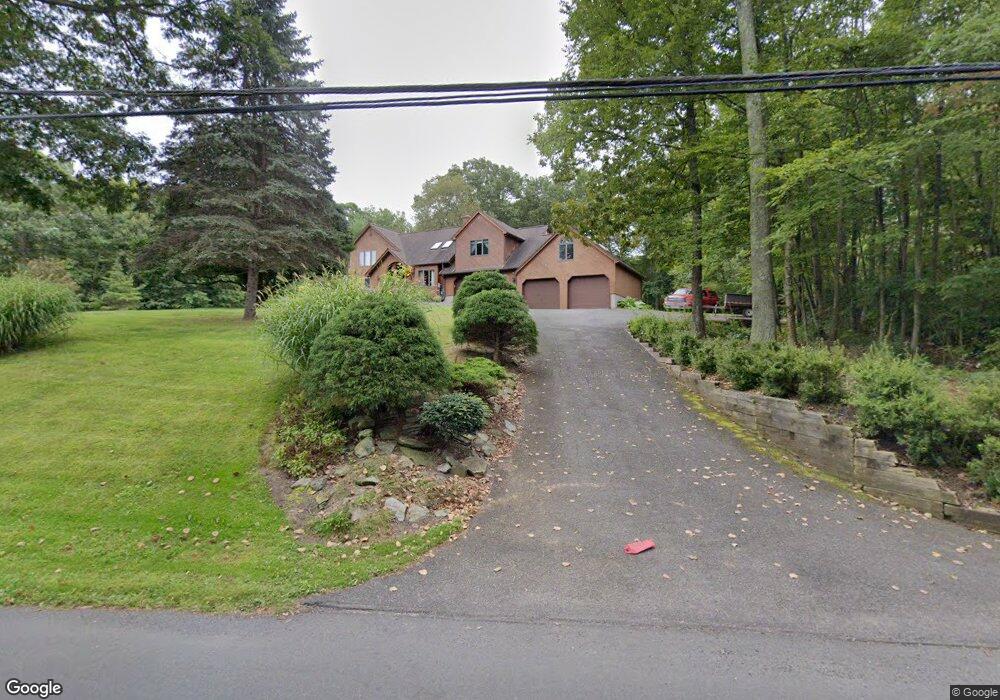
72 Reservoir Rd New Milford, CT 06776
Estimated Value: $586,000 - $836,000
3
Beds
3
Baths
2,855
Sq Ft
$242/Sq Ft
Est. Value
About This Home
This home is located at 72 Reservoir Rd, New Milford, CT 06776 and is currently estimated at $690,634, approximately $241 per square foot. 72 Reservoir Rd is a home located in Litchfield County with nearby schools including Northville Elementary School, Sarah Noble Intermediate School, and Schaghticoke Middle School.
Ownership History
Date
Name
Owned For
Owner Type
Purchase Details
Closed on
Feb 3, 1997
Sold by
Briggs John D and Briggs Suzanne F
Bought by
Russell Donald and Russell Karin A
Current Estimated Value
Purchase Details
Closed on
Jun 11, 1993
Sold by
Mathews Deborah
Bought by
Briggs John and Briggs Suzanne
Create a Home Valuation Report for This Property
The Home Valuation Report is an in-depth analysis detailing your home's value as well as a comparison with similar homes in the area
Home Values in the Area
Average Home Value in this Area
Purchase History
| Date | Buyer | Sale Price | Title Company |
|---|---|---|---|
| Russell Donald | $200,000 | -- | |
| Briggs John | $214,000 | -- |
Source: Public Records
Mortgage History
| Date | Status | Borrower | Loan Amount |
|---|---|---|---|
| Closed | Briggs John | $200,000 | |
| Closed | Briggs John | $188,000 | |
| Closed | Briggs John | $145,000 | |
| Closed | Briggs John | $145,000 |
Source: Public Records
Tax History Compared to Growth
Tax History
| Year | Tax Paid | Tax Assessment Tax Assessment Total Assessment is a certain percentage of the fair market value that is determined by local assessors to be the total taxable value of land and additions on the property. | Land | Improvement |
|---|---|---|---|---|
| 2025 | $12,945 | $283,530 | $57,080 | $226,450 |
| 2024 | $8,441 | $283,530 | $57,080 | $226,450 |
| 2023 | $8,217 | $283,530 | $57,080 | $226,450 |
| 2022 | $8,038 | $283,530 | $57,080 | $226,450 |
| 2021 | $7,930 | $283,530 | $57,080 | $226,450 |
| 2020 | $7,952 | $277,270 | $63,280 | $213,990 |
| 2019 | $7,958 | $277,270 | $63,280 | $213,990 |
| 2018 | $7,811 | $277,270 | $63,280 | $213,990 |
| 2017 | $7,556 | $277,270 | $63,280 | $213,990 |
| 2016 | $7,423 | $277,270 | $63,280 | $213,990 |
| 2015 | $7,782 | $290,920 | $63,280 | $227,640 |
| 2014 | $7,651 | $290,920 | $63,280 | $227,640 |
Source: Public Records
Map
Nearby Homes
- 183 Second Hill Rd
- 71 Upper Reservoir Rd
- 2 Delia Ln
- 4 Delia Ln
- 57 Second Hill Rd
- 12 Round Table Rd
- 18 Outlook Rd
- 26 Judds Bridge Rd
- 5 N Brook Hollow Dr S
- 2 Chatfield Rd
- 22 Standish Rd
- 61 Park Lane Rd
- 74 Park Lane Rd
- 15 Legion Rd
- 0 Chestnut Land Rd Unit 24024843
- 0 Chestnut Land Rd Unit 24024823
- 24 Whittlesey Ave
- 77 Carlson Ridge Rd
- 112 Beard Dr Unit 112
- 57 Carlson Ridge Rd Unit 57