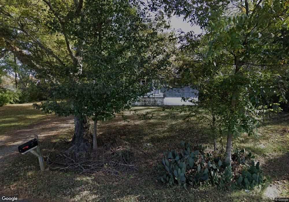
72 Road No 1 S Cartersville, GA 30120
Estimated Value: $282,799 - $294,000
3
Beds
2
Baths
1,144
Sq Ft
$252/Sq Ft
Est. Value
About This Home
This home is located at 72 Road No 1 S, Cartersville, GA 30120 and is currently estimated at $287,950, approximately $251 per square foot. 72 Road No 1 S is a home located in Bartow County with nearby schools including Mission Road Elementary School, Woodland Middle School, and Woodland High School.
Ownership History
Date
Name
Owned For
Owner Type
Purchase Details
Closed on
Oct 26, 2012
Sold by
Babin Gene P
Bought by
Dobson Anita L
Current Estimated Value
Home Financials for this Owner
Home Financials are based on the most recent Mortgage that was taken out on this home.
Original Mortgage
$82,231
Outstanding Balance
$56,904
Interest Rate
3.42%
Mortgage Type
FHA
Estimated Equity
$231,046
Purchase Details
Closed on
Mar 20, 2012
Bought by
Babin Gene P
Purchase Details
Closed on
Jan 3, 2012
Create a Home Valuation Report for This Property
The Home Valuation Report is an in-depth analysis detailing your home's value as well as a comparison with similar homes in the area
Home Values in the Area
Average Home Value in this Area
Purchase History
| Date | Buyer | Sale Price | Title Company |
|---|---|---|---|
| Dobson Anita L | $85,500 | -- | |
| Babin Gene P | $39,000 | -- | |
| Babin Gene P | $39,000 | -- | |
| -- | $92,208 | -- | |
| -- | $92,208 | -- | |
| Federal National Mtg Associati | $92,208 | -- | |
| Aurora Bank Fsb | $92,208 | -- |
Source: Public Records
Mortgage History
| Date | Status | Borrower | Loan Amount |
|---|---|---|---|
| Open | Dobson Anita L | $82,231 | |
| Closed | Dobson Anita L | $5,000 |
Source: Public Records
Tax History Compared to Growth
Tax History
| Year | Tax Paid | Tax Assessment Tax Assessment Total Assessment is a certain percentage of the fair market value that is determined by local assessors to be the total taxable value of land and additions on the property. | Land | Improvement |
|---|---|---|---|---|
| 2024 | $2,159 | $115,107 | $21,400 | $93,707 |
| 2023 | $2,641 | $109,632 | $21,400 | $88,232 |
| 2022 | $2,067 | $87,977 | $18,000 | $69,977 |
| 2021 | $1,689 | $63,305 | $18,000 | $45,305 |
| 2020 | $1,739 | $63,305 | $18,000 | $45,305 |
| 2019 | $1,626 | $58,564 | $18,000 | $40,564 |
| 2018 | $1,388 | $49,816 | $10,000 | $39,816 |
| 2017 | $1,111 | $39,680 | $7,200 | $32,480 |
| 2016 | $1,119 | $39,680 | $7,200 | $32,480 |
| 2015 | $1,035 | $36,640 | $7,200 | $29,440 |
| 2014 | $1,001 | $34,320 | $7,200 | $27,120 |
| 2013 | -- | $31,960 | $7,200 | $24,760 |
Source: Public Records
Map
Nearby Homes
- 28 Frances Way SW
- 19 Canefield Dr
- 14 Rubie Ln SW
- 33 Heartwood Dr SW
- 718 Sugar Valley Rd SW
- 20 Heartwood Dr SW
- 11 Forest Hill Dr SW
- 10 Wood Forest Dr SW
- 1100 Sugar Valley Rd SW
- 28 Weems Spur SW
- 39 Twin Oaks Ln SW
- 105 Garland Gable Dr Unit 3A
- 105 Garland Gable Dr
- 49 Bramblewood Trail SW
- 0 Dodson Rd SW Unit 7678715
- 0 Dodson Rd SW Unit 10641452
- 104 Road 3 South SW
- 79 Floyd Rd SW
- 56 Brent Cir SW
- 17 Bramblewood Place SW
- 72 Road 1 South SW
- 66 Road 1 South SW Unit 57
- 66 Road 1 South SW
- 56 Road Unit 1
- 60 Road 1 South SW Unit 58
- 60 Road 1 South SW
- 40 Rubie Ln SW
- 56 Road 1 South SW
- 41 Rubie Ln SW
- 38 Rubie Ln SW
- 63 Road 1 South SW
- 63 Road No 1 S
- 63 Road No 1 South SW
- 78 Road 1 South SW
- 53 Road 1 South SW
- 52 Road 1 South SW
- 39 Rubie Ln SW
- 36 Rubie Ln SW
- 49 Road 1 South SW
- 37 Rubie Ln SW