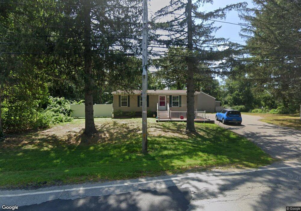
72 S Hampton Rd Amesbury, MA 01913
Estimated Value: $494,000 - $677,000
--
Bed
1
Bath
--
Sq Ft
1
Acres
About This Home
This home is located at 72 S Hampton Rd, Amesbury, MA 01913 and is currently estimated at $582,574. 72 S Hampton Rd is a home located in Essex County with nearby schools including Amesbury High School and Amesbury Seventh-Day Adventist School.
Ownership History
Date
Name
Owned For
Owner Type
Purchase Details
Closed on
Oct 4, 2016
Sold by
Mcneely Nancy
Bought by
Mcneely Nancy J
Current Estimated Value
Purchase Details
Closed on
Sep 28, 1990
Sold by
Mitchell Patricia M
Bought by
Mcneely Dennis
Create a Home Valuation Report for This Property
The Home Valuation Report is an in-depth analysis detailing your home's value as well as a comparison with similar homes in the area
Home Values in the Area
Average Home Value in this Area
Purchase History
| Date | Buyer | Sale Price | Title Company |
|---|---|---|---|
| Mcneely Nancy J | -- | -- | |
| Mcneely Dennis | $100,000 | -- |
Source: Public Records
Mortgage History
| Date | Status | Borrower | Loan Amount |
|---|---|---|---|
| Previous Owner | Mcneely Dennis | $15,000 | |
| Previous Owner | Mcneely Dennis | $170,000 |
Source: Public Records
Tax History Compared to Growth
Tax History
| Year | Tax Paid | Tax Assessment Tax Assessment Total Assessment is a certain percentage of the fair market value that is determined by local assessors to be the total taxable value of land and additions on the property. | Land | Improvement |
|---|---|---|---|---|
| 2025 | $4,864 | $317,900 | $146,400 | $171,500 |
| 2024 | $4,989 | $319,000 | $146,400 | $172,600 |
| 2023 | $5,070 | $310,300 | $146,400 | $163,900 |
| 2022 | $5,272 | $298,000 | $146,400 | $151,600 |
| 2021 | $5,530 | $303,000 | $146,400 | $156,600 |
| 2020 | $5,200 | $302,700 | $146,400 | $156,300 |
| 2019 | $5,349 | $291,200 | $146,400 | $144,800 |
| 2018 | $5,566 | $293,100 | $146,400 | $146,700 |
| 2017 | $4,090 | $205,000 | $146,400 | $58,600 |
| 2016 | $5,315 | $262,100 | $146,400 | $115,700 |
| 2015 | $5,258 | $256,000 | $146,400 | $109,600 |
| 2014 | $5,180 | $247,000 | $146,400 | $100,600 |
Source: Public Records
Map
Nearby Homes
- 25 Whittier Meadows Dr
- 2 Locke Hill Ln
- 1 Brown Ave Unit 1-37
- 1 Brown Ave Unit 3-78
- 1 Brown Ave Unit 3-80
- 3 Brown Ave Unit 75
- 16 Glen Devin St
- 28 Powderhouse Ct Unit 28
- 57 Clinton St
- 4 Woodsom Dr
- 10 Mason Ct Unit 10
- 20 Mason Ct
- 48 Orchard St
- 3 Arlington St
- 1 Stacey Ln
- 105 Market St Unit B
- 103 Market St Unit A
- 101 Market St Unit B
- 101 Market St Unit A
- 81 High St Unit 27
- 74 S Hampton Rd
- 69 S Hampton Rd
- 69 S Hampton Rd Unit A
- 1 Woodman Rd
- 66 S Hampton Rd
- 65 S Hampton Rd
- 0 Woodman Rd Lot 3
- 3 Woodman Rd
- 64 S Hampton Rd
- 1 Paige Farm Rd
- 62 S Hampton Rd
- 63 S Hampton Rd
- 4 Paige Farm Rd
- 5 Woodman Rd
- 58 S Hampton Rd
- 58 S Hampton Rd
- 3 Paige Farm Rd
- 61 S Hampton Rd
- 6 Paige Farm Rd
- 5 Paige Farm Rd