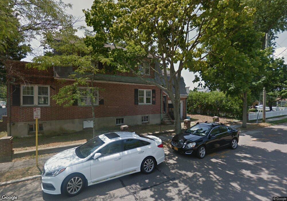
72 Shore Rd Babylon, NY 11702
Estimated Value: $550,533 - $858,000
Studio
--
Bath
2,086
Sq Ft
$350/Sq Ft
Est. Value
About This Home
This home is located at 72 Shore Rd, Babylon, NY 11702 and is currently estimated at $730,133, approximately $350 per square foot. 72 Shore Rd is a home located in Suffolk County with nearby schools including Babylon Memorial Grade School, Babylon Elementary School, and Babylon High School.
Ownership History
Date
Name
Owned For
Owner Type
Purchase Details
Closed on
Feb 28, 2022
Sold by
Grossman Elizabeth E Est
Bought by
Grossman Lisa and Madey Christopher
Current Estimated Value
Home Financials for this Owner
Home Financials are based on the most recent Mortgage that was taken out on this home.
Original Mortgage
$386,000
Outstanding Balance
$357,198
Interest Rate
3.11%
Mortgage Type
Stand Alone Refi Refinance Of Original Loan
Estimated Equity
$372,935
Purchase Details
Closed on
Jul 17, 2012
Sold by
County Of Suffolk
Bought by
Grossman Lisa
Create a Home Valuation Report for This Property
The Home Valuation Report is an in-depth analysis detailing your home's value as well as a comparison with similar homes in the area
Home Values in the Area
Average Home Value in this Area
Purchase History
| Date | Buyer | Sale Price | Title Company |
|---|---|---|---|
| Grossman Lisa | $400,000 | None Available | |
| Grossman Lisa | $68,036 | -- | |
| Grossman Lisa | $68,036 | -- | |
| Grossman Lisa | $400,000 | None Available |
Source: Public Records
Mortgage History
| Date | Status | Borrower | Loan Amount |
|---|---|---|---|
| Open | Grossman Lisa | $386,000 | |
| Closed | Grossman Lisa | $386,000 |
Source: Public Records
Tax History
| Year | Tax Paid | Tax Assessment Tax Assessment Total Assessment is a certain percentage of the fair market value that is determined by local assessors to be the total taxable value of land and additions on the property. | Land | Improvement |
|---|---|---|---|---|
| 2024 | $15,992 | $4,410 | $240 | $4,170 |
| 2023 | $14,410 | $4,410 | $240 | $4,170 |
| 2022 | $12,177 | $4,130 | $240 | $3,890 |
| 2021 | $12,177 | $4,130 | $240 | $3,890 |
| 2020 | $13,570 | $4,130 | $240 | $3,890 |
| 2019 | $13,551 | $0 | $0 | $0 |
| 2018 | $12,284 | $4,130 | $240 | $3,890 |
| 2017 | $12,284 | $4,130 | $240 | $3,890 |
| 2016 | $12,153 | $4,130 | $240 | $3,890 |
| 2015 | -- | $4,130 | $240 | $3,890 |
| 2014 | -- | $4,130 | $240 | $3,890 |
Source: Public Records
Map
Nearby Homes
- 278 Fire Island Ave
- 27 Hewlett Ct
- 230 W Islip Rd
- 188 Sequams Lane Center
- 33 Robbins Ave
- 121 Sequams Ln W
- 230 Sequams Lane Center
- 90 Thompson Ave
- 66 Cedar Ln
- 6 White Birch Dr
- 165 Peninsula Dr
- 24 Midway St
- 37 Whalers Cove Dr Unit 37
- 66 Davison Ln E
- 67 Edgewood Rd
- 113 Wilherm Ln
- 27 Simon St
- 624 Montauk Hwy
- 28 Deeringwood Ln
- 130 Wampum Ln
Your Personal Tour Guide
Ask me questions while you tour the home.