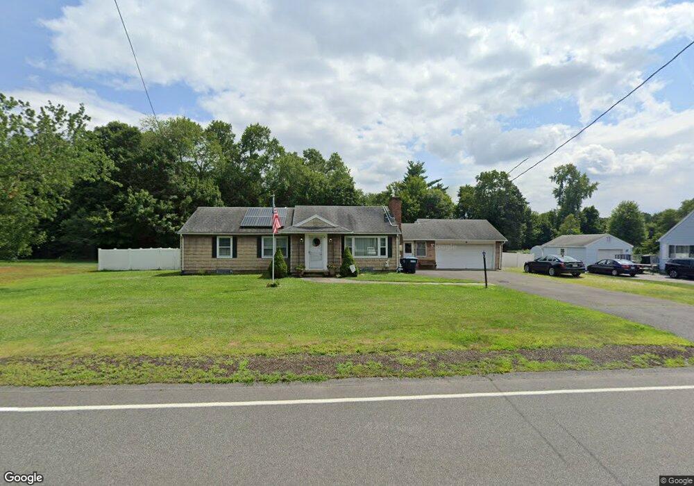
72 Springfield St Wilbraham, MA 01095
Estimated Value: $384,000 - $470,000
3
Beds
2
Baths
2,100
Sq Ft
$205/Sq Ft
Est. Value
About This Home
This home is located at 72 Springfield St, Wilbraham, MA 01095 and is currently estimated at $430,778, approximately $205 per square foot. 72 Springfield St is a home located in Hampden County with nearby schools including Minnechaug Regional High School, Springfield International Charter School, and Wilbraham & Monson Academy.
Ownership History
Date
Name
Owned For
Owner Type
Purchase Details
Closed on
Oct 26, 2011
Sold by
Lambert Alan L and Lambert Linda D
Bought by
Cotter Daniel J
Current Estimated Value
Home Financials for this Owner
Home Financials are based on the most recent Mortgage that was taken out on this home.
Original Mortgage
$151,690
Outstanding Balance
$103,886
Interest Rate
4.11%
Mortgage Type
Purchase Money Mortgage
Estimated Equity
$326,892
Create a Home Valuation Report for This Property
The Home Valuation Report is an in-depth analysis detailing your home's value as well as a comparison with similar homes in the area
Home Values in the Area
Average Home Value in this Area
Purchase History
| Date | Buyer | Sale Price | Title Company |
|---|---|---|---|
| Cotter Daniel J | $197,000 | -- |
Source: Public Records
Mortgage History
| Date | Status | Borrower | Loan Amount |
|---|---|---|---|
| Open | Cotter Daniel J | $151,690 |
Source: Public Records
Tax History
| Year | Tax Paid | Tax Assessment Tax Assessment Total Assessment is a certain percentage of the fair market value that is determined by local assessors to be the total taxable value of land and additions on the property. | Land | Improvement |
|---|---|---|---|---|
| 2025 | $6,067 | $339,300 | $99,600 | $239,700 |
| 2024 | $5,766 | $311,700 | $99,600 | $212,100 |
| 2023 | $5,325 | $293,000 | $99,600 | $193,400 |
| 2022 | $5,325 | $259,900 | $99,600 | $160,300 |
| 2021 | $5,217 | $227,200 | $109,100 | $118,100 |
| 2020 | $5,085 | $227,200 | $109,100 | $118,100 |
| 2019 | $4,955 | $227,300 | $109,100 | $118,200 |
| 2018 | $4,750 | $209,800 | $109,100 | $100,700 |
| 2017 | $4,616 | $209,800 | $109,100 | $100,700 |
| 2016 | $4,530 | $209,700 | $115,600 | $94,100 |
| 2015 | $4,358 | $208,700 | $115,600 | $93,100 |
Source: Public Records
Map
Nearby Homes
- 8 Patriot Ridge Ln
- 6 Hilltop Park
- 20 Old Orchard Rd
- 5 Edgewood Rd
- 592 Stony Hill Rd
- 474 Mountain Rd
- 6 Katie St
- 104 High Pine Cir
- 8 High Pine Cir
- 172 Main St
- 24 Mcintosh Dr
- 6 Teak Terrace Unit 24
- 103 Sandalwood Dr Unit site 00
- 57 Sandalwood Dr Unit site 61
- 1 Aspen Dr
- 474-480 Mountain Rd
- 84 Sandalwood Dr Unit site 00
- 26 Sandalwood Dr
- 46 Washington Rd
- 35 Lake Dr
- 80 Springfield St
- 68 Springfield St
- 75 Springfield St
- 71 Springfield St
- 62 Springfield St
- 84 Springfield St
- 81 Springfield St
- 88 Springfield St
- 67 Springfield St
- 89 Springfield St
- 6 Orlando St
- 96 Springfield St
- 4 Orlando St
- 63 Springfield St
- 95 Springfield St
- 2 Orlando St
- 44 Springfield St
- 104 Springfield St
- 5 Ripley St
- 9 Orlando St
Your Personal Tour Guide
Ask me questions while you tour the home.