Estimated Value: $597,530 - $744,000
Studio
--
Bath
1,620
Sq Ft
$416/Sq Ft
Est. Value
About This Home
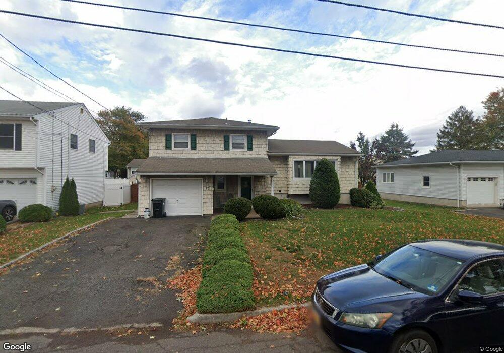
This home is located at 72 Stanton St, Clark, NJ 07066 and is currently estimated at $673,133, approximately $415 per square foot. 72 Stanton St is a home located in Union County with nearby schools including Valley Road Elementary School, Carl H. Kumpf Middle School, and Arthur L. Johnson High School.
Ownership History
Date
Name
Owned For
Owner Type
Purchase Details
Closed on
Dec 21, 2015
Sold by
Manuelian Michael and Manuelian Nancy
Bought by
Manuelian Nancy
Current Estimated Value
Purchase Details
Closed on
Jun 30, 2003
Sold by
Lebers William
Bought by
Manuelian Michael and Manuelian Nancy
Home Financials for this Owner
Home Financials are based on the most recent Mortgage that was taken out on this home.
Original Mortgage
$100,000
Interest Rate
5.34%
Create a Home Valuation Report for This Property
The Home Valuation Report is an in-depth analysis detailing your home's value as well as a comparison with similar homes in the area
Home Values in the Area
Average Home Value in this Area
Purchase History
| Date | Buyer | Sale Price | Title Company |
|---|---|---|---|
| Manuelian Nancy | -- | -- | |
| Manuelian Michael | $382,000 | -- |
Source: Public Records
Mortgage History
| Date | Status | Borrower | Loan Amount |
|---|---|---|---|
| Previous Owner | Manuelian Michael | $100,000 |
Source: Public Records
Tax History
| Year | Tax Paid | Tax Assessment Tax Assessment Total Assessment is a certain percentage of the fair market value that is determined by local assessors to be the total taxable value of land and additions on the property. | Land | Improvement |
|---|---|---|---|---|
| 2025 | $10,742 | $485,200 | $250,000 | $235,200 |
| 2024 | $10,582 | $485,200 | $250,000 | $235,200 |
| 2023 | $10,582 | $485,200 | $250,000 | $235,200 |
| 2022 | $10,277 | $485,200 | $250,000 | $235,200 |
| 2021 | $11,281 | $126,900 | $42,100 | $84,800 |
| 2020 | $11,097 | $126,900 | $42,100 | $84,800 |
| 2019 | $10,986 | $126,900 | $42,100 | $84,800 |
| 2018 | $10,854 | $126,900 | $42,100 | $84,800 |
| 2017 | $10,680 | $126,900 | $42,100 | $84,800 |
| 2016 | $10,287 | $126,900 | $42,100 | $84,800 |
| 2015 | $10,182 | $126,900 | $42,100 | $84,800 |
| 2014 | $9,968 | $126,900 | $42,100 | $84,800 |
Source: Public Records
Map
Nearby Homes
- 22 Washington St
- 52 Broadway
- 44 Joseph St
- 157 Westfield Ave
- 1044 Madison Hill Rd
- 1206 Westfield Ave
- 85 Fulton St
- 66 Lincoln Blvd
- 30 Brant Ave
- 814 Falesky St
- 272 Westfield Ave
- 45 Lexington Blvd
- 1472 Jefferson Ave
- 793 Garden St
- 1355 Jefferson Ave
- 262 Valley Rd
- 275 Valley Rd
- 1166 Jefferson Ave
- 205 West Ln
- 17 Rolling Hill Way
Your Personal Tour Guide
Ask me questions while you tour the home.