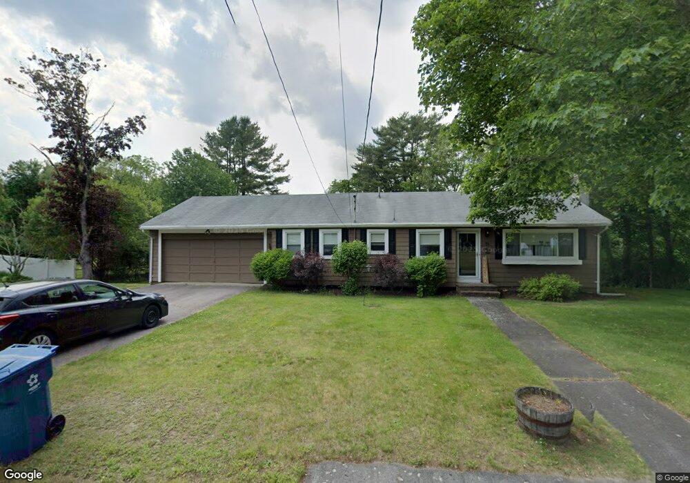
72 Summit Dr East Bridgewater, MA 02333
Estimated Value: $511,000 - $579,000
3
Beds
4
Baths
1,223
Sq Ft
$448/Sq Ft
Est. Value
About This Home
This home is located at 72 Summit Dr, East Bridgewater, MA 02333 and is currently estimated at $548,027, approximately $448 per square foot. 72 Summit Dr is a home located in Plymouth County with nearby schools including Central Elementary School, Gordon W Mitchell Middle School, and East Bridgewater Jr./Sr. High School.
Ownership History
Date
Name
Owned For
Owner Type
Purchase Details
Closed on
May 21, 1998
Sold by
Coyne Celeste L
Bought by
Arruda Manuel S and Arruda Jeannette T
Current Estimated Value
Purchase Details
Closed on
Dec 5, 1996
Sold by
Feeney Elizabeth M
Bought by
Coyne Celeste L
Create a Home Valuation Report for This Property
The Home Valuation Report is an in-depth analysis detailing your home's value as well as a comparison with similar homes in the area
Home Values in the Area
Average Home Value in this Area
Purchase History
| Date | Buyer | Sale Price | Title Company |
|---|---|---|---|
| Arruda Manuel S | $148,000 | -- | |
| Coyne Celeste L | $120,000 | -- |
Source: Public Records
Mortgage History
| Date | Status | Borrower | Loan Amount |
|---|---|---|---|
| Open | Coyne Celeste L | $288,000 | |
| Closed | Coyne Celeste L | $30,000 | |
| Closed | Coyne Celeste L | $250,000 | |
| Closed | Coyne Celeste L | $153,600 |
Source: Public Records
Tax History Compared to Growth
Tax History
| Year | Tax Paid | Tax Assessment Tax Assessment Total Assessment is a certain percentage of the fair market value that is determined by local assessors to be the total taxable value of land and additions on the property. | Land | Improvement |
|---|---|---|---|---|
| 2025 | $5,417 | $396,300 | $178,600 | $217,700 |
| 2024 | $5,330 | $385,100 | $171,800 | $213,300 |
| 2023 | $5,306 | $367,200 | $171,800 | $195,400 |
| 2022 | $5,293 | $339,300 | $156,300 | $183,000 |
| 2021 | $5,236 | $307,100 | $150,100 | $157,000 |
| 2020 | $5,196 | $300,500 | $144,400 | $156,100 |
| 2019 | $5,120 | $291,600 | $138,000 | $153,600 |
| 2018 | $4,917 | $273,800 | $138,000 | $135,800 |
| 2017 | $4,815 | $263,100 | $131,600 | $131,500 |
| 2016 | $4,725 | $260,200 | $131,600 | $128,600 |
| 2015 | $4,593 | $258,600 | $130,700 | $127,900 |
| 2014 | $4,410 | $253,900 | $127,900 | $126,000 |
Source: Public Records
Map
Nearby Homes
- 84 Summit Dr
- 52 Summit Dr
- Lot 6 Summit Dr
- Lot 7 Summit Dr
- Lot 5 Summit Dr
- Lot 4 Summit Dr
- LOT 10 Elmwood Village
- PLAN 8 Latham Farm
- LOT 13 Scribner Way
- LOT 2 Elm St
- 53 Summit Dr
- 240 Thayer Ave
- 38 Summit Dr
- 1 Flint Cir
- 2 Flint Cir
- Lot 3 Flint Cir
- Lot 1 Flint Cir
- 250 Thayer Ave
- 35 Summit Dr
- 107 Summit Dr