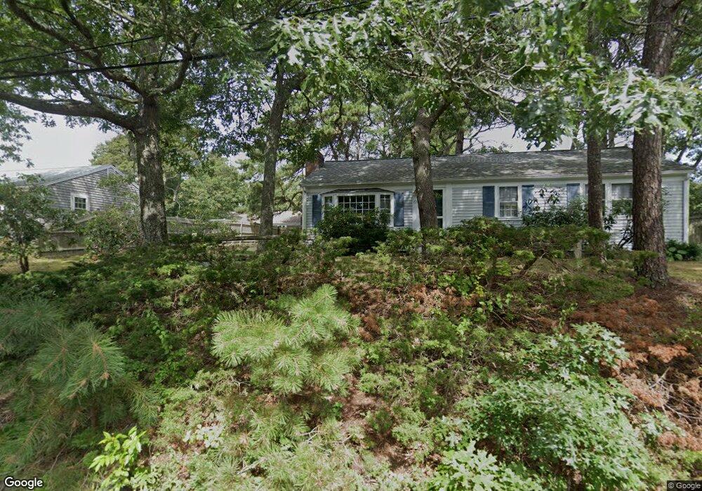
72 Uncle Bobs Way South Dennis, MA 02660
South Dennis NeighborhoodEstimated Value: $461,000 - $521,000
3
Beds
1
Bath
1,008
Sq Ft
$500/Sq Ft
Est. Value
About This Home
This home is located at 72 Uncle Bobs Way, South Dennis, MA 02660 and is currently estimated at $503,594, approximately $499 per square foot. 72 Uncle Bobs Way is a home located in Barnstable County with nearby schools including Dennis-Yarmouth Regional High School and St. Pius X. School.
Ownership History
Date
Name
Owned For
Owner Type
Purchase Details
Closed on
Jun 30, 2021
Sold by
Streciwilk Charles J
Bought by
Chalres J Streciwilk Ret
Current Estimated Value
Purchase Details
Closed on
Oct 1, 1992
Sold by
Frederick Carol L and Kemp Irene E
Bought by
Streciwilk Charles J
Home Financials for this Owner
Home Financials are based on the most recent Mortgage that was taken out on this home.
Original Mortgage
$60,000
Interest Rate
7.83%
Mortgage Type
Purchase Money Mortgage
Create a Home Valuation Report for This Property
The Home Valuation Report is an in-depth analysis detailing your home's value as well as a comparison with similar homes in the area
Home Values in the Area
Average Home Value in this Area
Purchase History
| Date | Buyer | Sale Price | Title Company |
|---|---|---|---|
| Chalres J Streciwilk Ret | -- | None Available | |
| Streciwilk Charles J | $90,500 | -- |
Source: Public Records
Mortgage History
| Date | Status | Borrower | Loan Amount |
|---|---|---|---|
| Previous Owner | Streciwilk Charles J | $60,000 |
Source: Public Records
Tax History Compared to Growth
Tax History
| Year | Tax Paid | Tax Assessment Tax Assessment Total Assessment is a certain percentage of the fair market value that is determined by local assessors to be the total taxable value of land and additions on the property. | Land | Improvement |
|---|---|---|---|---|
| 2025 | $1,893 | $437,100 | $130,000 | $307,100 |
| 2024 | $1,811 | $412,500 | $125,000 | $287,500 |
| 2023 | $1,751 | $375,000 | $113,600 | $261,400 |
| 2022 | $1,725 | $308,100 | $113,800 | $194,300 |
| 2021 | $1,640 | $272,000 | $111,500 | $160,500 |
| 2020 | $1,568 | $257,000 | $111,500 | $145,500 |
| 2019 | $1,540 | $249,600 | $120,300 | $129,300 |
| 2018 | $1,395 | $220,000 | $104,100 | $115,900 |
| 2017 | $1,330 | $216,300 | $104,100 | $112,200 |
| 2016 | $1,226 | $187,800 | $109,300 | $78,500 |
| 2015 | $1,202 | $187,800 | $109,300 | $78,500 |
| 2014 | $1,197 | $188,500 | $93,700 | $94,800 |
Source: Public Records
Map
Nearby Homes
- 15 Captain Jud Rd
- 17 Margate Ln
- 11 Uncle Stanleys Way
- 153 Bayridge Dr
- 4 Ebb Rd
- 10 Joanne Dr
- 25 Skerry Rd
- 17 Fairmount Rd
- 17 Fairmount Rd
- 7 Vinland Dr
- 13 Covey Dr
- 1 Norseman Dr
- 118 Driftwood Ln
- 32 Captain Walsh Dr
- 129 Driftwood Ln
- 111 Merchant Ave
- 62 Old Fish House Rd
- 6 Hawthorn St
- 6 Nimble Hill Dr
- 59 Main St Unit 19-2
- 68 Uncle Bobs Way
- 73 Uncle Stanleys Way
- 75 Uncle Stanleys Way
- 78 Uncle Bobs Way
- 69 Uncle Bobs Way
- 63 Uncle Bob's Way
- 65 Uncle Bobs Way
- 63 Uncle Bobs Way
- 73 Uncle Bobs Way
- 64 Uncle Bobs Way
- 67 Uncle Stanleys Way
- 61 Uncle Bobs Way
- 64 Uncle Bills Way
- 56 Dorothys Way
- 68 Uncle Bills Way
- 41 Dorothys Way
- 60 Dorothys Way
- 50 Dorothys Way
- 60 Uncle Bills Way
- 60 Uncle Bobs Way