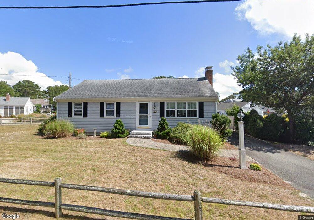
72 Union Wharf Rd Dennis Port, MA 02639
Dennis Port NeighborhoodEstimated Value: $758,000 - $913,919
3
Beds
4
Baths
1,404
Sq Ft
$591/Sq Ft
Est. Value
About This Home
This home is located at 72 Union Wharf Rd, Dennis Port, MA 02639 and is currently estimated at $830,230, approximately $591 per square foot. 72 Union Wharf Rd is a home located in Barnstable County with nearby schools including Dennis-Yarmouth Regional High School and St. Pius X. School.
Ownership History
Date
Name
Owned For
Owner Type
Purchase Details
Closed on
Sep 7, 2006
Sold by
72 Union Wharf T and Sullivan
Bought by
Scanlon Lawrence and Scanlon Patricia A
Current Estimated Value
Home Financials for this Owner
Home Financials are based on the most recent Mortgage that was taken out on this home.
Original Mortgage
$320,000
Interest Rate
6.79%
Mortgage Type
Purchase Money Mortgage
Create a Home Valuation Report for This Property
The Home Valuation Report is an in-depth analysis detailing your home's value as well as a comparison with similar homes in the area
Home Values in the Area
Average Home Value in this Area
Purchase History
| Date | Buyer | Sale Price | Title Company |
|---|---|---|---|
| Scanlon Lawrence | $400,000 | -- | |
| Scanlon Lawrence | $400,000 | -- |
Source: Public Records
Mortgage History
| Date | Status | Borrower | Loan Amount |
|---|---|---|---|
| Open | Scanlon Lawrence | $288,000 | |
| Closed | Scanlon Lawrence | $307,000 | |
| Closed | Scanlon Lawrence | $320,000 |
Source: Public Records
Tax History Compared to Growth
Tax History
| Year | Tax Paid | Tax Assessment Tax Assessment Total Assessment is a certain percentage of the fair market value that is determined by local assessors to be the total taxable value of land and additions on the property. | Land | Improvement |
|---|---|---|---|---|
| 2025 | $3,409 | $787,200 | $301,300 | $485,900 |
| 2024 | $3,325 | $757,500 | $289,700 | $467,800 |
| 2023 | $3,216 | $688,700 | $263,400 | $425,300 |
| 2022 | $2,918 | $521,000 | $207,600 | $313,400 |
| 2021 | $2,812 | $466,400 | $203,500 | $262,900 |
| 2020 | $2,697 | $442,100 | $203,500 | $238,600 |
| 2019 | $2,648 | $429,100 | $216,700 | $212,400 |
| 2018 | $2,532 | $399,400 | $206,200 | $193,200 |
| 2017 | $2,319 | $377,100 | $190,000 | $187,100 |
| 2016 | $2,344 | $359,000 | $179,100 | $179,900 |
| 2015 | $2,298 | $359,000 | $179,100 | $179,900 |
| 2014 | $2,211 | $348,200 | $168,300 | $179,900 |
Source: Public Records
Map
Nearby Homes
- 102 Sea St
- 402 Old Wharf Rd
- 402 Old Wharf Rd
- 22 Ferncliff Rd
- 405 Old Wharf Rd Unit B204
- 405 Old Wharf Rd Unit B204
- 11 Ocean Park W
- 9 Chase Ave Unit 6
- 37-A Beach Hills Rd
- 37 Beach Hills Rd
- 262 Old Wharf Rd Unit 67
- 262 Old Wharf Rd Unit 5
- 262 Old Wharf Rd Unit 5
- 262 Old Wharf Rd Unit 20
- 262 Old Wharf Rd Unit 87
- 12 Cross St
- 26 Manning Rd
- 241 Old Wharf Rd Unit 82
- 241 Old Wharf Rd Unit 127
- 241 Old Wharf Rd Unit 90
- 68 Union Wharf Rd Unit 3
- 68 Union Wharf Rd Unit 2
- 68 Union Wharf Rd Unit 1
- 68 Union Wharf Rd
- 68 Union Wharf Rd Unit 4
- 34 Highbank Cartway
- 38 Highbank Cartway
- 71 Union Wharf Rd
- 75 Union Wharf Rd Unit 3
- 75 Union Wharf Rd Unit 4
- 75 Union Wharf Rd Unit 2
- 75 Union Wharf Rd Unit 1
- 75 Union Wharf Rd Unit 2B
- 75 Union Wharf Rd Unit 2A
- 75 Union Wharf Rd Unit 1B
- 75 Union Wharf Rd Unit 1A
- 75 Union Wharf Rd
- 21 Highbank Cartway
- 64 Union Wharf Rd
- 28 Highbank Cartway