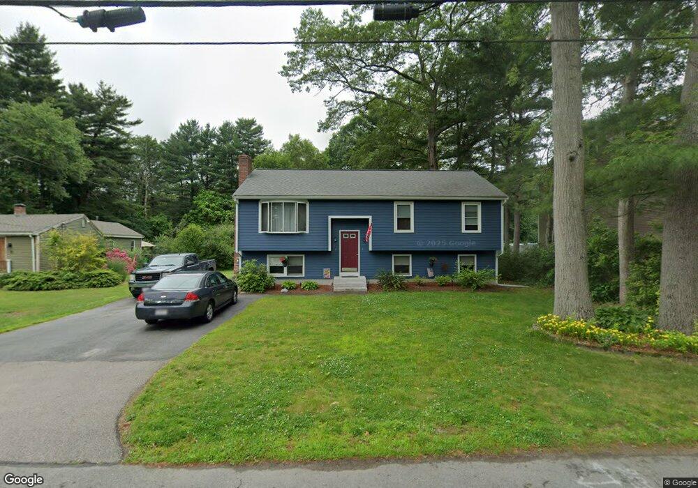
72 Walnut St Mansfield, MA 02048
Estimated Value: $542,000 - $668,000
3
Beds
2
Baths
1,080
Sq Ft
$543/Sq Ft
Est. Value
About This Home
This home is located at 72 Walnut St, Mansfield, MA 02048 and is currently estimated at $586,110, approximately $542 per square foot. 72 Walnut St is a home located in Bristol County with nearby schools including Everett W. Robinson Elementary School, Jordan/Jackson Elementary School, and Harold L. Qualters Middle School.
Ownership History
Date
Name
Owned For
Owner Type
Purchase Details
Closed on
Jun 4, 1990
Sold by
Matullo Emma D
Bought by
Allan Michael S
Current Estimated Value
Home Financials for this Owner
Home Financials are based on the most recent Mortgage that was taken out on this home.
Original Mortgage
$100,000
Interest Rate
10.25%
Mortgage Type
Purchase Money Mortgage
Create a Home Valuation Report for This Property
The Home Valuation Report is an in-depth analysis detailing your home's value as well as a comparison with similar homes in the area
Home Values in the Area
Average Home Value in this Area
Purchase History
| Date | Buyer | Sale Price | Title Company |
|---|---|---|---|
| Allan Michael S | $52,000 | -- |
Source: Public Records
Mortgage History
| Date | Status | Borrower | Loan Amount |
|---|---|---|---|
| Open | Allan Michael S | $90,000 | |
| Closed | Allan Michael S | $105,000 | |
| Closed | Allan Michael S | $100,000 |
Source: Public Records
Tax History
| Year | Tax Paid | Tax Assessment Tax Assessment Total Assessment is a certain percentage of the fair market value that is determined by local assessors to be the total taxable value of land and additions on the property. | Land | Improvement |
|---|---|---|---|---|
| 2025 | $6,838 | $519,200 | $228,600 | $290,600 |
| 2024 | $6,334 | $469,200 | $228,600 | $240,600 |
| 2023 | $6,178 | $438,500 | $228,600 | $209,900 |
| 2022 | $5,974 | $393,800 | $211,600 | $182,200 |
| 2021 | $5,726 | $372,800 | $185,100 | $187,700 |
| 2020 | $5,668 | $369,000 | $176,300 | $192,700 |
| 2019 | $5,170 | $339,700 | $147,000 | $192,700 |
| 2018 | $4,951 | $318,000 | $140,100 | $177,900 |
| 2017 | $4,764 | $317,200 | $136,000 | $181,200 |
| 2016 | $4,743 | $307,800 | $129,600 | $178,200 |
| 2015 | $4,383 | $282,800 | $129,600 | $153,200 |
Source: Public Records
Map
Nearby Homes
Your Personal Tour Guide
Ask me questions while you tour the home.