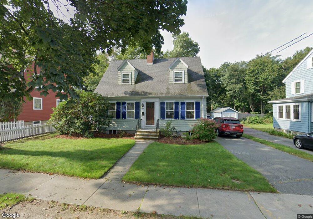
72 Woodside Rd Winchester, MA 01890
North Main NeighborhoodEstimated Value: $1,335,163 - $1,512,000
4
Beds
3
Baths
2,736
Sq Ft
$518/Sq Ft
Est. Value
About This Home
This home is located at 72 Woodside Rd, Winchester, MA 01890 and is currently estimated at $1,417,541, approximately $518 per square foot. 72 Woodside Rd is a home located in Middlesex County with nearby schools including Lynch Elementary School, McCall Middle School, and Winchester High School.
Ownership History
Date
Name
Owned For
Owner Type
Purchase Details
Closed on
Jan 18, 2024
Sold by
Mcphee Allan D and Mcphee Priscilla O
Bought by
Mcphee Ft and Mcphee
Current Estimated Value
Purchase Details
Closed on
Mar 28, 1985
Bought by
Mcphee Allan D and Mcphee Priscilla O
Create a Home Valuation Report for This Property
The Home Valuation Report is an in-depth analysis detailing your home's value as well as a comparison with similar homes in the area
Home Values in the Area
Average Home Value in this Area
Purchase History
| Date | Buyer | Sale Price | Title Company |
|---|---|---|---|
| Mcphee Ft | -- | None Available | |
| Mcphee Allan D | $147,000 | -- |
Source: Public Records
Mortgage History
| Date | Status | Borrower | Loan Amount |
|---|---|---|---|
| Previous Owner | Mcphee Allan D | $115,000 | |
| Previous Owner | Mcphee Allan D | $127,500 |
Source: Public Records
Tax History
| Year | Tax Paid | Tax Assessment Tax Assessment Total Assessment is a certain percentage of the fair market value that is determined by local assessors to be the total taxable value of land and additions on the property. | Land | Improvement |
|---|---|---|---|---|
| 2025 | $128 | $1,157,800 | $767,500 | $390,300 |
| 2024 | $13,107 | $1,156,800 | $767,500 | $389,300 |
| 2023 | $12,232 | $1,036,600 | $675,400 | $361,200 |
| 2022 | $12,200 | $975,200 | $614,000 | $361,200 |
| 2021 | $4,797 | $911,700 | $552,600 | $359,100 |
| 2020 | $12,981 | $911,700 | $552,600 | $359,100 |
| 2019 | $12,781 | $850,300 | $491,200 | $359,100 |
| 2018 | $9,495 | $778,900 | $443,600 | $335,300 |
| 2017 | $8,530 | $694,600 | $381,500 | $313,100 |
| 2016 | $7,723 | $661,200 | $359,200 | $302,000 |
| 2015 | $7,864 | $647,800 | $359,200 | $288,600 |
| 2014 | $7,330 | $579,000 | $299,300 | $279,700 |
Source: Public Records
Map
Nearby Homes
- 136 Sylvester Ave
- 62 Richardson St
- 36 Middlesex St Unit 38
- 8 Russell Rd Unit 10
- 6 Ivy Cir
- 89 Wildwood St
- 237 Swanton St
- 20 Arthur St
- 200 Swanton St Unit 228
- 200 Swanton St Unit 636
- 200 Swanton St Unit 234
- 200 Swanton St Unit T28
- 666 Main St Unit 312
- 7 Wainwright Rd Unit 15
- 28 Arlington St
- 171 Swanton St Unit 73
- 6 Porter St
- 61 Westland Ave
- 49 Spruce St
- 7 Conant Rd Unit 33