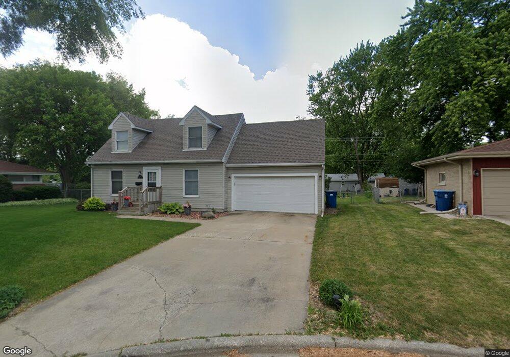
720 Burns Ct Bourbonnais, IL 60914
Estimated Value: $118,000 - $166,000
Studio
--
Bath
--
Sq Ft
8,059
Sq Ft Lot
About This Home
This home is located at 720 Burns Ct, Bourbonnais, IL 60914 and is currently estimated at $145,454. 720 Burns Ct is a home located in Kankakee County with nearby schools including Shabbona Elementary School, Liberty Intermediate School, and Bourbonnais Upper Grade Center.
Ownership History
Date
Name
Owned For
Owner Type
Purchase Details
Closed on
Jun 13, 2024
Sold by
Palmer Joyce E
Bought by
Laury Prudence
Current Estimated Value
Purchase Details
Closed on
Apr 29, 2024
Sold by
Pnp Enterprises Llc
Bought by
Palmer Joyce E
Purchase Details
Closed on
Jul 16, 2018
Sold by
Joyce E Palmer Revocable Living Trust
Bought by
Pnp Enterprises Llc
Create a Home Valuation Report for This Property
The Home Valuation Report is an in-depth analysis detailing your home's value as well as a comparison with similar homes in the area
Home Values in the Area
Average Home Value in this Area
Purchase History
| Date | Buyer | Sale Price | Title Company |
|---|---|---|---|
| Laury Prudence | $120,000 | Standard Title | |
| Palmer Joyce E | -- | None Listed On Document | |
| Pnp Enterprises Llc | -- | Barmann Bohlen & Scott Pc |
Source: Public Records
Tax History
| Year | Tax Paid | Tax Assessment Tax Assessment Total Assessment is a certain percentage of the fair market value that is determined by local assessors to be the total taxable value of land and additions on the property. | Land | Improvement |
|---|---|---|---|---|
| 2024 | $3,931 | $47,295 | $6,562 | $40,733 |
| 2023 | $3,616 | $43,792 | $6,076 | $37,716 |
| 2022 | $3,633 | $42,209 | $5,856 | $36,353 |
| 2021 | $3,576 | $41,280 | $5,727 | $35,553 |
| 2020 | $3,549 | $40,175 | $5,574 | $34,601 |
| 2019 | $3,368 | $37,713 | $5,412 | $32,301 |
| 2018 | $3,463 | $38,656 | $5,332 | $33,324 |
| 2017 | $3,402 | $37,713 | $5,202 | $32,511 |
| 2016 | $3,316 | $36,839 | $5,125 | $31,714 |
| 2015 | $3,384 | $37,115 | $5,074 | $32,041 |
| 2014 | $3,149 | $35,963 | $5,074 | $30,889 |
| 2013 | -- | $37,115 | $5,074 | $32,041 |
Source: Public Records
Map
Nearby Homes
- 179 N Levasseur Ave
- 250 N Levasseur Ave
- 292 Ashley Ave
- 417 E Beaudoin St
- 260 W Country Ct
- 899 Armour Rd
- 440 S Cryer Ave
- 261 Mohawk Dr
- 675 Washington Ave
- 609 Ivy Ln
- 132 N Tetrault Ave
- 508 N Forest Ave
- 901 W North St
- 0 Broadway St E Unit MRD12509049
- 206 Meadows Rd S
- 703 Heritage Dr
- 411 N Prairie Ave
- 15 Hanson Dr
- 1063 Yale Ave
- Lot 5/5A Almar Pkwy
- 726 Burns Ct
- 702 Burns Ct
- 160 N Levasseur Ave
- 144 N Levasseur Ave
- 172 N Levasseur Ave
- 734 Burns Ct
- 201 Ashley Ave
- 186 N Levasseur Ave
- 198 N Levasseur Ave
- 126 N Levasseur Ave
- 112 N Levasseur Ave
- 740 Burns Ct
- 213 Ashley Ave
- 208 N Levasseur Ave
- 165 N Levasseur Ave
- 151 N Levasseur Ave
- 715 Burns Ct
- 750 Burns Ct
- 225 Ashley Ave
- 135 N Levasseur Ave
Your Personal Tour Guide
Ask me questions while you tour the home.