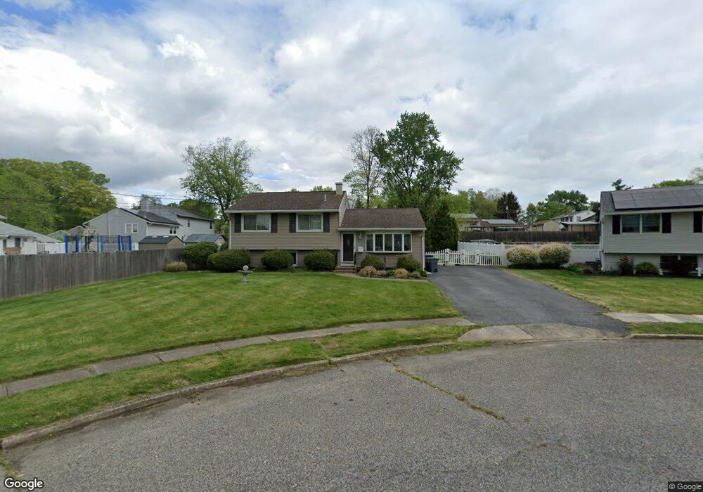
720 Dartmouth Ct Wenonah, NJ 08090
Deptford Township NeighborhoodEstimated Value: $329,848 - $378,000
3
Beds
2
Baths
1,680
Sq Ft
$208/Sq Ft
Est. Value
About This Home
This home is located at 720 Dartmouth Ct, Wenonah, NJ 08090 and is currently estimated at $350,212, approximately $208 per square foot. 720 Dartmouth Ct is a home located in Gloucester County with nearby schools including Deptford Township High School and St Margaret Regional School.
Ownership History
Date
Name
Owned For
Owner Type
Purchase Details
Closed on
Aug 31, 2005
Sold by
Anastasi Joseph J and Anastasi Maria A
Bought by
Pursglove Frank and Pursglove Etta Dolores
Current Estimated Value
Home Financials for this Owner
Home Financials are based on the most recent Mortgage that was taken out on this home.
Original Mortgage
$151,200
Outstanding Balance
$80,842
Interest Rate
5.84%
Mortgage Type
Fannie Mae Freddie Mac
Estimated Equity
$269,370
Create a Home Valuation Report for This Property
The Home Valuation Report is an in-depth analysis detailing your home's value as well as a comparison with similar homes in the area
Home Values in the Area
Average Home Value in this Area
Purchase History
| Date | Buyer | Sale Price | Title Company |
|---|---|---|---|
| Pursglove Frank | $216,000 | Group 21 |
Source: Public Records
Mortgage History
| Date | Status | Borrower | Loan Amount |
|---|---|---|---|
| Open | Pursglove Frank | $151,200 |
Source: Public Records
Tax History Compared to Growth
Tax History
| Year | Tax Paid | Tax Assessment Tax Assessment Total Assessment is a certain percentage of the fair market value that is determined by local assessors to be the total taxable value of land and additions on the property. | Land | Improvement |
|---|---|---|---|---|
| 2025 | $5,643 | $157,400 | $44,400 | $113,000 |
| 2024 | $5,462 | $157,400 | $44,400 | $113,000 |
| 2023 | $5,462 | $157,400 | $44,400 | $113,000 |
| 2022 | $5,422 | $157,400 | $44,400 | $113,000 |
| 2021 | $4,986 | $157,400 | $44,400 | $113,000 |
| 2020 | $5,284 | $157,400 | $44,400 | $113,000 |
| 2019 | $5,183 | $157,400 | $44,400 | $113,000 |
| 2018 | $5,067 | $157,400 | $44,400 | $113,000 |
| 2017 | $4,931 | $157,400 | $44,400 | $113,000 |
| 2016 | $4,831 | $157,400 | $44,400 | $113,000 |
| 2015 | $4,681 | $157,400 | $44,400 | $113,000 |
| 2014 | $4,560 | $157,400 | $44,400 | $113,000 |
Source: Public Records
Map
Nearby Homes
- 735 Glenside Dr
- 748 Dartmouth Dr
- 125 Ivy Ln
- 7 Manchester Ct
- 100 Buddy Powell Ln
- 114 Buddy Powell Ln
- 111 Cove Rd
- 711 Howard Ave
- 313 Ogden Station Rd
- 315 Ogden Station Rd
- 916 Georgetown Rd
- 629 Vassar Rd
- 505 W Mantua Ave
- 213 Barclay Ct
- 807 Saint Regis Ct
- 463 Durham Ct
- 411 Durham Ct Unit 411
- 75 Hickory Ave
- 827 Saint Regis Ct
- 8 W Buttonwood St
- 718 Dartmouth Dr
- 722 Dartmouth Ct
- 716 Dartmouth Dr
- 220 Rice Ave
- 222 Rice Ave
- 724 Dartmouth Ct
- 724 Dartmouth Ct
- 218 Rice Ave
- 224 Rice Ave
- 730 Dartmouth Ct
- 728 Dartmouth Ct
- 726 Dartmouth Ct
- 721 Dartmouth Dr
- 723 Dartmouth Dr
- 226 Rice Ave
- 719 Dartmouth Dr
- 725 Dartmouth Dr
- 732 Dartmouth Dr
- 723 Duke Dr
- 717 Dartmouth Dr