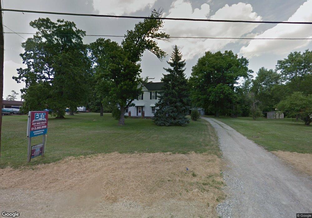
720 E Us Highway 22 and 3 Morrow, OH 45152
Hamilton Township NeighborhoodEstimated Value: $225,000
5
Beds
2
Baths
3,648
Sq Ft
$62/Sq Ft
Est. Value
About This Home
This home is located at 720 E Us Highway 22 and 3, Morrow, OH 45152 and is currently priced at $225,000, approximately $61 per square foot. 720 E Us Highway 22 and 3 is a home located in Warren County with nearby schools including Little Miami Early Childhood Center, Little Miami Intermediate Middle School, and Little Miami Middle School.
Ownership History
Date
Name
Owned For
Owner Type
Purchase Details
Closed on
Jun 13, 2017
Sold by
Kanta Oil Llc
Bought by
Kanta Oil Llc
Current Estimated Value
Purchase Details
Closed on
Aug 7, 1997
Sold by
Donald Books
Bought by
Timothy E & Mary K Books
Home Financials for this Owner
Home Financials are based on the most recent Mortgage that was taken out on this home.
Original Mortgage
$112,000
Interest Rate
7.68%
Mortgage Type
New Conventional
Create a Home Valuation Report for This Property
The Home Valuation Report is an in-depth analysis detailing your home's value as well as a comparison with similar homes in the area
Home Values in the Area
Average Home Value in this Area
Purchase History
| Date | Buyer | Sale Price | Title Company |
|---|---|---|---|
| Kanta Oil Llc | $16,667 | None Available | |
| Kanta Oil Llc | $200,000 | None Available | |
| Timothy E & Mary K Books | $70,000 | -- |
Source: Public Records
Mortgage History
| Date | Status | Borrower | Loan Amount |
|---|---|---|---|
| Previous Owner | Timothy E & Mary K Books | $112,000 |
Source: Public Records
Tax History Compared to Growth
Tax History
| Year | Tax Paid | Tax Assessment Tax Assessment Total Assessment is a certain percentage of the fair market value that is determined by local assessors to be the total taxable value of land and additions on the property. | Land | Improvement |
|---|---|---|---|---|
| 2024 | $13,345 | $262,570 | $39,500 | $223,070 |
| 2023 | $13,870 | $234,496 | $35,906 | $198,590 |
| 2022 | $12,722 | $214,862 | $35,907 | $178,955 |
| 2021 | $12,383 | $214,057 | $35,907 | $178,150 |
| 2020 | $12,167 | $186,127 | $35,907 | $150,220 |
| 2019 | $12,346 | $186,127 | $35,907 | $150,220 |
| 2018 | $2,390 | $35,907 | $35,907 | $0 |
| 2017 | $2,288 | $44,062 | $12,684 | $31,378 |
| 2016 | $2,445 | $44,062 | $12,684 | $31,378 |
| 2015 | $2,450 | $44,062 | $12,684 | $31,378 |
| 2014 | $2,539 | $40,330 | $11,810 | $28,530 |
| 2013 | $2,496 | $47,650 | $13,530 | $34,120 |
Source: Public Records
Map
Nearby Homes
- 792 Oak Forest Dr
- 723 Grande Oaks Dr
- 668 Thornton Dr
- 5708 Cochran Rd
- 619 Crabapple Ct
- 678 Emerald Dr
- 5672 Wyntree Ct
- 5234 Highmeadow Place
- 5481 Windsor Ct
- 721 Kingly Terrace
- 6244 Avebury Ct
- 5717 Pepperridge Ct
- 809 Emerald Dr
- 6250 Avebury Ct
- 6076 Driftwood Ct
- 5079 Ross Ridge
- 261 Forest Edge Dr
- 161 Arbor Glen Ct
- 5079 Ross Ridge Rd
- 6107 Driftwood Ct
- 720 E Us Highway 22 and 3
- 720 E Us Highway 22 and 3 Unit 2
- 720 E Us Highway 22 and 3 Unit 1
- 720 Us Rt 22 & 3
- 720 Us Rt 22 & 3 Unit 2
- 720 Us Rt 22 & 3 Unit 1
- 720 E Us Rt 22 & 3
- 746 E Us Highway 22 and 3
- 772 E Us Highway 22 and 3
- 639 Grande Oaks Dr
- 651 Grande Oaks Dr
- 651 Grande Oaks Dr
- 774 E Us Highway 22 and 3
- 774 Us Rt 22 & 3
- 774 U S 22
- 663 Grande Oaks Dr
- 761 E Us Highway 22 and 3
- 675 Grande Oaks Dr
- 687 Grande Oaks Dr
- 790 E Us Highway 22 and 3