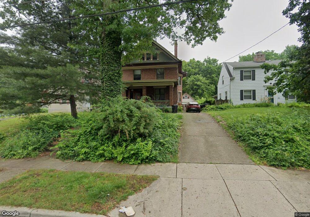
720 Hand Ave Cincinnati, OH 45232
Spring Grove Village NeighborhoodEstimated Value: $257,000 - $407,000
4
Beds
3
Baths
2,500
Sq Ft
$128/Sq Ft
Est. Value
About This Home
This home is located at 720 Hand Ave, Cincinnati, OH 45232 and is currently estimated at $320,351, approximately $128 per square foot. 720 Hand Ave is a home located in Hamilton County with nearby schools including Clifton Area Neighborhood School, Robert A. Taft Information Technology High School, and Shroder High School.
Ownership History
Date
Name
Owned For
Owner Type
Purchase Details
Closed on
Dec 5, 2011
Sold by
Monzel Christopher R and Monzel Jana Lee Moore
Bought by
Bowerman Michael and Bowerman Jinda A
Current Estimated Value
Home Financials for this Owner
Home Financials are based on the most recent Mortgage that was taken out on this home.
Original Mortgage
$151,086
Outstanding Balance
$103,848
Interest Rate
4.11%
Mortgage Type
VA
Estimated Equity
$216,503
Purchase Details
Closed on
Jan 30, 2008
Sold by
Monzel Christopher R
Bought by
Monzel Christopher R and Monzel Jana Lee Moore
Home Financials for this Owner
Home Financials are based on the most recent Mortgage that was taken out on this home.
Original Mortgage
$134,316
Interest Rate
6.2%
Mortgage Type
New Conventional
Purchase Details
Closed on
Aug 1, 2001
Sold by
Blackburn Kathleen M
Bought by
Monzel Christopher R
Create a Home Valuation Report for This Property
The Home Valuation Report is an in-depth analysis detailing your home's value as well as a comparison with similar homes in the area
Home Values in the Area
Average Home Value in this Area
Purchase History
| Date | Buyer | Sale Price | Title Company |
|---|---|---|---|
| Bowerman Michael | $149,000 | American Homeland Title Agen | |
| Monzel Christopher R | -- | Vintage Title Agency Inc | |
| Monzel Christopher R | $130,000 | -- |
Source: Public Records
Mortgage History
| Date | Status | Borrower | Loan Amount |
|---|---|---|---|
| Open | Bowerman Michael | $151,086 | |
| Closed | Monzel Christopher R | $134,316 |
Source: Public Records
Tax History Compared to Growth
Tax History
| Year | Tax Paid | Tax Assessment Tax Assessment Total Assessment is a certain percentage of the fair market value that is determined by local assessors to be the total taxable value of land and additions on the property. | Land | Improvement |
|---|---|---|---|---|
| 2024 | $4,436 | $73,962 | $7,721 | $66,241 |
| 2023 | $4,531 | $73,962 | $7,721 | $66,241 |
| 2022 | $3,580 | $52,346 | $7,175 | $45,171 |
| 2021 | $3,448 | $52,346 | $7,175 | $45,171 |
| 2020 | $3,543 | $52,346 | $7,175 | $45,171 |
| 2019 | $3,490 | $47,160 | $6,465 | $40,695 |
| 2018 | $3,495 | $47,160 | $6,465 | $40,695 |
| 2017 | $3,324 | $47,160 | $6,465 | $40,695 |
| 2016 | $3,726 | $52,150 | $6,076 | $46,074 |
| 2015 | $3,358 | $52,150 | $6,076 | $46,074 |
| 2014 | $3,381 | $52,150 | $6,076 | $46,074 |
| 2013 | $2,652 | $40,139 | $6,465 | $33,674 |
Source: Public Records
Map
Nearby Homes
- 4654 Winton Rd
- 622 E Epworth Ave
- 512 E Epworth Ave
- 749 E Epworth Ave
- 549 E Epworth Ave
- 553 Flatt Terrace
- 547 Flatt Terrace
- 5101 Winneste Ave
- 757 Mcmakin Ave
- 504 Orient Ave
- 4528 Circle Ave
- 649 Derby Ave
- 4443 Station Ave
- 130 Baker Ave
- 4706 Hassman Ct
- 1415 Weigold Ave
- 27 Phillips Ave
- 1542 Glen Parker Ave
- 15 Bertus St