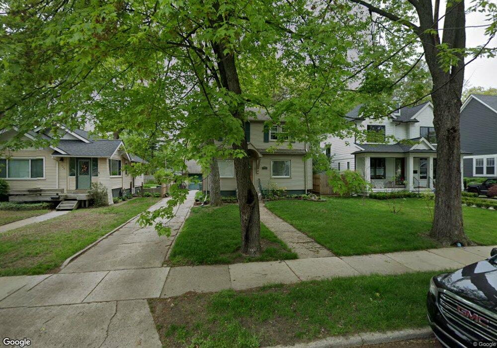
720 Kayser Ave Royal Oak, MI 48067
Estimated Value: $348,375 - $573,000
3
Beds
2
Baths
1,275
Sq Ft
$341/Sq Ft
Est. Value
About This Home
This home is located at 720 Kayser Ave, Royal Oak, MI 48067 and is currently estimated at $434,344, approximately $340 per square foot. 720 Kayser Ave is a home located in Oakland County with nearby schools including Oakland Elementary School, Royal Oak Middle School, and Royal Oak High School.
Ownership History
Date
Name
Owned For
Owner Type
Purchase Details
Closed on
Nov 30, 2010
Sold by
Forrest William and Forrest Alison
Bought by
Humphrey Melanie and Humphrey Scott
Current Estimated Value
Purchase Details
Closed on
Dec 5, 2003
Sold by
Forrest William and Forrest Alison
Bought by
Forrest William and Forrest Alison
Purchase Details
Closed on
Aug 9, 2001
Sold by
Sweeney Donald
Bought by
Forrest William
Home Financials for this Owner
Home Financials are based on the most recent Mortgage that was taken out on this home.
Original Mortgage
$215,000
Interest Rate
6.92%
Create a Home Valuation Report for This Property
The Home Valuation Report is an in-depth analysis detailing your home's value as well as a comparison with similar homes in the area
Home Values in the Area
Average Home Value in this Area
Purchase History
| Date | Buyer | Sale Price | Title Company |
|---|---|---|---|
| Humphrey Melanie | $180,000 | Capital Title Ins Agency | |
| Forrest William | -- | First American Title | |
| Forrest William | $210,000 | -- |
Source: Public Records
Mortgage History
| Date | Status | Borrower | Loan Amount |
|---|---|---|---|
| Previous Owner | Forrest William | $215,000 |
Source: Public Records
Tax History Compared to Growth
Tax History
| Year | Tax Paid | Tax Assessment Tax Assessment Total Assessment is a certain percentage of the fair market value that is determined by local assessors to be the total taxable value of land and additions on the property. | Land | Improvement |
|---|---|---|---|---|
| 2024 | $3,001 | $146,880 | $0 | $0 |
| 2022 | $3,314 | $130,960 | $0 | $0 |
| 2020 | $2,692 | $114,550 | $0 | $0 |
| 2018 | $3,314 | $103,650 | $0 | $0 |
| 2017 | $3,073 | $103,650 | $0 | $0 |
| 2015 | -- | $89,230 | $0 | $0 |
| 2014 | -- | $75,560 | $0 | $0 |
| 2011 | -- | $70,740 | $0 | $0 |
Source: Public Records
Map
Nearby Homes
- 818 Longfellow Ave
- 602 Lawson St
- 1008 Batavia Ave
- 607 Knowles St
- 707 S Alexander Ave
- 1007 Irving Ave
- 919 E Lincoln Ave
- 533 E Harrison Ave Unit 12
- 533 E Harrison Ave Unit 3
- 533 E Harrison Ave Unit 20
- 533 E Harrison Ave Unit 35
- 1036 Irving Ave
- 418 E 5th St Unit 2
- 1007 Mohawk Ave
- 614 S Troy St Unit 109
- 1118 Longfellow Ave
- 1213 Batavia Ave
- 322 E Harrison Ave Unit 18
- 322 E Harrison Ave Unit 1
- 1260 Diamond Ct Unit A
- 726 Kayser Ave
- 716 Kayser Ave
- 712 Kayser Ave
- 706 Kayser Ave
- 621 E Lincoln Ave
- 621 E Lincoln Ave
- 621 E Lincoln Ave
- 621 E Lincoln Ave Unit 2
- 730 E Lincoln Ave Unit 8
- 730 E Lincoln Ave
- 621 E Lincoln Ave Unit 6
- 730 E Lincoln Ave Unit 9
- 617 E Lincoln Unit 3 Ave
- 723 Lawson St
- 717 Lawson St
- 617 E Lincoln Ave
- 617 E Lincoln Ave
- 617 E Lincoln Ave
- 617 E Lincoln Ave Unit 7
- 617 E Lincoln Ave Unit 3