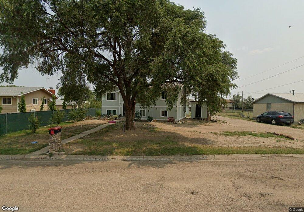
720 Mcafee Ave Unit 1 Las Animas, CO 81054
Estimated Value: $199,650 - $260,000
5
Beds
3
Baths
2,088
Sq Ft
$105/Sq Ft
Est. Value
About This Home
This home is located at 720 Mcafee Ave Unit 1, Las Animas, CO 81054 and is currently estimated at $218,913, approximately $104 per square foot. 720 Mcafee Ave Unit 1 is a home located in Bent County with nearby schools including Las Animas Elementary School, Las Animas Junior High School, and Las Animas High School.
Ownership History
Date
Name
Owned For
Owner Type
Purchase Details
Closed on
Aug 13, 2024
Sold by
County Treasurer Of Bent County
Bought by
Groves Clarence Gilbert
Current Estimated Value
Purchase Details
Closed on
Oct 20, 2017
Sold by
Comparoni Charles E
Bought by
Broome Ii Furman L
Purchase Details
Closed on
Oct 19, 2009
Sold by
Liquidation Properties Inc
Bought by
Comparoni Charles E
Home Financials for this Owner
Home Financials are based on the most recent Mortgage that was taken out on this home.
Original Mortgage
$49,150
Interest Rate
4.93%
Mortgage Type
New Conventional
Purchase Details
Closed on
Oct 8, 2009
Sold by
Citigroup Global Markets Realty
Bought by
Liquidation Properties Inc
Home Financials for this Owner
Home Financials are based on the most recent Mortgage that was taken out on this home.
Original Mortgage
$49,150
Interest Rate
4.93%
Mortgage Type
New Conventional
Create a Home Valuation Report for This Property
The Home Valuation Report is an in-depth analysis detailing your home's value as well as a comparison with similar homes in the area
Home Values in the Area
Average Home Value in this Area
Purchase History
| Date | Buyer | Sale Price | Title Company |
|---|---|---|---|
| Groves Clarence Gilbert | $4,910,600 | None Listed On Document | |
| Broome Ii Furman L | -- | None Available | |
| Comparoni Charles E | $51,750 | -- | |
| Liquidation Properties Inc | -- | -- | |
| Liquidation Properties Inc | -- | -- |
Source: Public Records
Mortgage History
| Date | Status | Borrower | Loan Amount |
|---|---|---|---|
| Previous Owner | Comparoni Charles E | $49,150 |
Source: Public Records
Tax History Compared to Growth
Tax History
| Year | Tax Paid | Tax Assessment Tax Assessment Total Assessment is a certain percentage of the fair market value that is determined by local assessors to be the total taxable value of land and additions on the property. | Land | Improvement |
|---|---|---|---|---|
| 2024 | $816 | $7,333 | $260 | $7,073 |
| 2023 | $5,691 | $7,333 | $260 | $7,073 |
| 2022 | $4,412 | $11,120 | $390 | $10,730 |
| 2021 | $880 | $8,246 | $323 | $7,923 |
| 2020 | $752 | $7,054 | $323 | $6,731 |
| 2019 | $509 | $7,054 | $323 | $6,731 |
| 2018 | $509 | $4,645 | $325 | $4,320 |
| 2017 | $513 | $4,645 | $325 | $4,320 |
| 2016 | $537 | $4,880 | $359 | $4,521 |
| 2015 | -- | $4,880 | $359 | $4,521 |
| 2014 | -- | $4,693 | $359 | $4,334 |
| 2013 | -- | $4,693 | $359 | $4,334 |
Source: Public Records
Map
Nearby Homes
- 1809 W 6th St
- 651 Ash Ave
- 1103 Ambassador Thompson Blvd
- TBD Ash Ave
- 426 Poplar Ave
- 433 Grove Ave
- 422 Grove Ave
- 145 Liberty Ct
- 643&645 Ambassador Thompson Blvd Unit 2
- 705 Locust Ave
- 706 3rd St
- 1032 Locust Ave
- 1046 Locust Ave
- 509 5th St
- 428 Elm Ave
- 243 Elm Ave
- 434 2nd St
- 312 Carson Ave
- 629 St Vrain Ave
- 134 11th St
- 720 Mcafee Ave
- 706 Mcafee Ave
- 736 Mcafee Ave
- 719 Mcbride Ave
- 731 Mcbride Ave
- 635 Mcbride Ave
- 705 Mcbride Ave
- 744 Mcafee Ave
- 741 Mcbride Ave
- 1740 W 8th St
- 719 Mcafee Ave
- 634 Mcafee Ave
- 660 Mcbride Ave
- 1818 W 8th St
- 741 Mcafee Ave
- 1825 W Amb Thompson Blvd
- 633 Mcafee Ave
- 624 Mcafee Ave
- 1733 W 6th St
- 1707 W 6th St