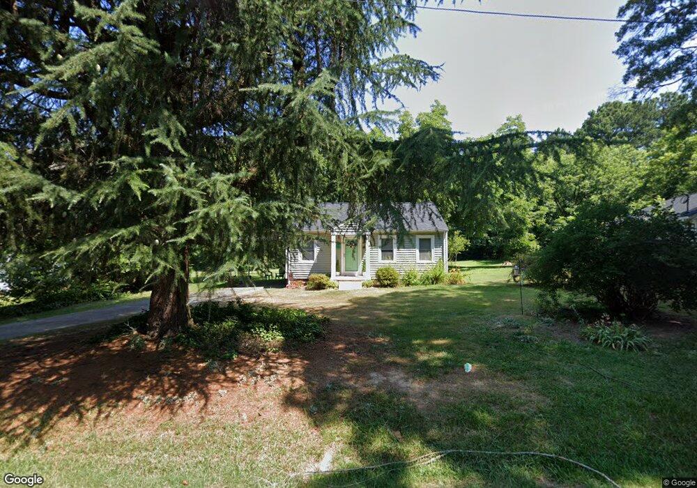
720 Morgan Ave Asheboro, NC 27205
Estimated Value: $158,000 - $198,815
--
Bed
1
Bath
880
Sq Ft
$205/Sq Ft
Est. Value
About This Home
This home is located at 720 Morgan Ave, Asheboro, NC 27205 and is currently estimated at $180,204, approximately $204 per square foot. 720 Morgan Ave is a home located in Randolph County with nearby schools including Guy B. Teachey Elementary School, South Asheboro Middle School, and Asheboro High School.
Ownership History
Date
Name
Owned For
Owner Type
Purchase Details
Closed on
Oct 12, 2023
Sold by
Hunt Law Patricia
Bought by
Russell Pamela Donice and Baker Regina R
Current Estimated Value
Home Financials for this Owner
Home Financials are based on the most recent Mortgage that was taken out on this home.
Original Mortgage
$172,800
Outstanding Balance
$169,284
Interest Rate
7.18%
Mortgage Type
New Conventional
Estimated Equity
$10,920
Purchase Details
Closed on
Apr 17, 2023
Sold by
Powers Iris Brower Hill and Powers Charles Dougla
Bought by
Hunt Law Patricia
Home Financials for this Owner
Home Financials are based on the most recent Mortgage that was taken out on this home.
Original Mortgage
$58,500
Interest Rate
6.65%
Mortgage Type
New Conventional
Purchase Details
Closed on
May 16, 2005
Sold by
Pulliam Carolyn B and Pulliam Venice U
Bought by
Nance Clara B
Create a Home Valuation Report for This Property
The Home Valuation Report is an in-depth analysis detailing your home's value as well as a comparison with similar homes in the area
Home Values in the Area
Average Home Value in this Area
Purchase History
| Date | Buyer | Sale Price | Title Company |
|---|---|---|---|
| Russell Pamela Donice | $180,000 | None Listed On Document | |
| Hunt Law Patricia | $90,000 | None Listed On Document | |
| Hunt Law Patricia | $90,000 | None Listed On Document | |
| Nance Clara B | -- | -- |
Source: Public Records
Mortgage History
| Date | Status | Borrower | Loan Amount |
|---|---|---|---|
| Open | Russell Pamela Donice | $172,800 | |
| Closed | Russell Pamela Donice | $15,000 | |
| Previous Owner | Hunt Law Patricia | $58,500 |
Source: Public Records
Tax History Compared to Growth
Tax History
| Year | Tax Paid | Tax Assessment Tax Assessment Total Assessment is a certain percentage of the fair market value that is determined by local assessors to be the total taxable value of land and additions on the property. | Land | Improvement |
|---|---|---|---|---|
| 2025 | $1,393 | $105,120 | $39,850 | $65,270 |
| 2024 | $1,393 | $105,120 | $39,850 | $65,270 |
| 2023 | $1,391 | $104,930 | $39,850 | $65,080 |
| 2022 | $877 | $60,860 | $17,430 | $43,430 |
| 2021 | $877 | $60,860 | $17,430 | $43,430 |
| 2020 | $877 | $60,860 | $17,430 | $43,430 |
| 2019 | $747 | $60,860 | $17,430 | $43,430 |
| 2018 | $770 | $52,460 | $16,860 | $35,600 |
| 2016 | $770 | $52,463 | $16,860 | $35,603 |
| 2015 | $771 | $52,463 | $16,860 | $35,603 |
| 2014 | -- | $52,463 | $16,860 | $35,603 |
Source: Public Records
Map
Nearby Homes
- 724 Sherwood Rd
- 1922 Oak Dr
- 811 Sherwood Ave
- 1427 S Fayetteville St
- 1037 Robbins St
- 960 Lee St
- 737 Britt Ave
- 481 McLarkling Ln
- 7808 State Highway 49
- 2006 Lambert Dr
- 406 Ashmont Ct
- 386 Sherwood Oaks Dr
- 01 Mack Rd
- 855 Lee St
- 228 Anchor Dr
- 828 Windermere Ct
- 287 Eldorado Rd
- 211 Armfield Ave
- 209 Armfield Ave
- 261 Charles Ave