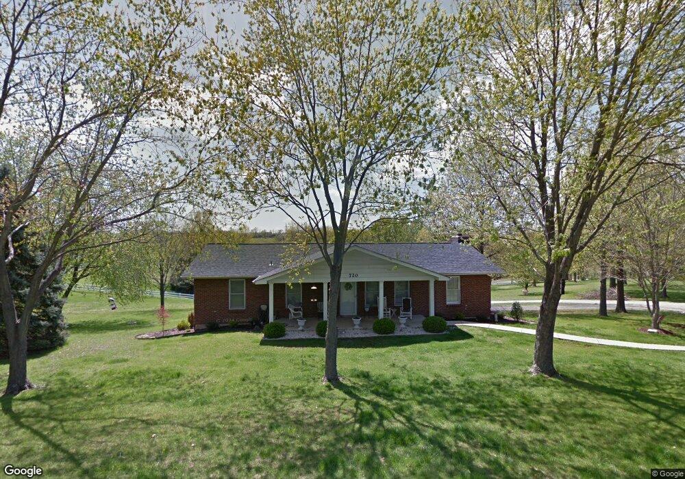
720 Noll Dr Arnold, MO 63010
Estimated Value: $270,126 - $335,000
Studio
1
Bath
1,568
Sq Ft
$193/Sq Ft
Est. Value
About This Home
This home is located at 720 Noll Dr, Arnold, MO 63010 and is currently estimated at $302,032, approximately $192 per square foot. 720 Noll Dr is a home located in Jefferson County with nearby schools including Rockport Heights Elementary School, Fox Middle School, and Fox Senior High School.
Ownership History
Date
Name
Owned For
Owner Type
Purchase Details
Closed on
Mar 16, 2001
Sold by
Gaskill Robert C and Gaskill Emily H
Bought by
Pottgen Charles M and Pottgen Beverly
Current Estimated Value
Home Financials for this Owner
Home Financials are based on the most recent Mortgage that was taken out on this home.
Original Mortgage
$139,650
Interest Rate
7.07%
Purchase Details
Closed on
Jul 30, 1999
Sold by
Spurlock Lyndell D and Spurlock Etha E
Bought by
Gaskill Robert C and Gaskill Emily H
Home Financials for this Owner
Home Financials are based on the most recent Mortgage that was taken out on this home.
Original Mortgage
$110,400
Interest Rate
6.5%
Create a Home Valuation Report for This Property
The Home Valuation Report is an in-depth analysis detailing your home's value as well as a comparison with similar homes in the area
Home Values in the Area
Average Home Value in this Area
Purchase History
| Date | Buyer | Sale Price | Title Company |
|---|---|---|---|
| Pottgen Charles M | -- | -- | |
| Gaskill Robert C | -- | Commonwealth Title |
Source: Public Records
Mortgage History
| Date | Status | Borrower | Loan Amount |
|---|---|---|---|
| Previous Owner | Pottgen Charles M | $139,650 | |
| Previous Owner | Gaskill Robert C | $110,400 |
Source: Public Records
Tax History
| Year | Tax Paid | Tax Assessment Tax Assessment Total Assessment is a certain percentage of the fair market value that is determined by local assessors to be the total taxable value of land and additions on the property. | Land | Improvement |
|---|---|---|---|---|
| 2025 | $1,686 | $25,800 | $3,000 | $22,800 |
| 2024 | $1,686 | $24,100 | $3,000 | $21,100 |
| 2023 | $1,686 | $24,100 | $3,000 | $21,100 |
| 2022 | $1,718 | $24,100 | $3,000 | $21,100 |
| 2021 | $1,719 | $24,100 | $3,000 | $21,100 |
| 2020 | $1,654 | $22,000 | $2,700 | $19,300 |
| 2019 | $1,659 | $22,000 | $2,700 | $19,300 |
| 2018 | $1,648 | $22,000 | $2,700 | $19,300 |
| 2017 | $1,673 | $22,000 | $2,700 | $19,300 |
| 2016 | $1,426 | $20,100 | $2,700 | $17,400 |
| 2015 | $1,430 | $20,100 | $2,700 | $17,400 |
| 2013 | -- | $19,500 | $2,500 | $17,000 |
Source: Public Records
Map
Nearby Homes
- 170 Bogey Blvd
- 1951 Fox Pointe Dr
- 3335 Boca Raton Dr
- 324 Bramtonn Place
- 656 Rockwood Dr
- 3550 Saint Martin Dr
- 2929 Tenbrook Rd
- 0 Unknown Unit 22001740
- 0 Unknown Unit 22071117
- 0 Unknown Unit 22001730
- 0 Unknown Unit 21017758
- 2721 Rose Dr
- Lot 2 Baeumners Second Subdivision
- 1258 Arnold Tenbrook Rd
- 1981 Saint Johns Crossing
- 3941 Orchard Dr
- 2558 Frederitzi Ln
- 1611 Hobelman Dr
- 0000 Botanical Dr
- 2631 Georgia Dr
- 727 Noll Dr
- 713 Noll Dr
- 707 Noll Dr
- 709 Noll Dr
- 705 Sur Vista Dr
- 721 Noll Dr
- 707 Sur Vista Dr
- 701 Sur Vista Dr
- 709 Sur Vista Dr
- 763 Noll Dr
- 3380 Tenbrook Rd
- 708 Sur Vista Dr
- 702 Sur Vista Dr
- 3363 Tenbrook Rd
- 711 Sur Vista Dr
- 712 Sur Vista Dr
- 3339 Tenbrook Rd
- 3421 Tenbrook Rd
- 713 Sur Vista Dr
- 799 Noll Dr
Your Personal Tour Guide
Ask me questions while you tour the home.