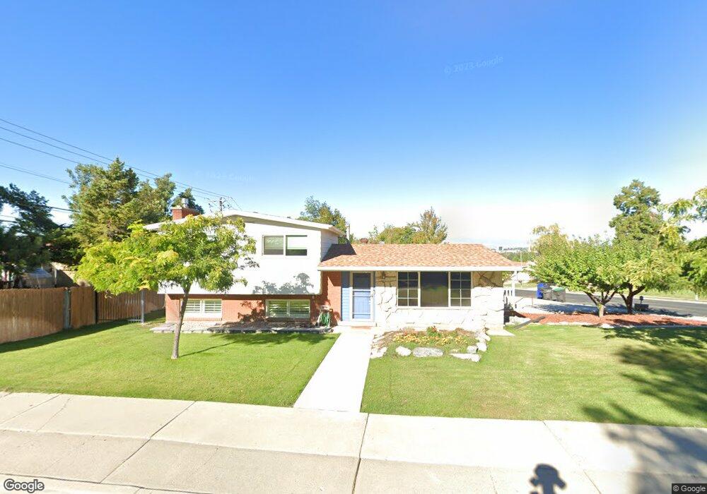
720 S 1500 E Provo, UT 84606
Provost NeighborhoodEstimated Value: $520,000 - $570,000
4
Beds
3
Baths
2,391
Sq Ft
$231/Sq Ft
Est. Value
About This Home
This home is located at 720 S 1500 E, Provo, UT 84606 and is currently estimated at $551,478, approximately $230 per square foot. 720 S 1500 E is a home located in Utah County with nearby schools including Provost School, Centennial Middle School, and Timpview High School.
Ownership History
Date
Name
Owned For
Owner Type
Purchase Details
Closed on
Jul 6, 2009
Sold by
Babb Julie C and Miles Julie C
Bought by
Gramajo Leonardo A and Gramajo Shelly
Current Estimated Value
Home Financials for this Owner
Home Financials are based on the most recent Mortgage that was taken out on this home.
Original Mortgage
$169,375
Outstanding Balance
$110,207
Interest Rate
5.25%
Mortgage Type
FHA
Estimated Equity
$441,271
Purchase Details
Closed on
Mar 7, 1998
Sold by
Miles Donald Joseph and Miles Julie C
Bought by
Miles Julie C
Home Financials for this Owner
Home Financials are based on the most recent Mortgage that was taken out on this home.
Original Mortgage
$118,400
Interest Rate
7%
Create a Home Valuation Report for This Property
The Home Valuation Report is an in-depth analysis detailing your home's value as well as a comparison with similar homes in the area
Home Values in the Area
Average Home Value in this Area
Purchase History
| Date | Buyer | Sale Price | Title Company |
|---|---|---|---|
| Gramajo Leonardo A | -- | First American Orem | |
| Miles Julie C | -- | -- |
Source: Public Records
Mortgage History
| Date | Status | Borrower | Loan Amount |
|---|---|---|---|
| Open | Gramajo Leonardo A | $169,375 | |
| Previous Owner | Miles Julie C | $118,400 |
Source: Public Records
Tax History
| Year | Tax Paid | Tax Assessment Tax Assessment Total Assessment is a certain percentage of the fair market value that is determined by local assessors to be the total taxable value of land and additions on the property. | Land | Improvement |
|---|---|---|---|---|
| 2025 | $2,612 | $273,240 | -- | -- |
| 2024 | $2,612 | $257,125 | $0 | $0 |
| 2023 | $2,617 | $253,990 | $0 | $0 |
| 2022 | $2,565 | $251,020 | $0 | $0 |
| 2021 | $1,887 | $322,100 | $119,700 | $202,400 |
| 2020 | $1,678 | $292,800 | $108,800 | $184,000 |
| 2019 | $1,678 | $279,100 | $101,800 | $177,300 |
| 2018 | $1,582 | $266,900 | $94,700 | $172,200 |
| 2017 | $1,435 | $133,045 | $0 | $0 |
| 2016 | $1,402 | $121,165 | $0 | $0 |
| 2015 | $1,352 | $118,085 | $0 | $0 |
| 2014 | $1,130 | $102,850 | $0 | $0 |
Source: Public Records
Map
Nearby Homes
- 1417 E 700 S
- 596 S 1500 E
- 1304 E 900 S
- 1332 Cinnamon Ridge Way
- 1245 E 580 S
- 1169 E 700 S
- 1231 E 520 S
- 1052 Canyon Meadow Dr Unit 4
- 1066 Cinnamon Ridge Dr
- 1105 S 1420 E
- 1077 Canyon Meadow Dr Unit 3
- 1154 S 1430 E
- 1090 E 460 S
- 1482 E 1280 S
- 984 E 900 S
- 1311 Alpine Loop
- 1347 S 1370 E
- 1005 E 300 S
- 1141 E 1320 S Unit A404
- 1141 E 1320 S Unit B401
Your Personal Tour Guide
Ask me questions while you tour the home.