Estimated Value: $299,000 - $345,856
4
Beds
4
Baths
1,828
Sq Ft
$178/Sq Ft
Est. Value
About This Home
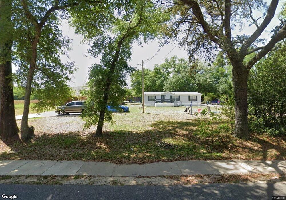
This home is located at 720 S Maple St S, Foley, AL 36535 and is currently estimated at $326,214, approximately $178 per square foot. 720 S Maple St S is a home with nearby schools including Foley Elementary School, Foley Middle School, and Foley High School.
Ownership History
Date
Name
Owned For
Owner Type
Purchase Details
Closed on
Jul 16, 2021
Sold by
Foster Felicia and Foster Derrick
Bought by
Foster Felicia and Foster Derrick
Current Estimated Value
Home Financials for this Owner
Home Financials are based on the most recent Mortgage that was taken out on this home.
Original Mortgage
$203,600
Outstanding Balance
$185,923
Interest Rate
3%
Mortgage Type
New Conventional
Estimated Equity
$140,291
Purchase Details
Closed on
Sep 20, 2007
Sold by
Bullard Roosevelt
Bought by
Foster Felicia
Create a Home Valuation Report for This Property
The Home Valuation Report is an in-depth analysis detailing your home's value as well as a comparison with similar homes in the area
Home Values in the Area
Average Home Value in this Area
Purchase History
| Date | Buyer | Sale Price | Title Company |
|---|---|---|---|
| Foster Felicia | $196,000 | None Listed On Document | |
| Foster Felicia | -- | None Available |
Source: Public Records
Mortgage History
| Date | Status | Borrower | Loan Amount |
|---|---|---|---|
| Open | Foster Felicia | $203,600 |
Source: Public Records
Tax History Compared to Growth
Tax History
| Year | Tax Paid | Tax Assessment Tax Assessment Total Assessment is a certain percentage of the fair market value that is determined by local assessors to be the total taxable value of land and additions on the property. | Land | Improvement |
|---|---|---|---|---|
| 2024 | -- | $29,540 | $2,280 | $27,260 |
| 2023 | $0 | $29,780 | $2,680 | $27,100 |
| 2022 | $180 | $5,460 | $0 | $0 |
| 2021 | $159 | $4,820 | $0 | $0 |
| 2020 | $116 | $3,500 | $0 | $0 |
| 2019 | $116 | $3,500 | $0 | $0 |
| 2018 | $116 | $3,500 | $0 | $0 |
| 2017 | $116 | $3,500 | $0 | $0 |
| 2016 | $74 | $2,240 | $0 | $0 |
| 2015 | $74 | $2,240 | $0 | $0 |
| 2014 | $69 | $2,100 | $0 | $0 |
| 2013 | -- | $2,100 | $0 | $0 |
Source: Public Records
Map
Nearby Homes
- 19129 S Maple St
- 19250 S Maple St
- 1524 Kairos Loop
- 637 E Pedigo Ave
- 1476 Kairos Loop
- 1166 Pheasant Cir
- 1311 Plymouth Dr
- 615 E Pedigo Ave
- 704 Mayflower Dr
- 801 S Juniper St
- 691 Mayflower Dr
- 688 Mayflower Dr
- 1338 Plymouth Dr
- 637 Revere St
- 652 Mayflower Dr
- 651 Mayflower Dr
- 643 Mayflower Dr
- 12215 Robert Lane Dr
- 1704 Arcadia Dr
- 639 Mayflower Dr
- 709 S Maple St
- 707 S Maple St
- 706 S Maple St
- 702 S Maple St
- 1105 E Jefferson Ave
- 703 S Maple St
- 1105 E Jackson Ave
- 1010 E Azalea Ave
- 1008 E Azalea Ave
- 809 S Maple St
- 1013 E Azalea Ave
- 919 S Maple St
- 1017 E Bullard Ave
- 21183 E Bullard Ave
- 921 E Azalea Ave
- 921 Azalea St
- 921 S Maple St
- 901 S Pecan St
- 903 S Pecan St
- 1023 E Bullard Ave