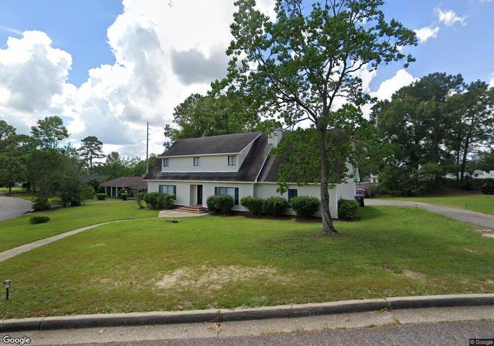
7201 Carson Rd S Mobile, AL 36695
Sheldon NeighborhoodEstimated Value: $255,467 - $350,000
About This Home
This home is located at 7201 Carson Rd S, Mobile, AL 36695 and is currently estimated at $290,367, approximately $127 per square foot. 7201 Carson Rd S is a home located in Mobile County with nearby schools including Burns Middle School, WP Davidson High School, and Covenant Christian School.
Ownership History
We collect this data history from publicly available records. To have your information removed, we recommend requesting removal directly through your county’s website.
Purchase Details
Purchase Details
Purchase Details
Home Financials for this Owner
Home Financials are based on the most recent Mortgage that was taken out on this home.Home Values in the Area
Average Home Value in this Area
Purchase History
We collect this data history from publicly available records. To have your information removed, we recommend requesting removal directly through your county’s website.
| Date | Buyer | Sale Price | Title Company |
|---|---|---|---|
| $73,500 | None Available | ||
| $128,000 | None Available | ||
| $135,000 | -- |
Mortgage History
We collect this data history from publicly available records. To have your information removed, we recommend requesting removal directly through your county’s website.
| Date | Status | Borrower | Loan Amount |
|---|---|---|---|
| Closed | $133,941 | ||
| Closed | $80,185 |
Tax History
We collect this data history from publicly available records. To have your information removed, we recommend requesting removal directly through your county’s website.
| Year | Tax Paid | Tax Assessment Tax Assessment Total Assessment is a certain percentage of the fair market value that is determined by local assessors to be the total taxable value of land and additions on the property. | Land | Improvement |
|---|---|---|---|---|
| 2025 | $2,212 | $45,400 | $7,000 | $38,400 |
| 2024 | $2,212 | $44,640 | $7,000 | $37,640 |
| 2023 | $2,124 | $43,800 | $7,000 | $36,800 |
| 2022 | $1,906 | $39,300 | $7,000 | $32,300 |
| 2021 | $1,826 | $37,640 | $7,000 | $30,640 |
| 2020 | $1,837 | $37,880 | $7,000 | $30,880 |
| 2019 | $1,786 | $36,820 | $7,000 | $29,820 |
| 2018 | $1,717 | $35,400 | $0 | $0 |
| 2017 | $1,584 | $32,660 | $0 | $0 |
| 2016 | $1,661 | $34,240 | $0 | $0 |
| 2013 | $1,644 | $31,800 | $0 | $0 |
Map
- 1361 Dellwyn Ct
- 7321 Carson Rd S Unit 2
- 1215 Richmond Ct
- 7320 Smithfield Rd
- 7086 Crown Pointe Dr
- 7315 Bridgewood Ct
- 1345 Wellsley Ct
- 7201 Ashmoor Dr N
- 1630 Ashmoor Dr E
- 6939 Johnston Ln
- 7412 Wesley Ct
- 7243 Bull Pen Cir
- 1291 Carson Rd W
- 1735 Ashmoor Dr W
- 7180 Charlanda Blvd
- 1280 Cameron Dr Unit 2
- 6701 Somerby Ln
- 6617 Somerby Ln
- 1817 Bradshire Dr
- 7601 Cameron Ct
- 7162 Smithfield Rd
- 7158 Smithfield Rd
- 1335 Dunbrooke Ct
- 1325 Dunbrooke Ct
- 1315 Dunbrooke Ct
- 7200 Carson Rd S
- 7154 Smithfield Rd
- 7205 Smithfield Rd
- 7152 Smithfield Rd
- 7171 Smithfield Rd
- 1330 Dunbrooke Ct
- 1310 Dunbrooke Ct
- 7167 Smithfield Rd
- 7222 Carson Rd S
- 1305 Dunbrooke Ct
- 1320 Dunbrooke Ct
- 7215 Smithfield Rd
- 7140 Smithfield Rd
- 7211 Carson Rd S
- 7163 Smithfield Rd
Ask me questions while you tour the home.