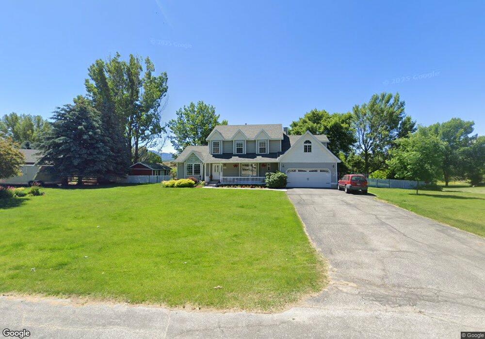
7201 E 1000 N Huntsville, UT 84317
Estimated Value: $1,275,774 - $1,908,000
7
Beds
4
Baths
5,728
Sq Ft
$265/Sq Ft
Est. Value
About This Home
This home is located at 7201 E 1000 N, Huntsville, UT 84317 and is currently estimated at $1,516,925, approximately $264 per square foot. 7201 E 1000 N is a home located in Weber County with nearby schools including Valley Elementary School, Snowcrest Junior High School, and Weber High School.
Ownership History
Date
Name
Owned For
Owner Type
Purchase Details
Closed on
Dec 1, 2022
Sold by
Roskelley Douglas S and Roskelley Michelle J
Bought by
Douglas And Michelle Roskelley Irrevocable Tr and Bloxham
Current Estimated Value
Purchase Details
Closed on
Jun 1, 2004
Sold by
Gage Froerer & Associates Inc
Bought by
Casey Acres Homeowners Assn
Purchase Details
Closed on
May 21, 1998
Sold by
Roskelley Doug S and Roskelley Michelle J
Bought by
Roskelley Douglas S and Roskelley Michelle J
Create a Home Valuation Report for This Property
The Home Valuation Report is an in-depth analysis detailing your home's value as well as a comparison with similar homes in the area
Home Values in the Area
Average Home Value in this Area
Purchase History
| Date | Buyer | Sale Price | Title Company |
|---|---|---|---|
| Douglas And Michelle Roskelley Irrevocable Tr | -- | None Listed On Document | |
| Casey Acres Homeowners Assn | -- | -- | |
| Roskelley Douglas S | -- | Founders Title Co |
Source: Public Records
Tax History Compared to Growth
Tax History
| Year | Tax Paid | Tax Assessment Tax Assessment Total Assessment is a certain percentage of the fair market value that is determined by local assessors to be the total taxable value of land and additions on the property. | Land | Improvement |
|---|---|---|---|---|
| 2025 | $5,431 | $1,021,167 | $280,325 | $740,842 |
| 2024 | $4,984 | $525,557 | $148,679 | $376,878 |
| 2023 | $4,882 | $508,200 | $148,680 | $359,520 |
| 2022 | $5,214 | $553,106 | $132,207 | $420,899 |
| 2021 | $3,598 | $643,000 | $165,624 | $477,376 |
| 2020 | $3,160 | $518,244 | $130,577 | $387,667 |
| 2019 | $3,206 | $503,379 | $110,629 | $392,750 |
| 2018 | $3,228 | $486,155 | $110,629 | $375,526 |
| 2017 | $2,837 | $420,563 | $100,256 | $320,307 |
| 2016 | $2,783 | $223,963 | $49,033 | $174,930 |
| 2015 | $2,485 | $197,804 | $46,434 | $151,370 |
| 2014 | $2,338 | $181,807 | $46,434 | $135,373 |
Source: Public Records
Map
Nearby Homes
- 7768 E 1075 N
- 260 S 7900 E
- 260 S 7900 E Unit 3
- 439 S 7900 E Unit 11
- 439 S 7900 E
- 387 S 7900 E
- 1762 N 6250 E Unit 5
- 4400 Plan at SAGE
- 3500 Plan at SAGE
- 4200 Plan at SAGE
- 1785 N 6250 E
- 1823 N 6250 E
- 441 S 7900 E
- 6486 E Highway 39 Unit 47
- 6486 E Highway 39 Unit 64
- 6486 E Highway 39 Unit 32
- 6486 E Highway 39 Unit 24
- 6486 E Hwy 39 Unit 47
- 6486 E Hwy 39 Unit 64
- 8927 Pineview Dr