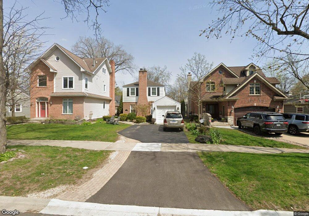
721 Arbor Ln Glenview, IL 60025
Estimated Value: $550,776 - $588,000
3
Beds
2
Baths
1,456
Sq Ft
$393/Sq Ft
Est. Value
About This Home
This home is located at 721 Arbor Ln, Glenview, IL 60025 and is currently estimated at $571,944, approximately $392 per square foot. 721 Arbor Ln is a home located in Cook County with nearby schools including Romona Elementary School, Highcrest Middle School, and Wilmette Junior High School.
Ownership History
Date
Name
Owned For
Owner Type
Purchase Details
Closed on
May 8, 2009
Sold by
Boyle Mary Kate
Bought by
Boyle Mary Kate and Patka Robert
Current Estimated Value
Home Financials for this Owner
Home Financials are based on the most recent Mortgage that was taken out on this home.
Original Mortgage
$310,000
Outstanding Balance
$193,851
Interest Rate
4.9%
Mortgage Type
New Conventional
Estimated Equity
$378,093
Purchase Details
Closed on
Sep 26, 2008
Sold by
Wereski Robert P and Wereski Katherine
Bought by
Boyle Mary Kate
Home Financials for this Owner
Home Financials are based on the most recent Mortgage that was taken out on this home.
Original Mortgage
$310,000
Interest Rate
6.52%
Mortgage Type
Unknown
Purchase Details
Closed on
Apr 9, 2003
Sold by
Pot Eric A and Pot Amy Lynn
Bought by
Wereski Robert P and Bauschard Katherine
Home Financials for this Owner
Home Financials are based on the most recent Mortgage that was taken out on this home.
Original Mortgage
$300,000
Interest Rate
5.9%
Mortgage Type
Unknown
Purchase Details
Closed on
Jan 31, 2000
Sold by
Bernstein Randall and Bernstein Veronica
Bought by
Pot Eric A and Pot Amy Lynn
Home Financials for this Owner
Home Financials are based on the most recent Mortgage that was taken out on this home.
Original Mortgage
$207,500
Interest Rate
7.5%
Purchase Details
Closed on
Jun 30, 1999
Sold by
Morrissey Joseph and Morrissey Monica
Bought by
Bernstein Randall and Bernstein Veronica
Home Financials for this Owner
Home Financials are based on the most recent Mortgage that was taken out on this home.
Original Mortgage
$209,600
Interest Rate
3.95%
Purchase Details
Closed on
Jun 24, 1996
Sold by
Grady Cherris D
Bought by
Morrissey Joseph and Morrissey Monica
Home Financials for this Owner
Home Financials are based on the most recent Mortgage that was taken out on this home.
Original Mortgage
$196,000
Interest Rate
7.5%
Purchase Details
Closed on
Feb 27, 1996
Sold by
Dewolf Robert J and Dewolf Isabel C
Bought by
Grady Robert D
Create a Home Valuation Report for This Property
The Home Valuation Report is an in-depth analysis detailing your home's value as well as a comparison with similar homes in the area
Home Values in the Area
Average Home Value in this Area
Purchase History
| Date | Buyer | Sale Price | Title Company |
|---|---|---|---|
| Boyle Mary Kate | -- | Chicago Title Insurance Co | |
| Boyle Mary Kate | $432,000 | Cti | |
| Wereski Robert P | $375,000 | Pntn | |
| Wereski Robert P | $375,000 | Pntn | |
| Pot Eric A | $287,500 | Chicago Title Insurance Co | |
| Bernstein Randall | $262,000 | Centennial Title Incorporate | |
| Morrissey Joseph | $245,000 | -- | |
| Morrissey Joseph | -- | -- | |
| Grady Robert D | -- | -- |
Source: Public Records
Mortgage History
| Date | Status | Borrower | Loan Amount |
|---|---|---|---|
| Open | Boyle Mary Kate | $310,000 | |
| Closed | Boyle Mary Kate | $310,000 | |
| Previous Owner | Wereski Robert P | $300,000 | |
| Previous Owner | Pot Eric A | $207,500 | |
| Previous Owner | Bernstein Randall | $209,600 | |
| Previous Owner | Morrissey Joseph | $196,000 | |
| Closed | Wereski Robert P | $37,450 |
Source: Public Records
Tax History
| Year | Tax Paid | Tax Assessment Tax Assessment Total Assessment is a certain percentage of the fair market value that is determined by local assessors to be the total taxable value of land and additions on the property. | Land | Improvement |
|---|---|---|---|---|
| 2025 | $8,996 | $62,000 | $8,512 | $53,488 |
| 2024 | $8,996 | $44,000 | $8,512 | $35,488 |
| 2023 | $8,562 | $44,000 | $8,512 | $35,488 |
| 2022 | $8,562 | $44,000 | $8,512 | $35,488 |
| 2021 | $5,546 | $25,278 | $6,118 | $19,160 |
| 2020 | $5,469 | $25,278 | $6,118 | $19,160 |
| 2019 | $5,335 | $27,779 | $6,118 | $21,661 |
| 2018 | $7,706 | $36,707 | $5,054 | $31,653 |
| 2017 | $7,467 | $36,707 | $5,054 | $31,653 |
| 2016 | $7,204 | $36,707 | $5,054 | $31,653 |
| 2015 | $7,001 | $31,787 | $4,123 | $27,664 |
| 2014 | $6,873 | $31,787 | $4,123 | $27,664 |
| 2013 | $7,028 | $33,871 | $4,123 | $29,748 |
Source: Public Records
Map
Nearby Homes
- 821 Harms Rd
- 623 Echo Ln
- 716 Indian Rd
- 808 Indian Rd
- 1041 Arbor Ln
- 800 Glenview Rd
- 411 Woodland Ct
- 846 Wagner Rd
- 408 Lavergne Ave
- 809 Lenox Rd
- 1119 Longvalley Rd
- 10059 Frontage Rd Unit F
- 9725 Woods Dr Unit 305
- 9725 Woods Dr Unit 1913
- 9725 Woods Dr Unit 309
- 9725 Woods Dr Unit 1005
- 9725 Woods Dr Unit 802
- 9725 Woods Dr Unit 1502
- 9655 Woods Dr Unit 517
- 9655 Woods Dr Unit 1102
Your Personal Tour Guide
Ask me questions while you tour the home.