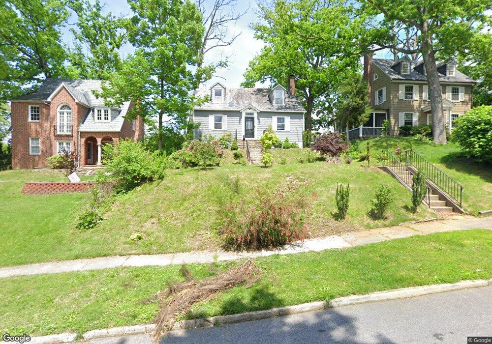
721 Brookwood Rd Baltimore, MD 21229
Hunting Ridge NeighborhoodEstimated Value: $346,000 - $383,000
Studio
2
Baths
1,575
Sq Ft
$230/Sq Ft
Est. Value
About This Home
This home is located at 721 Brookwood Rd, Baltimore, MD 21229 and is currently estimated at $361,734, approximately $229 per square foot. 721 Brookwood Rd is a home located in Baltimore City with nearby schools including Thomas Jefferson Elementary School, Booker T. Washington Middle School, and Forest Park High School.
Ownership History
Date
Name
Owned For
Owner Type
Purchase Details
Closed on
Nov 9, 2007
Sold by
Coley Hildegarde L
Bought by
West Nathaniel R
Current Estimated Value
Home Financials for this Owner
Home Financials are based on the most recent Mortgage that was taken out on this home.
Original Mortgage
$280,000
Outstanding Balance
$177,980
Interest Rate
6.47%
Mortgage Type
Purchase Money Mortgage
Estimated Equity
$183,754
Create a Home Valuation Report for This Property
The Home Valuation Report is an in-depth analysis detailing your home's value as well as a comparison with similar homes in the area
Home Values in the Area
Average Home Value in this Area
Purchase History
| Date | Buyer | Sale Price | Title Company |
|---|---|---|---|
| West Nathaniel R | $280,000 | -- |
Source: Public Records
Mortgage History
| Date | Status | Borrower | Loan Amount |
|---|---|---|---|
| Open | West Nathaniel R | $280,000 |
Source: Public Records
Tax History
| Year | Tax Paid | Tax Assessment Tax Assessment Total Assessment is a certain percentage of the fair market value that is determined by local assessors to be the total taxable value of land and additions on the property. | Land | Improvement |
|---|---|---|---|---|
| 2025 | $4,528 | $238,100 | -- | -- |
| 2024 | $4,528 | $221,200 | -- | -- |
| 2023 | $4,821 | $204,300 | $72,300 | $132,000 |
| 2022 | $4,405 | $202,133 | $0 | $0 |
| 2021 | $4,719 | $199,967 | $0 | $0 |
| 2020 | $4,313 | $197,800 | $72,300 | $125,500 |
| 2019 | $4,265 | $196,667 | $0 | $0 |
| 2018 | $4,301 | $195,533 | $0 | $0 |
| 2017 | $4,322 | $194,400 | $0 | $0 |
| 2016 | -- | $189,767 | $0 | $0 |
| 2015 | $6,261 | $185,133 | $0 | $0 |
| 2014 | $6,261 | $180,500 | $0 | $0 |
Source: Public Records
Map
Nearby Homes
- 4814 Briarclift Rd
- 4905 Briarclift Rd
- 719 Brinkwood Rd
- 905 Cooks Ln
- 829 N Chapel Gate Ln
- 918 Cooks Ln
- 5022 Westhills Rd
- 603 Stamford Rd
- 4509 Rokeby Rd
- 1215 Cooks Ln
- 416 Nottingham Rd
- 1231 Kevin Rd
- 1024 Wicklow Rd
- 402 Westgate Rd
- 6 Cromarty Rd
- 1017 Wicklow Rd
- 0 Franklintown Subdivision Unit MDBA2166112
- 1603 N Forest Park Ave
- 809 Braeside Rd
- 619 Aldershot Rd
- 723 Brookwood Rd
- 719 Brookwood Rd
- 717 Brookwood Rd
- 727 Brookwood Rd
- 718 Hunting Place
- 722 Hunting Place
- 716 Hunting Place
- 722 Brookwood Rd
- 720 Brookwood Rd
- 729 Brookwood Rd
- 724 Brookwood Rd
- 718 Brookwood Rd
- 800 Winans Way
- 714 Hunting Place
- 726 Brookwood Rd
- 802 Winans Way
- 713 Brookwood Rd
- 716 Brookwood Rd
- 731 Brookwood Rd
- 804 Winans Way