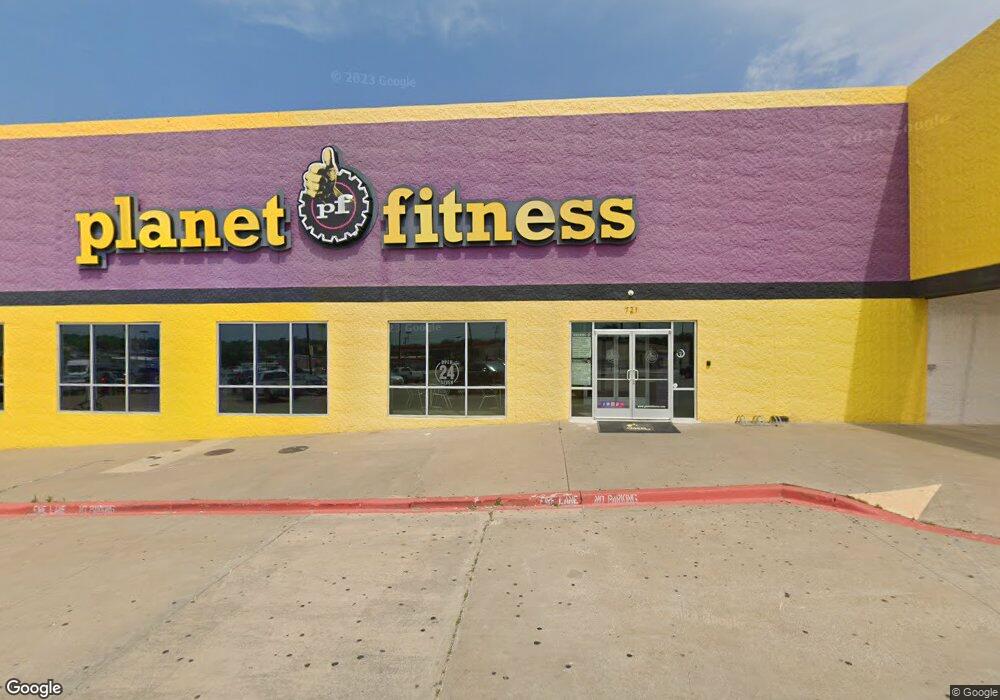
721 E Taylor St Sherman, TX 75090
--
Bed
--
Bath
39,350
Sq Ft
3.32
Acres
About This Home
This home is located at 721 E Taylor St, Sherman, TX 75090. 721 E Taylor St is a home located in Grayson County with nearby schools including Percy W. Neblett Elementary School, Dillingham Intermediate School, and Piner Middle School.
Ownership History
Date
Name
Owned For
Owner Type
Purchase Details
Closed on
Mar 7, 2012
Sold by
9Krm Corp
Bought by
Altona Inc
Home Financials for this Owner
Home Financials are based on the most recent Mortgage that was taken out on this home.
Original Mortgage
$840,000
Interest Rate
3.59%
Mortgage Type
Commercial
Purchase Details
Closed on
Aug 14, 2008
Sold by
Ft Krg Property Lp
Bought by
Ft Krg Sherman Llc
Purchase Details
Closed on
Nov 18, 2004
Sold by
Greyhound Real Estate Investment One Llc
Bought by
Ft Krg Property Lp
Create a Home Valuation Report for This Property
The Home Valuation Report is an in-depth analysis detailing your home's value as well as a comparison with similar homes in the area
Home Values in the Area
Average Home Value in this Area
Purchase History
| Date | Buyer | Sale Price | Title Company |
|---|---|---|---|
| Altona Inc | -- | None Available | |
| Ft Krg Sherman Llc | -- | Landamerica | |
| Ft Krg Property Lp | -- | -- |
Source: Public Records
Mortgage History
| Date | Status | Borrower | Loan Amount |
|---|---|---|---|
| Previous Owner | Altona Inc | $840,000 |
Source: Public Records
Tax History Compared to Growth
Tax History
| Year | Tax Paid | Tax Assessment Tax Assessment Total Assessment is a certain percentage of the fair market value that is determined by local assessors to be the total taxable value of land and additions on the property. | Land | Improvement |
|---|---|---|---|---|
| 2025 | $54,143 | $2,850,221 | $538,308 | $2,311,913 |
| 2024 | $54,143 | $2,468,576 | $538,308 | $1,930,268 |
| 2023 | $52,694 | $2,400,000 | $538,308 | $1,861,692 |
| 2022 | $56,247 | $2,400,000 | $519,496 | $1,880,504 |
| 2021 | $41,245 | $1,645,539 | $562,233 | $1,083,306 |
| 2020 | $47,219 | $1,883,893 | $562,233 | $1,321,660 |
| 2019 | $50,890 | $1,888,000 | $565,570 | $1,322,430 |
| 2018 | $64,014 | $2,374,882 | $640,646 | $1,734,236 |
| 2017 | $58,110 | $2,316,178 | $640,646 | $1,675,532 |
| 2016 | $57,657 | $2,316,178 | $640,646 | $1,675,532 |
| 2015 | $19,872 | $799,910 | $640,646 | $159,264 |
| 2014 | $19,873 | $799,910 | $640,646 | $159,264 |
Source: Public Records
Map
Nearby Homes
- 000 N Masters St
- 2012 Texoma Pkwy
- 15.125 acres E Peyton St
- 604 N Frisco St
- 705 E Lamberth Rd
- 812 E McGee St
- 2606 Bennett Ave
- 914 Boone Dr
- 1516 E Peyton St
- 1705 E Hilton St
- 210 W Dexter St
- 2412 N Travis St
- 224 W Dexter St
- 225 W Texas St
- 2117 N Shannon St
- 1718 N Shannon St
- 2321 N Shannon St
- TBD Sam Rayburn
- 1416 N Cleveland Ave
- 2419 N Shannon St
- 715 E Taylor St
- 2000 N Loy Lake Rd
- 500 E Peyton St
- 1911 N Loy Lake Rd
- 2009 Independence Dr Unit 105
- 2009 Independence Dr Unit 103
- 2009 Independence Dr
- 2001 N Loy Lake Rd
- 506 E Taylor St
- 2113 N Loy Lake Rd Unit RD
- 2113 N Loy Lake Rd
- 902 Cottonwood Dr
- 1804 N Loy Lake Rd
- 600 E Taylor St Unit 103
- 600 E Taylor St Unit 308
- 600 E Taylor St Unit 300
- 600 E Taylor St Unit 311
- 600 E Taylor St Unit 3011
- 600 E Taylor St
- 2131 N Loy Lake Rd