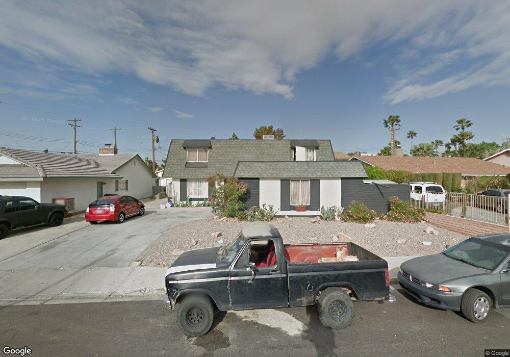
721 Langtry Dr Las Vegas, NV 89107
Twin Lakes NeighborhoodEstimated Value: $351,000 - $524,000
4
Beds
3
Baths
2,888
Sq Ft
$152/Sq Ft
Est. Value
About This Home
This home is located at 721 Langtry Dr, Las Vegas, NV 89107 and is currently estimated at $440,265, approximately $152 per square foot. 721 Langtry Dr is a home located in Clark County with nearby schools including E.W. Griffith Elementary School, Robert O Gibson Middle School, and Western High School.
Ownership History
Date
Name
Owned For
Owner Type
Purchase Details
Closed on
Feb 23, 2011
Sold by
Federal Home Loan Mortgage Corporation
Bought by
Whitten Joseph
Current Estimated Value
Purchase Details
Closed on
Jun 30, 2010
Sold by
Strickler Matthew
Bought by
Federal Home Loan Mortgage Corporation
Purchase Details
Closed on
Jul 12, 2007
Sold by
Strickler Theresa
Bought by
Strickler Matthew
Home Financials for this Owner
Home Financials are based on the most recent Mortgage that was taken out on this home.
Original Mortgage
$272,000
Interest Rate
6.41%
Mortgage Type
Unknown
Purchase Details
Closed on
Jul 6, 2007
Sold by
Cox Kenneth L and Cox Kathleen A
Bought by
Strickler Matthew
Home Financials for this Owner
Home Financials are based on the most recent Mortgage that was taken out on this home.
Original Mortgage
$272,000
Interest Rate
6.41%
Mortgage Type
Unknown
Create a Home Valuation Report for This Property
The Home Valuation Report is an in-depth analysis detailing your home's value as well as a comparison with similar homes in the area
Home Values in the Area
Average Home Value in this Area
Purchase History
| Date | Buyer | Sale Price | Title Company |
|---|---|---|---|
| Whitten Joseph | $90,100 | Pacific Coast Title | |
| Federal Home Loan Mortgage Corporation | $116,124 | Pacific Coast Title | |
| Strickler Matthew | -- | Old Republic Title Co Of Nv | |
| Strickler Matthew | $340,000 | Old Republic Title Co Of Nv |
Source: Public Records
Mortgage History
| Date | Status | Borrower | Loan Amount |
|---|---|---|---|
| Previous Owner | Strickler Matthew | $272,000 |
Source: Public Records
Tax History Compared to Growth
Tax History
| Year | Tax Paid | Tax Assessment Tax Assessment Total Assessment is a certain percentage of the fair market value that is determined by local assessors to be the total taxable value of land and additions on the property. | Land | Improvement |
|---|---|---|---|---|
| 2025 | $2,450 | $74,697 | $32,200 | $42,497 |
| 2024 | $2,269 | $74,697 | $32,200 | $42,497 |
| 2023 | $2,269 | $72,134 | $33,950 | $38,184 |
| 2022 | $2,101 | $64,331 | $30,100 | $34,231 |
| 2021 | $1,946 | $59,257 | $25,550 | $33,707 |
| 2020 | $1,910 | $59,468 | $24,850 | $34,618 |
| 2019 | $1,790 | $56,530 | $21,350 | $35,180 |
| 2018 | $1,708 | $52,103 | $17,500 | $34,603 |
| 2017 | $1,756 | $53,560 | $17,500 | $36,060 |
| 2016 | $1,600 | $51,898 | $13,300 | $38,598 |
| 2015 | $1,596 | $47,779 | $9,100 | $38,679 |
| 2014 | $1,549 | $45,862 | $5,950 | $39,912 |
Source: Public Records
Map
Nearby Homes
- 800 Langtry Dr
- 821 Mar Jay Ct
- 4301 Fortune Ave
- 812 Hogan Dr
- 4317 Hanford Ave
- 309 Estella Ave
- 4405 Hanford Ave
- 312 Estella Ave
- 812 Pyramid Dr
- 1112 Hazard Ave
- 1317 Pyramid Dr
- 1300 Oak Tree Ln
- 1325 Pyramid Dr
- 3616 Roseglen Ct
- 1101 Silver Lake Dr
- 605 N Yale St
- 1313 Purple Sage Ave
- 324 Princeton St
- 3871 Mountain Trail
- 4404 Mayflower Ln