

Estimated payment $1,521/month
Highlights
- No HOA
- Bathroom on Main Level
- Wood Siding
- Troy High School Rated 9+
- Central Air
- Heating System Uses Natural Gas
About This Home
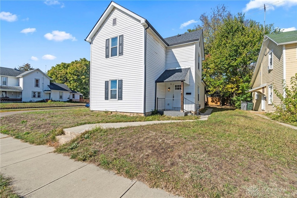
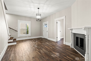
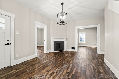
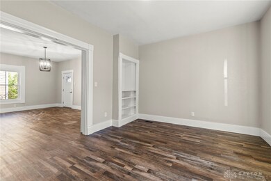
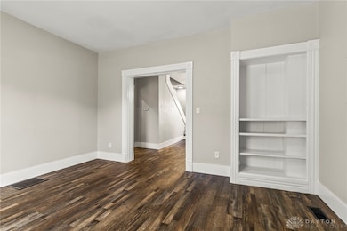
Experience the charm of historic Troy reimagined with modern style at 721 McKaig Avenue. This beautifully renovated historic home blends timeless character with the upgrades today’s buyers expect—delivering the perfect move-in-ready lifestyle just moments from downtown. Step inside to discover nearly 2,340 sqft of thoughtfully finished living space, featuring wide-plank luxury vinyl flooring, tall ceilings, and abundant natural light. The main level showcases a bright, open kitchen with quartz-look countertops, subway-tile backsplash, stainless-steel appliances, and crisp cabinetry that ties the renovation together with understated sophistication. A formal dining area and spacious living room make entertaining effortless, while three updated full baths featuring modern fixtures. Upstairs, you’ll find well-sized bedrooms with generous closet storage and fresh paint throughout Outside, enjoy a private backyard with off-street parking and room for outdoor living. Located within walking distance to Troy’s restaurants, boutiques, and local parks, this home offers the convenience of city amenities in a quiet neighborhood setting.
Recent updates include new HVAC, electrical, plumbing, and roof (see supplement for full list). Highlights:
- Completely renovated interior (2024–25)
- Updated kitchen & baths with modern finishes
- Energy-efficient mechanicals and newer roof
- Off-street parking; low-maintenance yard
- Walkable to downtown Troy List Price: $289,900
Presented by: Derek Blevins | RED 1 Realty
Listing Agent
Red 1 Realty Brokerage Phone: (937) 689-6134 License #2022004164 Listed on: 10/30/2025

Home Details
Home Type
- Single Family
Est. Annual Taxes
- $826
Year Built
- 1920
Lot Details
- 5,663 Sq Ft Lot
- Lot Dimensions are 59 x 97
Parking
- No Garage
Home Design
- Brick Exterior Construction
- Wood Siding
- Shingle Siding
- Vinyl Siding
Interior Spaces
- 2,392 Sq Ft Home
- 2-Story Property
- Decorative Fireplace
- Vinyl Clad Windows
- Unfinished Basement
Kitchen
- Range
- Microwave
- Dishwasher
Bedrooms and Bathrooms
- 4 Bedrooms
- Bathroom on Main Level
- 3 Full Bathrooms
Utilities
- Central Air
- Heating System Uses Natural Gas
Community Details
- No Home Owners Association
Listing and Financial Details
- Property Available on 11/7/25
- Assessor Parcel Number D08010680
Map
Home Values in the Area
Average Home Value in this Area
Tax History
| Year | Tax Paid | Tax Assessment Tax Assessment Total Assessment is a certain percentage of the fair market value that is determined by local assessors to be the total taxable value of land and additions on the property. | Land | Improvement |
|---|---|---|---|---|
| 2024 | $826 | $15,400 | $6,790 | $8,610 |
| 2023 | $826 | $15,400 | $6,790 | $8,610 |
| 2022 | $614 | $15,400 | $6,790 | $8,610 |
| 2021 | $593 | $14,000 | $6,160 | $7,840 |
| 2020 | $593 | $14,000 | $6,160 | $7,840 |
| 2019 | $598 | $14,000 | $6,160 | $7,840 |
| 2018 | $617 | $14,000 | $6,160 | $7,840 |
| 2017 | $1,234 | $30,980 | $6,160 | $24,820 |
| 2016 | $1,218 | $30,980 | $6,160 | $24,820 |
| 2015 | $1,284 | $30,980 | $6,160 | $24,820 |
| 2014 | $1,284 | $30,980 | $6,160 | $24,820 |
| 2013 | $1,401 | $30,980 | $6,160 | $24,820 |
Property History
| Date | Event | Price | List to Sale | Price per Sq Ft |
|---|---|---|---|---|
| 11/21/2025 11/21/25 | Price Changed | $274,900 | -4.9% | $115 / Sq Ft |
| 10/30/2025 10/30/25 | For Sale | $289,000 | -- | $121 / Sq Ft |
Purchase History
| Date | Type | Sale Price | Title Company |
|---|---|---|---|
| Warranty Deed | $62,500 | None Available | |
| Warranty Deed | $62,500 | None Listed On Document | |
| Warranty Deed | -- | None Available | |
| Warranty Deed | $68,000 | -- | |
| Deed | $32,000 | -- |
Mortgage History
| Date | Status | Loan Amount | Loan Type |
|---|---|---|---|
| Closed | $0 | No Value Available |
Source: Dayton REALTORS®
MLS Number: 946887
APN: D08010680
Disclaimer: Certain information contained herein is derived from information provided by parties other than Homes.com. All information provided is deemed reliable, but is not guaranteed to be accurate and should be independently verified.
![]() The information is being provided by Dayton Area Board of Realtors MLS. Information deemed reliable but not guaranteed. Information is provided for the consumer's personal, non-commercial use, and may not be used for any purpose other than the identification of potential properties for purchase. Copyright 2025 Dayton Area Board of Realtors MLS. All Rights Reserved.
The information is being provided by Dayton Area Board of Realtors MLS. Information deemed reliable but not guaranteed. Information is provided for the consumer's personal, non-commercial use, and may not be used for any purpose other than the identification of potential properties for purchase. Copyright 2025 Dayton Area Board of Realtors MLS. All Rights Reserved.
- 25 S Plum St Unit 3
- 25 S Plum St Unit 3
- 525 Lake St
- 906 1/2 S Mulberry St Unit 906
- 1525 Mckaig Ave
- 1023 Laurel Tree Ct Unit A
- 471 Vincent Ave
- 415 Ohio Ave
- 1052 Greenfield Dr
- 2257 Shamrock Ln
- 1850 Towne Park Dr
- 1200 Bunker Hill Rd Unit C
- 1115 Stephenson Dr
- 187 Westhaven Dr
- 1030 Office Redharvest Dr
- 2401 Highland Ct
- 2411 New Castle Dr
- 890 Copperfield Ln
- 2005 Abby Glen Dr
- 101 Rohrer Dr