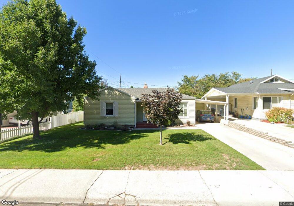
721 N 1100 E Provo, UT 84606
Foot Hills NeighborhoodEstimated Value: $418,824 - $453,000
3
Beds
1
Bath
1,538
Sq Ft
$281/Sq Ft
Est. Value
About This Home
This home is located at 721 N 1100 E, Provo, UT 84606 and is currently estimated at $431,941, approximately $280 per square foot. 721 N 1100 E is a home located in Utah County with nearby schools including Wasatch Elementary School, Centennial Middle School, and Timpview High School.
Ownership History
Date
Name
Owned For
Owner Type
Purchase Details
Closed on
Jun 8, 2023
Sold by
Lendt Welda Beate
Bought by
Lendt Welda Beate and Rasmussen Mark L
Current Estimated Value
Purchase Details
Closed on
Mar 13, 2023
Sold by
Jesse Loraine Adams Trust
Bought by
Lendt Welda Beate
Purchase Details
Closed on
Sep 27, 2022
Sold by
Adams Jesse Loraine
Bought by
Jesse Loraine Adams Trust
Create a Home Valuation Report for This Property
The Home Valuation Report is an in-depth analysis detailing your home's value as well as a comparison with similar homes in the area
Home Values in the Area
Average Home Value in this Area
Purchase History
| Date | Buyer | Sale Price | Title Company |
|---|---|---|---|
| Lendt Welda Beate | -- | Utah First Title | |
| Lendt Welda Beate | -- | Utah First Title | |
| Lendt Welda Beate | -- | Utah First Title | |
| Jesse Loraine Adams Trust | -- | -- |
Source: Public Records
Tax History
| Year | Tax Paid | Tax Assessment Tax Assessment Total Assessment is a certain percentage of the fair market value that is determined by local assessors to be the total taxable value of land and additions on the property. | Land | Improvement |
|---|---|---|---|---|
| 2025 | $1,927 | $203,885 | -- | -- |
| 2024 | $1,927 | $189,695 | $0 | $0 |
| 2023 | $1,936 | $187,880 | $0 | $0 |
| 2022 | $2,148 | $210,210 | $0 | $0 |
| 2021 | $1,560 | $266,300 | $107,000 | $159,300 |
| 2020 | $1,513 | $242,100 | $97,300 | $144,800 |
| 2019 | $1,400 | $232,900 | $97,300 | $135,600 |
| 2018 | $1,237 | $208,700 | $90,800 | $117,900 |
| 2017 | $1,146 | $106,260 | $0 | $0 |
| 2016 | $1,058 | $91,465 | $0 | $0 |
| 2015 | $969 | $84,645 | $0 | $0 |
| 2014 | $820 | $74,690 | $0 | $0 |
Source: Public Records
Map
Nearby Homes
- 907 E 820 N Unit 11
- 532 N Seven Peaks Blvd Unit 302
- 785 E 560 N Unit 405
- 737 E 750 N Unit 1
- 1051 E 300 N
- 635 N Ridge Dr Unit 25
- 362 N 800 E
- 1040 N Oakmont Ln
- 541 E 500 N Unit 12
- 864 E 200 N
- 1205 N Old Willow Ln
- 990 Cedar Ave
- 386 N 500 E
- 364 N 500 E
- 1215 N Terrace Dr
- 905 N Terrace Dr
- 240 N 500 East St
- 1411 N Locust Ln
- 394 N 300 E
- 433 N 300 E
Your Personal Tour Guide
Ask me questions while you tour the home.