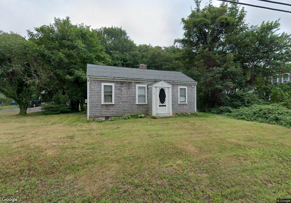
721 W Falmouth Hwy Falmouth, MA 02540
Estimated Value: $671,797 - $843,000
2
Beds
1
Bath
1,001
Sq Ft
$726/Sq Ft
Est. Value
About This Home
This home is located at 721 W Falmouth Hwy, Falmouth, MA 02540 and is currently estimated at $726,699, approximately $725 per square foot. 721 W Falmouth Hwy is a home located in Barnstable County with nearby schools including Mullen-Hall School, Morse Pond School, and Lawrence School.
Ownership History
Date
Name
Owned For
Owner Type
Purchase Details
Closed on
May 31, 2007
Sold by
Sanford Jonathan R
Bought by
Sanford Jonathan R and Sanford Margaret M
Current Estimated Value
Home Financials for this Owner
Home Financials are based on the most recent Mortgage that was taken out on this home.
Original Mortgage
$294,400
Outstanding Balance
$179,758
Interest Rate
6.24%
Mortgage Type
Purchase Money Mortgage
Estimated Equity
$546,941
Create a Home Valuation Report for This Property
The Home Valuation Report is an in-depth analysis detailing your home's value as well as a comparison with similar homes in the area
Home Values in the Area
Average Home Value in this Area
Purchase History
| Date | Buyer | Sale Price | Title Company |
|---|---|---|---|
| Sanford Jonathan R | -- | -- | |
| Sanford Jonathan R | -- | -- | |
| Sanford Jonathan R | -- | -- |
Source: Public Records
Mortgage History
| Date | Status | Borrower | Loan Amount |
|---|---|---|---|
| Open | Sanford Jonathan R | $294,400 | |
| Closed | Sanford Jonathan R | $294,400 | |
| Previous Owner | Sanford Jonathan R | $31,000 |
Source: Public Records
Tax History Compared to Growth
Tax History
| Year | Tax Paid | Tax Assessment Tax Assessment Total Assessment is a certain percentage of the fair market value that is determined by local assessors to be the total taxable value of land and additions on the property. | Land | Improvement |
|---|---|---|---|---|
| 2025 | $3,388 | $577,100 | $315,500 | $261,600 |
| 2024 | $3,229 | $514,200 | $274,700 | $239,500 |
| 2023 | $2,951 | $426,500 | $219,700 | $206,800 |
| 2022 | $3,102 | $385,300 | $205,400 | $179,900 |
| 2021 | $2,915 | $342,900 | $205,400 | $137,500 |
| 2020 | $2,786 | $324,300 | $186,800 | $137,500 |
| 2019 | $2,711 | $316,700 | $186,800 | $129,900 |
| 2018 | $2,671 | $310,600 | $186,800 | $123,800 |
| 2017 | $2,611 | $306,100 | $186,800 | $119,300 |
| 2016 | $2,559 | $305,700 | $186,800 | $118,900 |
| 2015 | $2,504 | $305,700 | $186,800 | $118,900 |
| 2014 | $2,489 | $305,400 | $186,800 | $118,600 |
Source: Public Records
Map
Nearby Homes
- 4 Ambleside Dr
- 102 Nashawena St
- 106 Ambleside Dr
- 70 Westmoreland Dr
- 126 Ambleside Dr
- 850 W Falmouth Hwy Unit 11
- 113 Blacksmith Shop Rd
- 22 Acorn Dr
- 908 W Falmouth Hwy
- 0 Chapoquoit Rd
- 37 Katelyn Hills Dr
- 82 Dale Dr
- 24 Jae Rd
- 61 Mckenna Ridge Dr
- 104 Streeter Hill Rd
- 345 Quaker Rd
- 121 Streeter Hill Rd
- 121 Streeter Hill Rd
- 717 W Falmouth Hwy
- 722 W Falmouth Hwy
- 729 W Falmouth Hwy
- 716 W Falmouth Hwy
- 48 Ambleside Dr
- 726 W Falmouth Hwy
- 711 W Falmouth Hwy
- 737 W Falmouth Hwy
- 714 W Falmouth Hwy
- 734 W Falmouth Hwy
- 40 Ambleside Dr
- 704 W Falmouth Hwy
- 724 W Falmouth Hwy
- 708 W Falmouth Hwy
- 54 Ambleside Dr
- 700 W Falmouth Hwy
- 738 W Falmouth Hwy
- 701 W Falmouth Hwy
- 49 Ambleside Dr
- 32 Ambleside Dr