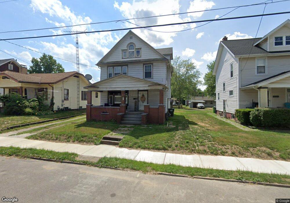
721 Wright Ave Alliance, OH 44601
Estimated Value: $84,000 - $102,000
3
Beds
2
Baths
1,476
Sq Ft
$65/Sq Ft
Est. Value
About This Home
This home is located at 721 Wright Ave, Alliance, OH 44601 and is currently estimated at $95,333, approximately $64 per square foot. 721 Wright Ave is a home located in Stark County with nearby schools including Alliance Early Learning School, Alliance Intermediate School at Northside, and Alliance Middle School.
Ownership History
Date
Name
Owned For
Owner Type
Purchase Details
Closed on
Jun 6, 2022
Sold by
Kempthorne Property Management Llc
Bought by
Wottensoldner Ryan S and Wittensoldner Kelly N
Current Estimated Value
Home Financials for this Owner
Home Financials are based on the most recent Mortgage that was taken out on this home.
Original Mortgage
$840,000
Outstanding Balance
$612,373
Interest Rate
5.11%
Mortgage Type
New Conventional
Estimated Equity
-$517,040
Purchase Details
Closed on
Mar 26, 2009
Sold by
Kempthorne Dennis C and Kempthorne Debra L
Bought by
Kempthrone Property Management Llc
Purchase Details
Closed on
May 6, 2003
Sold by
Snow Jan C
Bought by
Kempthorne Dennis C
Purchase Details
Closed on
Jan 31, 1994
Purchase Details
Closed on
May 7, 1991
Create a Home Valuation Report for This Property
The Home Valuation Report is an in-depth analysis detailing your home's value as well as a comparison with similar homes in the area
Home Values in the Area
Average Home Value in this Area
Purchase History
| Date | Buyer | Sale Price | Title Company |
|---|---|---|---|
| Wottensoldner Ryan S | $1,050,000 | Pidgeon Emilie K | |
| Kempthrone Property Management Llc | -- | Attorney | |
| Kempthorne Dennis C | $12,600 | -- | |
| -- | -- | -- | |
| -- | $27,500 | -- |
Source: Public Records
Mortgage History
| Date | Status | Borrower | Loan Amount |
|---|---|---|---|
| Open | Wottensoldner Ryan S | $840,000 |
Source: Public Records
Tax History
| Year | Tax Paid | Tax Assessment Tax Assessment Total Assessment is a certain percentage of the fair market value that is determined by local assessors to be the total taxable value of land and additions on the property. | Land | Improvement |
|---|---|---|---|---|
| 2025 | -- | $26,050 | $5,640 | $20,410 |
| 2024 | -- | $26,050 | $5,640 | $20,410 |
| 2023 | $840 | $20,410 | $5,250 | $15,160 |
| 2022 | $615 | $14,840 | $5,250 | $9,590 |
| 2021 | $617 | $14,840 | $5,250 | $9,590 |
| 2020 | $564 | $12,680 | $4,590 | $8,090 |
| 2019 | $556 | $12,680 | $4,590 | $8,090 |
Source: Public Records
Map
Nearby Homes
- 621 S Haines Ave
- 233 W Cambridge St
- 203 Glamorgan St
- 228 W Oxford St
- 535 S Mckinley Ave
- 807 S Union Ave
- 479 W High St
- 427 S Union Ave
- 46 Rosenberry St
- 343 W Columbia St
- 264 W Market St
- 118 S Mckinley Ave
- 33 S Lincoln Ave
- 163 W Market St
- 134 11th St
- 234 Rosenberry St
- 231 Rosenberry St
- 1044 Glamorgan St
- 226 Milner St
- 664 Fairview Place
- 721 Wright Ave
- 711 Wright Ave
- 731 Wright Ave
- 715 Wright Ave
- 739 Wright Ave
- 732 S Lincoln Ave
- 714 S Lincoln Ave
- 751 Wright Ave
- 740 S Lincoln Ave
- 704 S Lincoln Ave
- 720 Wright Ave
- 716 Wright Ave
- 730 Wright Ave
- 708 Wright Ave
- 679 Wright Ave
- 740 Wright Ave
- 748 S Lincoln Ave
- 757 Wright Ave
- 750 Wright Ave
- 680 S Lincoln Ave
Your Personal Tour Guide
Ask me questions while you tour the home.