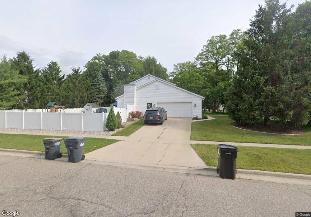
7210 Crown Pointe Cir Portage, MI 49024
Estimated Value: $331,000 - $381,000
3
Beds
3
Baths
1,800
Sq Ft
$198/Sq Ft
Est. Value
About This Home
This home is located at 7210 Crown Pointe Cir, Portage, MI 49024 and is currently estimated at $356,927, approximately $198 per square foot. 7210 Crown Pointe Cir is a home located in Kalamazoo County with nearby schools including Moorsbridge Elementary School, Portage West Middle School, and Portage Northern High School.
Ownership History
Date
Name
Owned For
Owner Type
Purchase Details
Closed on
May 2, 2025
Sold by
Benson Scott G
Bought by
Scott Geoffrey Benson And Anita Anne-Mcmanus and Benson
Current Estimated Value
Purchase Details
Closed on
Aug 25, 2011
Sold by
Bailey Shane A and Bailey Claire A
Bought by
Benson Kelsey and Benson Scott
Home Financials for this Owner
Home Financials are based on the most recent Mortgage that was taken out on this home.
Original Mortgage
$124,000
Interest Rate
4.59%
Mortgage Type
New Conventional
Purchase Details
Closed on
Aug 21, 2003
Sold by
Prudential Residential Services Lp
Bought by
Bailey Shane A and Bailey Claire A
Home Financials for this Owner
Home Financials are based on the most recent Mortgage that was taken out on this home.
Original Mortgage
$131,870
Interest Rate
5.97%
Mortgage Type
Unknown
Create a Home Valuation Report for This Property
The Home Valuation Report is an in-depth analysis detailing your home's value as well as a comparison with similar homes in the area
Home Values in the Area
Average Home Value in this Area
Purchase History
| Date | Buyer | Sale Price | Title Company |
|---|---|---|---|
| Scott Geoffrey Benson And Anita Anne-Mcmanus | -- | None Listed On Document | |
| Benson Kelsey | $155,000 | Devon Title | |
| Bailey Shane A | $167,500 | Metro | |
| Prudential Residential Services Lp | $167,500 | Metro |
Source: Public Records
Mortgage History
| Date | Status | Borrower | Loan Amount |
|---|---|---|---|
| Previous Owner | Benson Kelsey | $124,000 |
Source: Public Records
Tax History Compared to Growth
Tax History
| Year | Tax Paid | Tax Assessment Tax Assessment Total Assessment is a certain percentage of the fair market value that is determined by local assessors to be the total taxable value of land and additions on the property. | Land | Improvement |
|---|---|---|---|---|
| 2025 | $4,614 | $160,600 | $0 | $0 |
| 2024 | $4,062 | $161,300 | $0 | $0 |
| 2023 | $3,872 | $134,200 | $0 | $0 |
| 2022 | $4,183 | $117,400 | $0 | $0 |
| 2021 | $4,043 | $112,600 | $0 | $0 |
| 2020 | $3,955 | $103,500 | $0 | $0 |
| 2019 | $356 | $96,600 | $0 | $0 |
| 2018 | $0 | $94,500 | $0 | $0 |
| 2017 | $0 | $92,100 | $0 | $0 |
| 2016 | -- | $94,400 | $0 | $0 |
| 2015 | -- | $87,700 | $0 | $0 |
| 2014 | -- | $81,200 | $0 | $0 |
Source: Public Records
Map
Nearby Homes
- 7160 Crown Pointe Cir
- 1819 Woodland Dr
- 2604 Radcliffe Ave
- 7104 Rockford St
- 6748 Trotwood St
- 6803 Bluegrass St
- 7403 Rockford St
- 2801 Daventry Ave
- 6827 Marlow St
- 6636 Trotwood St
- 7481 Turnberry Ct
- 7464 Saint George Cir
- 1524 Greenview Ave
- 7639 Dunross Dr
- 6740 Amberly St
- 3320 Scots Pine Way Unit 2
- 7717 Julie Dr
- 2029 Brighton Ln Unit 7
- 7784 Primrose Ln
- 7814 Julie Dr
- 7192 Crown Pointe Cir
- 2480 Mansfield Ave
- 7207 Hickory Point Dr
- 2373 Mansfield Ave
- 7176 Crown Pointe Cir
- 7193 Hickory Point Dr
- 2375 Mansfield Ave
- 2399 Mansfield Ave
- 7209 Crown Pointe Cir
- 2345 Mansfield Ave
- 7191 Crown Pointe Cir
- 2429 Mansfield Ave
- 7175 Hickory Point Dr
- 7175 Crown Pointe Cir
- 2319 Mansfield Ave
- 2455 Mansfield Ave
- 7159 Hickory Point Dr
- 7159 Crown Pointe Cir
- 7210 Bridlewood Cir
- 7186 Hickory Point Dr