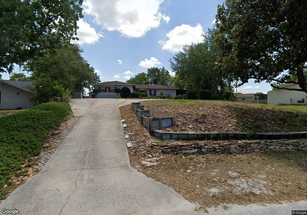
7211 County Line Rd Spring Hill, FL 34606
Estimated Value: $770,821
Studio
3
Baths
3,984
Sq Ft
$193/Sq Ft
Est. Value
About This Home
This home is located at 7211 County Line Rd, Spring Hill, FL 34606 and is currently estimated at $770,821, approximately $193 per square foot. 7211 County Line Rd is a home located in Hernando County with nearby schools including Suncoast Elementary School, Fox Chapel Middle School, and Frank W. Springstead High School.
Ownership History
Date
Name
Owned For
Owner Type
Purchase Details
Closed on
Oct 29, 2004
Sold by
Trimar Investment Inc
Bought by
Puerto Luis Manuel and Puerto Brenda
Current Estimated Value
Home Financials for this Owner
Home Financials are based on the most recent Mortgage that was taken out on this home.
Original Mortgage
$300,000
Interest Rate
5.6%
Mortgage Type
Seller Take Back
Purchase Details
Closed on
Oct 21, 2002
Sold by
Chrisafulle Raymond J and Chrisafulle Lucille H
Bought by
Trimar Inv Inc
Create a Home Valuation Report for This Property
The Home Valuation Report is an in-depth analysis detailing your home's value as well as a comparison with similar homes in the area
Home Values in the Area
Average Home Value in this Area
Purchase History
| Date | Buyer | Sale Price | Title Company |
|---|---|---|---|
| Puerto Luis Manuel | $350,000 | -- | |
| Trimar Inv Inc | $310,000 | -- |
Source: Public Records
Mortgage History
| Date | Status | Borrower | Loan Amount |
|---|---|---|---|
| Closed | Puerto Luis Manuel | $300,000 |
Source: Public Records
Tax History
| Year | Tax Paid | Tax Assessment Tax Assessment Total Assessment is a certain percentage of the fair market value that is determined by local assessors to be the total taxable value of land and additions on the property. | Land | Improvement |
|---|---|---|---|---|
| 2025 | $10,211 | $639,251 | -- | -- |
| 2024 | $9,911 | $581,137 | -- | -- |
| 2023 | $9,911 | $528,306 | $0 | $0 |
| 2022 | $8,227 | $480,278 | $0 | $0 |
| 2021 | $7,167 | $436,616 | $114,232 | $322,384 |
| 2020 | $7,268 | $432,324 | $114,232 | $318,092 |
| 2019 | $7,973 | $462,200 | $203,581 | $258,619 |
| 2018 | $7,071 | $460,073 | $185,879 | $274,194 |
| 2017 | $7,590 | $452,467 | $174,814 | $277,653 |
| 2016 | $7,025 | $421,661 | $0 | $0 |
| 2015 | $7,203 | $424,781 | $0 | $0 |
| 2014 | $7,345 | $431,827 | $0 | $0 |
Source: Public Records
Map
Nearby Homes
- 216 Cobblestone Dr
- 0 County Line Rd
- 18818 Skiff Dr
- 126 Canby Cir
- 18741 Cayman Dr
- 133 Canby Cir
- 18736 Tortuga Dr
- 7264 Lindhurst St
- 225 Portland Ave
- 7157 Landmark Dr
- 7547 Landmark Dr
- 18923 Rolling Oak Dr
- 7172 Toledo Rd
- 7605 Landmark Dr
- 7629 Landmark Dr
- 7606 Landmark Dr
- 12631 Oak Tree Dr
- 383 Cobblestone Dr
- 7318 Tranquil Dr
- 351 Upland Ave
- 7184 Davenport Ln
- 7192 Davenport Ln
- 97 Cabot Ave
- 89 Cabot Ave
- 7193 County Line Rd
- 7200 Davenport Ln
- 105 Cabot Ave
- 7197 Davenport Ln
- 13028 County Line Rd
- 7160 Davenport Ln
- 7208 Davenport Ln
- 0 Cabot Ave Unit HC2232017
- 0 Cabot Ave Unit 2212469
- 7177 County Line Rd
- 104 Cabot Ave
- 7205 Davenport Ln
- 0 Davenport Ln
- 7152 Davenport Ln
- 7216 Davenport Ln
- 119 Cabot Ave
Your Personal Tour Guide
Ask me questions while you tour the home.