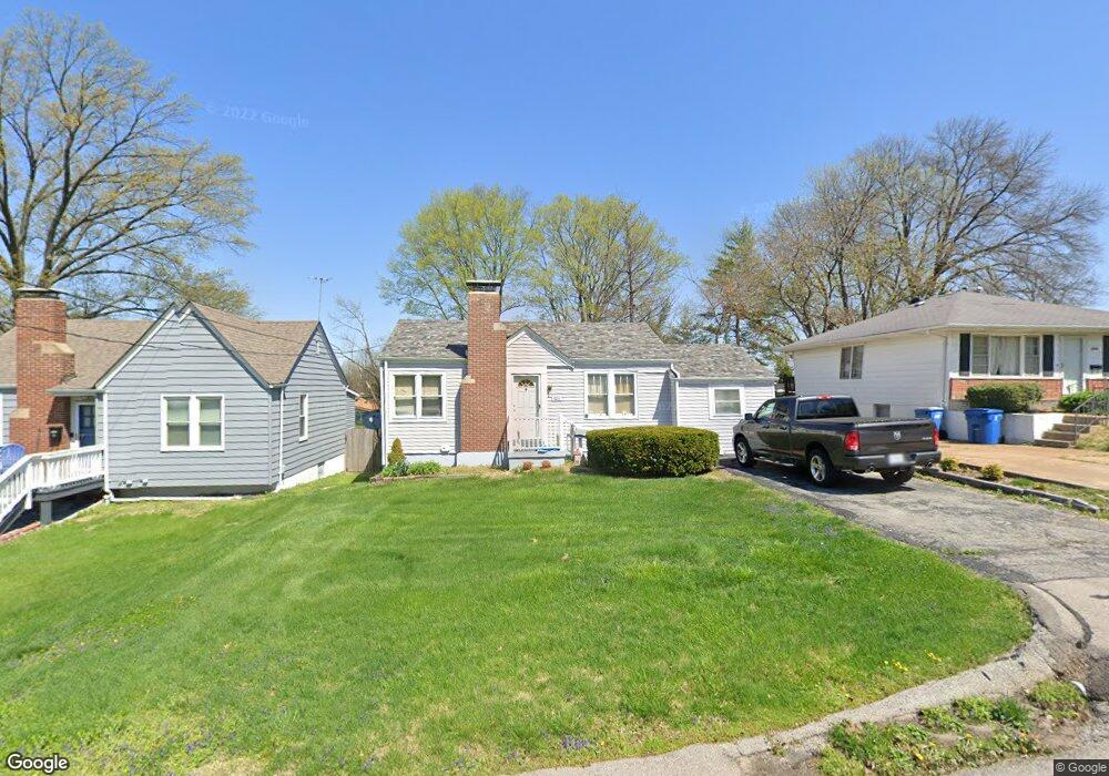
7211 Stafford Ct Saint Louis, MO 63123
Estimated Value: $160,000 - $237,000
2
Beds
1
Bath
1,126
Sq Ft
$174/Sq Ft
Est. Value
About This Home
This home is located at 7211 Stafford Ct, Saint Louis, MO 63123 and is currently estimated at $195,732, approximately $173 per square foot. 7211 Stafford Ct is a home located in St. Louis County with nearby schools including Mesnier Primary School, Gotsch Intermediate School, and Rogers Middle School.
Ownership History
Date
Name
Owned For
Owner Type
Purchase Details
Closed on
Dec 26, 2012
Sold by
Secretary Of Housing & Urban Development
Bought by
Conley Dottie L
Current Estimated Value
Home Financials for this Owner
Home Financials are based on the most recent Mortgage that was taken out on this home.
Original Mortgage
$68,500
Outstanding Balance
$48,300
Interest Rate
3.75%
Mortgage Type
FHA
Estimated Equity
$147,432
Purchase Details
Closed on
Aug 23, 2012
Sold by
Wells Fargo Bank Na
Bought by
Secretary Of Housing & Urban Development
Purchase Details
Closed on
Jun 7, 2012
Sold by
Fowler Shannon Marie
Bought by
Wells Fargo Bank Na
Purchase Details
Closed on
Jun 15, 2010
Sold by
Fowler Shannon Mara and Fowler Shannon Marie
Bought by
Fowler Shannon Mara
Purchase Details
Closed on
Sep 18, 2009
Sold by
Secrease Jean
Bought by
Fowler Shannon Marie
Home Financials for this Owner
Home Financials are based on the most recent Mortgage that was taken out on this home.
Original Mortgage
$139,428
Interest Rate
5.2%
Mortgage Type
FHA
Purchase Details
Closed on
Aug 4, 2009
Sold by
Secrease Jean and Fowler Shannon Marie
Bought by
Secrease Jean
Home Financials for this Owner
Home Financials are based on the most recent Mortgage that was taken out on this home.
Original Mortgage
$139,428
Interest Rate
5.2%
Mortgage Type
FHA
Purchase Details
Closed on
Aug 1, 2006
Sold by
Magee Thomas D and Magee Lisa
Bought by
Secrease Jean and Fowler Shannon Marie
Home Financials for this Owner
Home Financials are based on the most recent Mortgage that was taken out on this home.
Original Mortgage
$109,600
Interest Rate
8.12%
Mortgage Type
Purchase Money Mortgage
Purchase Details
Closed on
Aug 10, 1998
Sold by
Barnes Jeffrey B and Barnes Jacquelines
Bought by
Magee Thomas D
Home Financials for this Owner
Home Financials are based on the most recent Mortgage that was taken out on this home.
Original Mortgage
$63,000
Interest Rate
6.9%
Create a Home Valuation Report for This Property
The Home Valuation Report is an in-depth analysis detailing your home's value as well as a comparison with similar homes in the area
Home Values in the Area
Average Home Value in this Area
Purchase History
| Date | Buyer | Sale Price | Title Company |
|---|---|---|---|
| Conley Dottie L | $67,500 | None Available | |
| Secretary Of Housing & Urban Development | -- | None Available | |
| Wells Fargo Bank Na | $146,080 | None Available | |
| Fowler Shannon Mara | -- | Gateway Title Company Inc | |
| Fowler Shannon Marie | $142,000 | None Available | |
| Secrease Jean | -- | Gateway Title Company Inc | |
| Secrease Jean | $137,000 | None Available | |
| Magee Thomas D | -- | First American Title |
Source: Public Records
Mortgage History
| Date | Status | Borrower | Loan Amount |
|---|---|---|---|
| Open | Conley Dottie L | $68,500 | |
| Previous Owner | Fowler Shannon Marie | $139,428 | |
| Previous Owner | Secrease Jean | $109,600 | |
| Previous Owner | Magee Thomas D | $63,000 |
Source: Public Records
Tax History Compared to Growth
Tax History
| Year | Tax Paid | Tax Assessment Tax Assessment Total Assessment is a certain percentage of the fair market value that is determined by local assessors to be the total taxable value of land and additions on the property. | Land | Improvement |
|---|---|---|---|---|
| 2025 | $2,065 | $28,650 | $16,380 | $12,270 |
| 2024 | $2,065 | $25,340 | $9,840 | $15,500 |
| 2023 | $1,997 | $25,340 | $9,840 | $15,500 |
| 2022 | $1,945 | $22,470 | $12,290 | $10,180 |
| 2021 | $1,900 | $22,470 | $12,290 | $10,180 |
| 2020 | $1,860 | $20,520 | $9,860 | $10,660 |
| 2019 | $1,844 | $20,520 | $9,860 | $10,660 |
| 2018 | $1,607 | $15,770 | $8,210 | $7,560 |
| 2017 | $1,597 | $15,770 | $8,210 | $7,560 |
| 2016 | $1,680 | $17,660 | $9,010 | $8,650 |
| 2015 | $1,685 | $17,660 | $9,010 | $8,650 |
| 2014 | $2,123 | $22,230 | $5,470 | $16,760 |
Source: Public Records
Map
Nearby Homes
- 8415 Rockhaven Ln
- 8405 Rockhaven Ln
- 7123 Craighill Dr
- 7243 General Sherman Ln
- 8613 Carriage Way Dr
- 8215 General Sheridan Ln
- 7101 Fernbrook Dr
- 7424 Granbury Cir
- 8853 Raleigh Dr
- 7452 Rockwood Dr
- 7369 Whitehaven Dr
- 7625 General Meade Ln
- 8875 Rock Forest Dr
- 9008 Fernald Dr
- 8400 New Hampshire Ave
- 8736 New Hampshire Ave
- 6540 Lawnside Dr
- 8942 Eden Ave
- 1405 Culverhill Dr
- 8261 Watson Rd
- 7215 Stafford Ct
- 7215 Stafford Ct Unit A
- 7219 Stafford Ct
- 7127 Stafford Ct
- 7228 Rockspring Dr
- 7224 Rockspring Dr
- 7232 Rockspring Dr
- 7123 Stafford Ct
- 7214 Stafford Ct
- 7200 Stafford Ct
- 7220 Rockspring Dr
- 8454 S Laclede Station Rd
- 8450 S Laclede Station Rd
- 7222 Stafford Ct
- 7236 Rockspring Dr
- 7126 Stafford Ct
- 7121 Stafford Ct
- 7240 Rockspring Dr
- 7226 Stafford Ct
- 7216 Rockspring Dr